Home & Garden
Connecticut Weather: Hazardous Weather Outlook Cancelled; Some Snow Still Possible
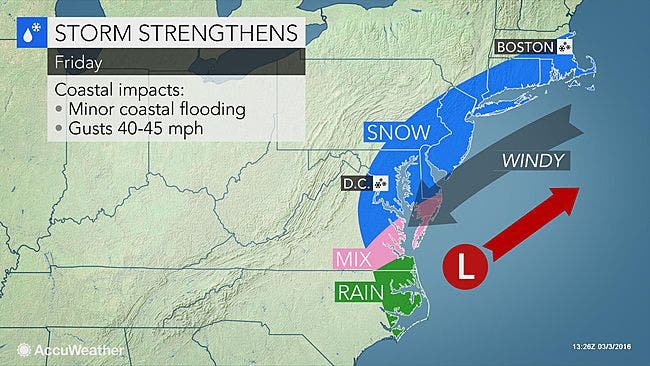
In southern Connecticut very light snow is still possible and could impact Friday's morning commute but accumulation estimates have dropped.

Good news for those who don’t like snow. The chance of snow and the amount of snow have decreased since this morning, according to the latest National Weather Service update for southern Connecticut.
This morning we were looking at an inch or two of accumulation for Fairfield, New Haven, Middlesex, and New London counties, and a Hazardous Weather Outlook had been issued for snow covered roads impacting Friday’s morning commute.
In an update, the National Weather Service has dropped the Hazardous Weather Outlook for all of southern Connecticut and the chance of snow still exists, but its below 50 percent for most of the area.
Also the accumulation expectation, if there is any, has also decreased too.
The most snow is now forecast for lower Fairfield County near the coastline with up to an inch of snow possible between 4 a.m. and 10 a.m.
The immediate coastline further up in Fairfield and New Haven counties will only see a half inch maximum and snow is possible here from 1 a.m. to 10 a.m. The snow chance is 60 percent currently.
For Middlesex and New London counties the snow chance is less than 50 percent and no snow accumulation prediction has been made. The snow chance here is just 30-40 percent.
Interior sections of Fairfield and New Haven counties may also see snow after 1 a.m. but there is just a 40 percent chance of snow and no snow accumulation prediction has been made.
Regardless of whether it snows, temps will be very cold into the teens and Friday will be chilly with highs only in the 30s, and the wind chill factor will make it feel much colder.
Photo credit: Accuweather.com
Get more local news delivered straight to your inbox. Sign up for free Patch newsletters and alerts.


