Community Corner
Mystic The ‘Bullseye’ For The Hurricane Sandy Storm Surge
A mandatory evacuation is in effect for parts of Mystic, parts of the village are already flooding and this morning The Whether Channel called the village the bullseye for the storm surge


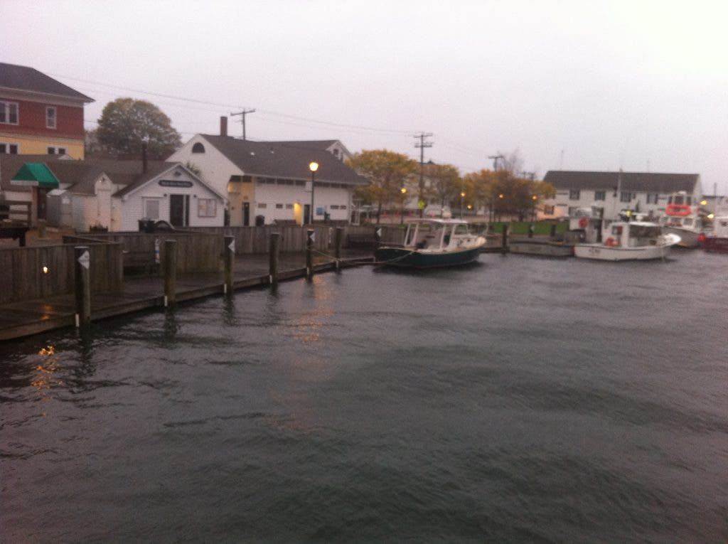

The Weather Channel’s Reynolds Wolfe was supposed to be in New York City by Monday morning at least according to Twitter. But the meteorologist is still with us here in Mystic.
Earlier this morning several Mystic residents listening to The Weather Channel did a bit of a double take when Wolfe said Mystic is the bullseye for Hurricane Sandy’s storm surge.
The National Weather Service warned on Sunday afternoon that Hurricane Sandy brings with it a "life-threatening" storm surge that will hit the Mid-Atlantic coast, Long Island Sound and New York Harbor. The storm's hurricane-force winds extend out 175 miles from the center, so its effects will be felt in Connecticut long before it hits landfall Monday
Find out what's happening in Stonington-Mysticfor free with the latest updates from Patch.
Rain and wind began Sunday night and will increase throughout the day Monday. A high wind warning, coastal flood warning, flood watch, hazardous weather outlook is in effect.
Find out what's happening in Stonington-Mysticfor free with the latest updates from Patch.
For breaking Hurricane Sandy updates sign up for our free newsletter and follow us on Facebook and Twitter.
Parts of Mystic on both the Stonington and Groton sides of the river, and surrounding areas are on under mandatory evacuation orders.
Stonington
On the Stonington side of the river a mandatory evacuation went into effect Sunday afternoon and the Stonington High School emergency shelter opened. Places under a mandatory evacuation order include Stonington Borough, Lords Point, Latimer Point, Mason’s Island, parts of lower Mystic and Mechanic Street and River Road and downtown Pawcatuck. Members of the Red Cross and Stonington Human Services staff the emergency shelter at Stonington High School. The shelter will have meals. Pets in crates are allowed. Contact the Stonington Emergency Operations Center at 860-599-7588 for more information.
Groton
In Groton a mandatory evacuation in low-lying areas of town went into effect at 7 p.m., Sunday, Oct. 28. According to the Groton Town Police in Mystic: Cedar Road, Willow Point, Fort Rachel Place, Gravel Street, Pearl Street, Grove Street, Eldridge Avenue, River Road, Elm Street South of Fishtown Road, Route 27, and North Stonington Road are under mandatory evacuation. The emergency shelter at Robert E. Fitch Senior High School opened at 4 p.m. For more information on the items the Red Cross is encouraging people to bring to the shelter and the complete Groton evacuation list visit: Mandatory Evacuations For Parts of Mystic.
What’s Open; What’s Closed
There were still people walking around downtown Mystic this morning and there were plenty of cars driving along the streets but the village has an eerie feel. Plywood and tape covered the windows of stores and outside of Webster Road on West Main Street a sign said closed Monday and Tuesday due to weather.
Wide World of Bagels and Lis Bake Shop were both open and serving customers in downtown Mystic, and in Stonington Borough both the Yellow House Coffee & Tea Room and Tom’s were open.
A full list of what’s open and what’s closed is available here and with your help is being continually updated.
Forecast
Here is the forecast as of 8:20 a.m: on Monday, Oct. 29, 2012:
- Today Rain, mainly after 10am. High near 64. Very windy, with a northeast wind 30 to 35 mph increasing to 36 to 41 mph in the morning. Winds could gust as high as 70 mph. Chance of precipitation is 100 percent. New precipitation amounts between a quarter and half of an inch possible.
- Tonight Rain, with thunderstorms also possible after midnight. Some of the storms could produce heavy rainfall. Low around 59. Very windy, with a southeast wind 45 to 55 mph decreasing to 30 to 40 mph after midnight. Winds could gust as high as 85 mph. Chance of precipitation is 90 percent. New rainfall amounts between a half and three quarters of an inch possible.
- Tuesday Showers and possibly a thunderstorm. High near 65. Breezy, with a south wind 20 to 25 mph, with gusts as high as 45 mph. Chance of precipitation is 80 percent. New rainfall amounts between a tenth and quarter of an inch, except higher amounts possible in thunderstorms.
- Tuesday Night Showers likely. Cloudy, with a low around 51. Southeast wind 14 to 16 mph. Chance of precipitation is 70 percent. New precipitation amounts between a tenth and quarter of an inch possible.
- Wednesday A chance of showers. Cloudy, with a high near 60. Breezy, with a south wind 15 to 20 mph. Chance of precipitation is 40 percent.
- Wednesday Night A chance of showers. Mostly cloudy, with a low around 47. Chance of precipitation is 30 percent.
Get more local news delivered straight to your inbox. Sign up for free Patch newsletters and alerts.