Home & Garden
Latest Details on Stratford's Blizzard Warning: UPDATE
The National Weather Service upgraded the area to a blizzard warning and snowfall totals are significantly increasing.


UPDATE: 12:30 p.m.
Snow Totals Dramatically Increasing for Stratford: UPDATE
UPDATE, 9 A.M.: Snow has begun to fall in Connecticut and traveling in the afternoon and evening will be very difficult.
Find out what's happening in Stratfordfor free with the latest updates from Patch.
Well that escalated quickly last night. What a strange week. Since last Sunday there has been talk of a major Nor’Easter that may impact Connecticut late Friday and into Saturday.
As you know the forecast has changed more than a dozen times between then and now.
Find out what's happening in Stratfordfor free with the latest updates from Patch.
Even in the past 48 hours the forecasts have changed dramatically. At one time it appeared we may get just a few inches of snow but then it was upgraded Friday afternoon to six inches and just before midnight the storm was upgraded to what it is now, a Blizzard Warning, which is now in effect as we face more than a foot of snow possibly.
The Blizzard Warning remains in effect until 7 a.m. Sunday for all communities along the Connecticut coastline or I-95 corridor including southern Fairfield, southern New Haven, southern Middlesex, and southern New London counties.
Heavy snow is forecast and “potentially damaging winds,” blowing and drifting snow with near zero visibilities. expected Saturday and Saturday evening.
Snow will accumulate anywhere between 8-12 inches and higher amounts are possible.
Winds will be sustained at 20 to 30 mph with gusts of up to 50 mph and the temps will be in the mid to upper 20s.
Conditions deteriorate as the day moves along.
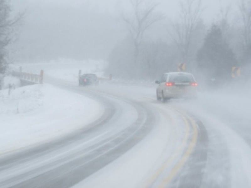
Travel may be extremely dangerous because of the likelihood of “whiteout conditions” and power outages may be a concern. The National Weather Service urges against traveling unless you have to.
WTNH News 8’s Meteorologist Gil Simmons wrote, “Snow will be picking up steadily through the morning. Heavy snow midday through the afternoon with strong winds and low visibility. I would not advise traveling for the afternoon it will be very difficult to see.”
Snow flurries have now entered the state as of 7 a.m. and Simmons said the snow will really pick up by 11 a.m. and traveling after that time will be difficult.
The National Weather Service has issued a “Blizzard Warning” for the Connecticut coastline, which includes southern portions of Fairfield, New Haven, Middlesex, and New London counties.
A Winter Storm Warning was issued at 4 p.m. Friday but was upgraded late Friday as the storm track shifted and we’re expected to receive significantly more snow now.
Here are the important details:
...BLIZZARD WARNING IN EFFECT FROM 2 AM SATURDAY TO 7 AM EST
SUNDAY....
* HAZARD TYPES...HEAVY SNOW ALONG WITH STRONG AND POTENTIALLY DAMAGING WINDS. BLOWING AND DRIFTING SNOW WITH NEAR ZERO VISIBILITIES IS EXPECTED SATURDAY AND SATURDAY EVENING.
* ACCUMULATIONS...SNOW ACCUMULATION OF 10 TO 15 INCHES. LOCALLY HIGHER AMOUNTS POSSIBLE.
* WINDS...NORTHEAST 20 TO 30 MPH WITH GUSTS UP TO 50 MPH.
* VISIBILITIES...NEAR ZERO AT TIMES.
* TEMPERATURES...20S.
* TIMING...LATE TONIGHT THROUGH SATURDAY NIGHT.
* IMPACTS...EXTREMELY DANGEROUS TRAVEL DUE TO HEAVY SNOWFALL AND STRONG WINDS WITH WHITEOUT CONDITIONS LIKELY. SECONDARY AND TERTIARY ROADS MAY BECOME IMPASSABLE. STRONG WINDS MAY DOWN POWER LINES AND TREE LIMBS.
PRECAUTIONARY/PREPAREDNESS ACTIONS...
A BLIZZARD WARNING MEANS SEVERE WINTER WEATHER CONDITIONS ARE EXPECTED OR OCCURRING. FALLING AND BLOWING SNOW WITH STRONG WINDS AND POOR VISIBILITIES ARE LIKELY. THIS WILL LEAD TO WHITEOUT CONDITIONS...MAKING TRAVEL EXTREMELY DANGEROUS. DO NOT TRAVEL. IF YOU MUST TRAVEL...HAVE A WINTER SURVIVAL KIT WITH YOU. IF YOU GET STRANDED...STAY WITH YOUR VEHICLE.
Get more local news delivered straight to your inbox. Sign up for free Patch newsletters and alerts.