Community Corner
New And Improved Map Posted For Shenipsit Lake Trail
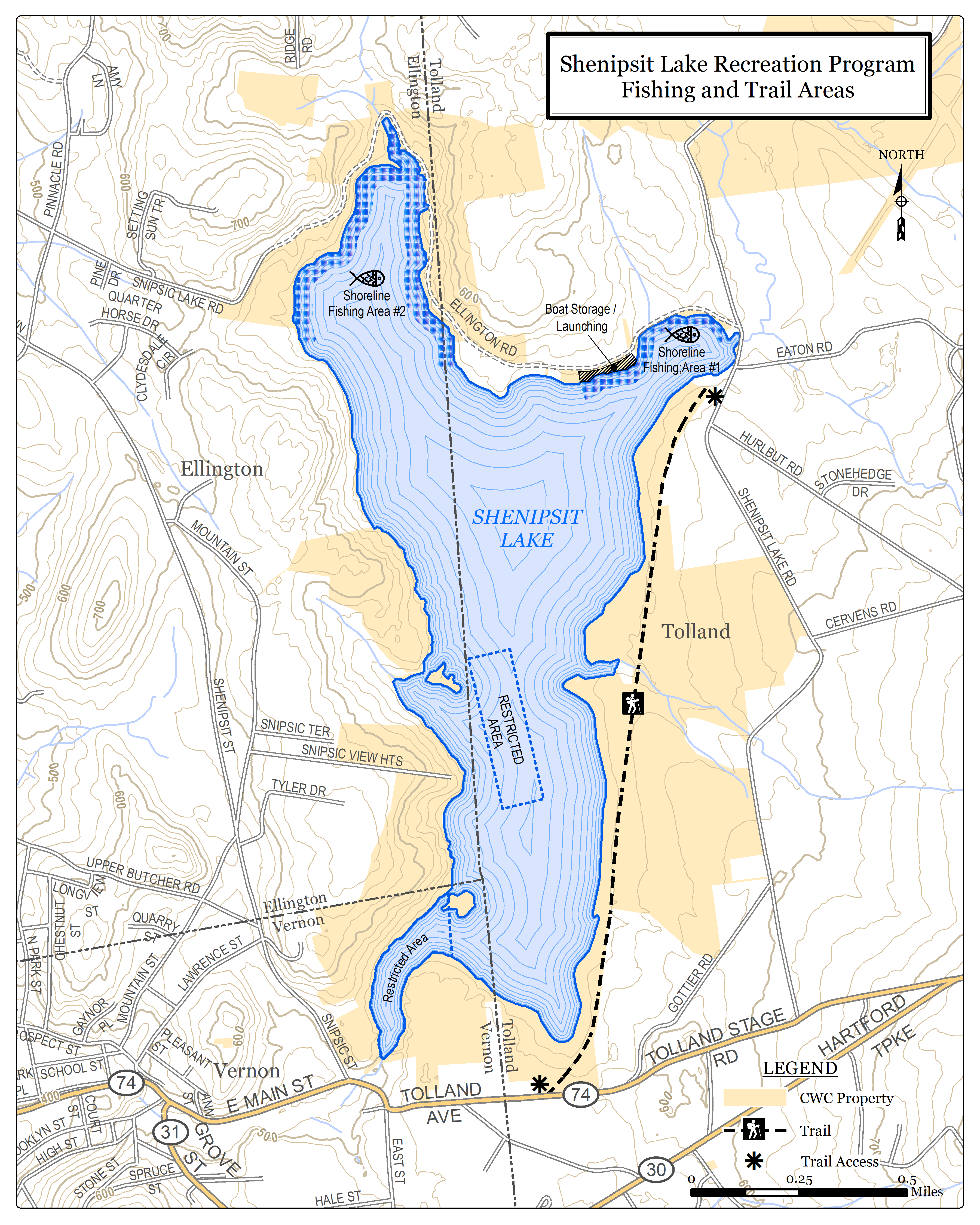
Connecticut Water has posted a new map for the trail along the Shenipsit Lake Reservoir.


VERNON/TOLLAND/ELLINGTON, CT — A new map of the Shenipsit Lake Trail has been posted just in time for the spring hiking season.
Connecticut Water Company updated the map this week to make the trailhead locations easier to decipher.
The map is on display below or at the Connecticut Water recreation site.
Find out what's happening in Tollandfor free with the latest updates from Patch.
The hiking trail covers the expanse of the reservoir. It is open year-round from sunrise to sunset. A considerable portion of the trail is located along the old railroad grade and on the existing town roadway in Tolland and Ellington and provides a lake-view walk.
The trail encompasses "minimum hill climbing" and is not suitable to qualify as a handicapped accessible trail.
Find out what's happening in Tollandfor free with the latest updates from Patch.
Entrances to the trail are available from auto accessible roads.
Hikers are to limit their activities to the designated areas on the town road or the Connecticut Water Company property.
Here is the new map:
Get more local news delivered straight to your inbox. Sign up for free Patch newsletters and alerts.