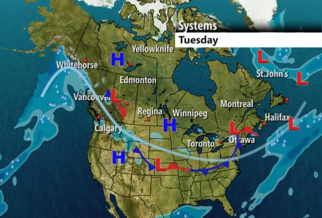
Today we are going to Canada to look at a forecast current weather map for mid week. A high pressure system will move rapidly south and east through Regina and over the middle USA. This is ushering in the coldest temps of the season by far and a reinforcing shot of cold (the big blue H located between Whitehorse and Yellowknife) will insure the cold makes it to the eastern seaboard (read: West Hartford). I'll report later in the week about the snow. I know the weather outlets are calling for a 'big one' later this week. I don't quite yet believe the maps and want to see some further data. What I am concerned about is the bitter cold that will arrive on Thursday. I think we will have at least one and maybe two nights of temps below zero in West Hartford and well below zero in parts of the state. I think -5 is attainable here and -10 will be achieved on parts of the state. The temps on friday will not break single digits over widespread areas of CT so take the following precautions: If you have oil or propane heat; make sure you have enough fuel for several days beyond Friday. Frigid temps will increase demand tremendously and oil consumption will be high. Also, if you have a fireplace or wood stove, make sure you have plenty of wood indoors in case of an electrical failure. Good news is that it is a fairly fast moving system and much milder air is on the back side of it. I'll talk this week about visual signs that can tell you (in the absence of a computer, radio or TV) that a cold snap is breaking. I expect those signs will be abundant on a still-cold Saturday. More later, stay tuned!