Home & Garden
WEATHER UPDATE: Hazardous Weather Outlook Issued For Wilton
The forecast calls for very unsettled weather on Tuesday and we'll let you know what to expect for each day of the week.

In the back-to-work week weather forecast a good portion of the state has already been hit with a “Hazardous Weather Outlook” by the National Weather Service.
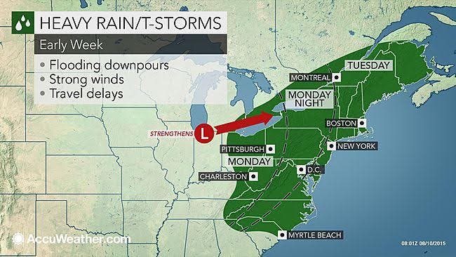
For Fairfield, New Haven, Middlesex and New London counties there is an advisory already in effect for Tuesday. Heavy rains are expected on Tuesday with up to 2 inches of rain possible for the southern half of Connecticut. The rain could begin early Tuesday morning and continue through the day.
Find out what's happening in Wiltonfor free with the latest updates from Patch.
According to the National Weather Service, “There is the potential for isolated flash flooding on Tuesday and also a small chance for a few strong to severe thunderstorms Tuesday afternoon and evening. The main threat is from damaging wind gusts.”
Hartford and Tolland counties have avoided the “Hazardous Weather Outlook” statement by the weather service, but Tuesday is still looking like mostly a washout for northern Connecticut.
Find out what's happening in Wiltonfor free with the latest updates from Patch.
For those two northern counties, rain is predicted after 11 a.m. Tuesday, and maybe some fog and thunderstorms too, and up to an inch of rain is likely before ending around midnight, the NWS predicts.
Outside of unsettled weather on Tuesday the rest of the week including Monday’s forecast looks great for all of Connecticut.
Sunny skies predicted for Monday with highs around 80 degrees, the rain moves in all day Tuesday, and back to sun for Wednesday, Thursday, Friday, and even the weekend looks great with sun predicted.
Temps will be in the low to mid 80s through Sunday.
Photo credit: Accuweather.com
Get more local news delivered straight to your inbox. Sign up for free Patch newsletters and alerts.