Home & Garden
WEATHER UPDATE: Showers, Thunderstorms Possible Tuesday, Then Sun For Days
We'll let you know when the unsettled weather is possible and then share some good news about the extended forecast.

It’s 50-50 as to whether we’ll see showers and thunderstorms today for those of us living in Fairfield, New Haven, Middlesex and New London counties on Tuesday.
If you live in Hartford and Tolland counties the odds are slightly higher at 60 percent and a “Hazardous Weather Outlook” has been issued for there.
Find out what's happening in Wiltonfor free with the latest updates from Patch.
If we do see severe weather, it’s likely to begin after 9 a.m. and could last up until midnight for the southern half of Connecticut, except in New London County where storms are possible beginning after noon.
In Hartford and Tolland counties severe weather is possible after 11 a.m. and according to the National Weather Service’s “Hazardous Weather Outlook” a “few to severe” storms are possible and the main threat is “damaging wind gusts.”
Find out what's happening in Wiltonfor free with the latest updates from Patch.
The severe weather threat ends up north by 10 p.m. tonight.
Despite the chance of storms for the entire state on Tuesday, we can also expect to see sun too, the weather service writes.
WTNH News 8’s Meteorologist Gil Simmons summed up Tuesday’s forecast in a lot less words, “Humid with a passing downpour or thunderstorm today. Some sun too.”
After Tuesday, the forecast can be summed up by one word from Wednesday through the end of next Monday, sunshine.
Sunshine and temps in the low to mid 80s are forecast from Wednesday and through the upcoming weekend.
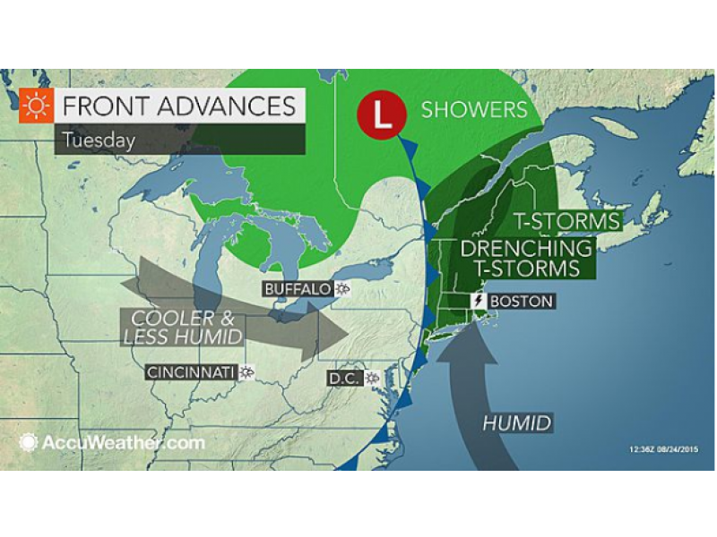
Graphic Courtesy: Accuweather
Get more local news delivered straight to your inbox. Sign up for free Patch newsletters and alerts.