Weather
Tropical Depression Fred Expected To Strengthen Near Florida
Starting Friday into next week, heavy rainfall from Fred will affect Florida and the Southeast. The storm should reach Tampa by Sunday.

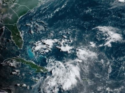
TAMPA, FL — The National Hurricane Center in Miami downgraded Fred to a tropical depression as the storm lost momentum over Hispaniola's rugged terrain Wednesday, but predicts Tropical Depression Fred will strengthen once it passes over the Bahamas and Cuba Thursday.
The tropical depression is moving west-northwest at about 16 mph, but a decrease in the depression's speed is expected during the next couple of days, followed by a turn northwest, according to the hurricane center's 8 a.m. advisory.
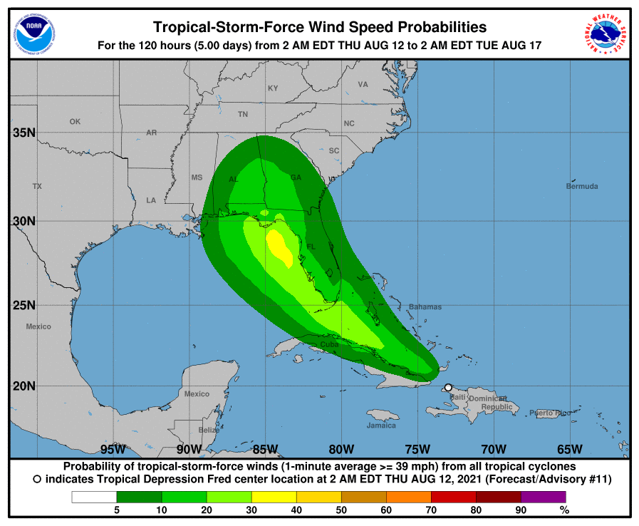
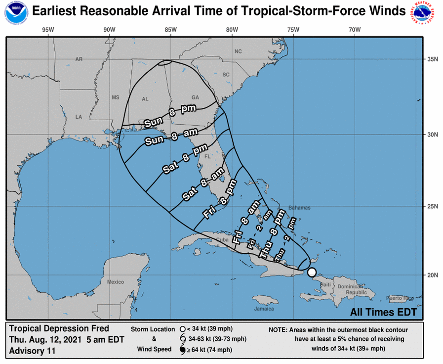
This will put Fred near the Florida Keys and south Florida on Saturday, and it should reach the Tampa Bay region by Sunday morning.
Find out what's happening in Tampafor free with the latest updates from Patch.
The models show some uncertainty as to when Fred will make that turn to the right, with models currently spanning a region from over Florida to the east-central Gulf of Mexico.
According to Air Force Reserve and National Oceanic and Atmosphere Administration Hurricane Hunter aircraft data, Fred has sustained winds of near 35 mph with higher gusts.
Find out what's happening in Tampafor free with the latest updates from Patch.
Beginning Friday into next week, heavy rainfall associated with Fred will affect Florida and parts of the Southeast. Through Monday, 3 to 5 inches of rain is anticipated across the Keys and the southern Florida Peninsula, with isolated maximum totals of 8 inches.
There is a risk of tropical storm conditions beginning early Saturday in the Florida Keys and south Florida. These conditions are expected to spread north along portions of the Florida west coast and the Florida Panhandle through Monday.
The heavy rainfall could lead to urban, and small-stream flooding, along with possible rapid river rises. Swells generated by Fred could reach the Florida Keys and south Florida by early Saturday. Fred could also produce storm surge and rip tides along the west coast of the state.
Tropical Depression Fred's intensity depends on how much interaction the storm has with Florida, said the hurricane center. Since the official forecast shows a track over the eastern Gulf of Mexico, additional strengthening is predicted before Fred makes its final landfall along the Florida Big Bend region or Florida Panhandle late in the weekend or early next week.
Emergency management departments in counties along the west coast of Florida are urging residents to have their hurricane survival kits ready.
Tropical Depression Fred officially became the sixth named storm of the Atlantic hurricane season Tuesday night.
Stay tuned to Patch for updates on Tropical Storm Fred.
NOAA has predicted a busier-than-average Atlantic hurricane center, which runs from June 1 to Nov. 30.
NOAA predicted 15 to 21 named storms, with seven to 10 becoming hurricanes. Researchers from Colorado State University, who provide storm predictions for the season each April, revised their forecast on Aug. 5.
Researchers Philip J. Klotzbach, Michael M. Bell and Jhordanne Jones have predicted 18 named storms, up from 17 in their April forecast, including the five named storms that have already occurred.
The researchers also revised their prediction to eight hurricanes, four of which will be Category 3 or higher.
"Elsa's development and intensification into a hurricane in the tropical Atlantic also typically portends an active season," the researchers said in their revised report. "We anticipate an above-normal probability for major hurricanes making landfall along the continental United States coastline and in the Caribbean."
This will make 2021 the sixth straight year of an above-average Atlantic hurricane season. The record 2020 season had 30 named storms, 12 of which made landfall, including Laura and Delta, which struck southwest Louisiana.
The Colorado State forecasters also said there is a 68 percent chance a major hurricane will strike the U.S. coastline. In an average year, that number is 52 percent.
They also noted a 43 percent chance for the East Coast including Florida to be hit (up from 31) and a 43 percent chance the Gulf Coast from the Florida Panhandle to Brownsville, Texas (up from 30) will experience a hurricane.
Those increases are based on a lack of any El Niño conditions, which typically reduce Atlantic hurricane activity.
See related stories:
Get more local news delivered straight to your inbox. Sign up for free Patch newsletters and alerts.