Weather
Hurricane Agatha: Latest On Impacts To Florida
National Weather Service meteorologists updated Florida residents with what to expect as the remnants of Hurricane Agatha reach the state.

TAMPA, FL — Residents shouldn't have much to worry about from the tropical disturbance left behind by Hurricane Agatha and now churning off the coast of Cancun, Mexico.
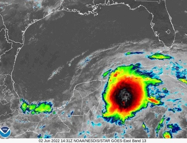
During a 10 a.m. Thursday news briefing from the National Weather Service Tampa Bay office in Ruskin, Daniel Noah, warning coordination meteorologist, said the satellite photos may look ominous but that Florida should experience "nothing worse than you get with normal summer storms."
After making landfall Monday afternoon as a Category 2 hurricane just west of Puerto Angel, Mexico, Hurricane Agatha rapidly weakened into a low-pressure system.
Find out what's happening in Tampafor free with the latest updates from Patch.
Noah said the west coast of Florida should begin to experience some impacts in the next two days in the form of rain bands and wind gusts of up to 40 mph, with the strongest winds remaining offshore.
"It's nice to give a forecast that isn't full of doom and gloom," he said.
Find out what's happening in Tampafor free with the latest updates from Patch.
Currently, the disturbance is producing 30 mph rotating winds. It won't get a name until winds reach 39 mph and it's officially declared a tropical depression or cyclone, Noah explained.
Once the disturbance gets into the Gulf of Mexico, Noah said the NWS and National Hurricane Center in Miami's storm track models are all in agreement.
"Our confidence levels in the tract are high," he said.
The disturbance will head toward south Florida, making landfall either in the Florida Keys or around Fort Myers, where there will be a slight risk of localized flooding because that area has already gotten 4 to 7 inches of rainfall in the past seven days.
The NWS expects about 9 inches of rain in the Keys and thta the amount will drop off incrementally as the disturbance moves farther up the west coast.
He said there is a potential of the disturbance spawning tornadoes along the Keys and the north Florida coast.
Currently, the NWS had issued no advisories on the storm, although Noah said he expects one to be issued later Thursday.
See related story: 2 Tropical Weather Disturbances Eyed By National Hurricane Center
Meanwhile, the National Hurricane Center is continuing to keep an eye on a weak surface trough now located about 100 miles northeast of the Bahamas that is producing disorganized showers.
The NHC said it's still too early to predict the storm's track. It could strengthen once it hits the warm waters in the southern Gulf of Mexico, but currently the disturbance isn't showing any indication of strengthening.
For further updates, visit Patch partner, AccuWeather.
Get more local news delivered straight to your inbox. Sign up for free Patch newsletters and alerts.