Weather
Updated Spring/Summer Forecast Released For FL: Here's What To Expect
A new long-range spring and summer forecast has been released for Florida. Here's what you need to know.

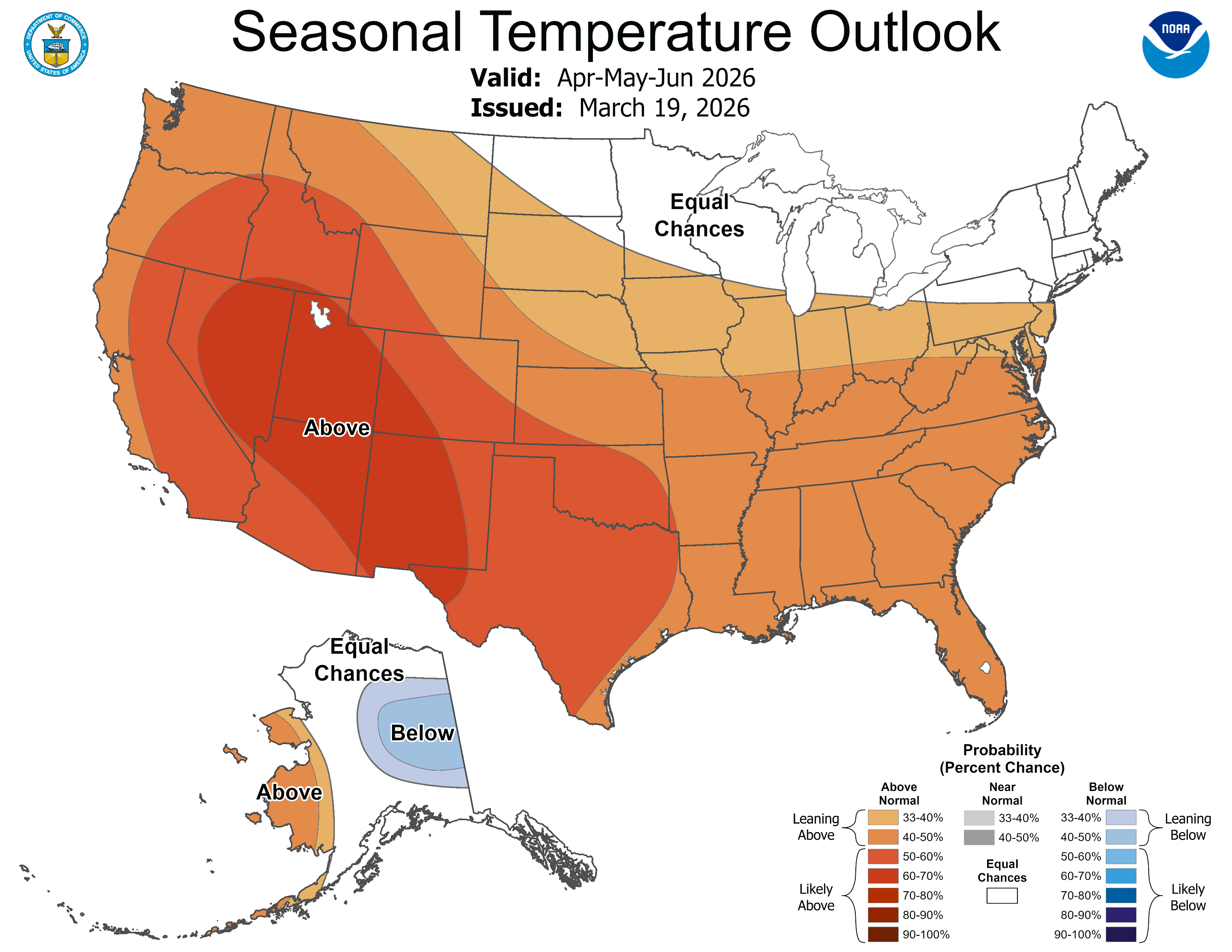
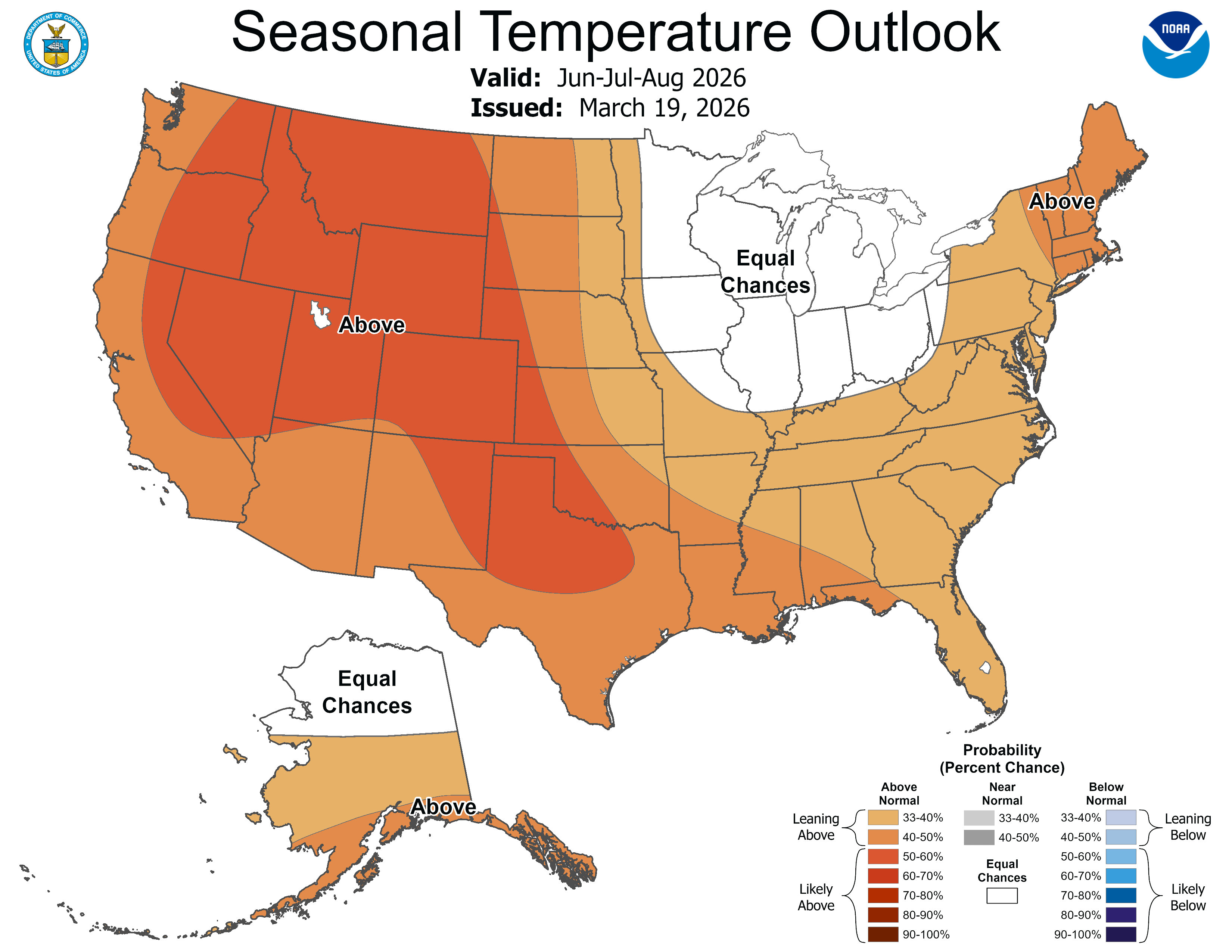
The Sunshine State is going to feel warmer than usual this summer as long-range outlooks suggest a heatwave in coming months.
Starting in April, temperatures are expected to be above normal through at least August, according to both the National Oceanic and Atmospheric Administration's Climate Prediction Center and the National Weather Service's Central Region Climate Outlook.
As of Sunday, there was a 62 percent probability of spring bringing a La Niña to an an end and an El Niño occurring from June to August, according to the NWS. During an El Niño, the weather is either warmer-than-normal or wetter-than-normal. (See more information below.)
Find out what's happening in Tampafor free with the latest updates from Patch.
Though there are below-normal chances of precipitation in April in Florida, forecasters say the possibility of precipitation will rise during the summertime into August and bring equal chances of rain to the Sunshine State, the NWS stated.
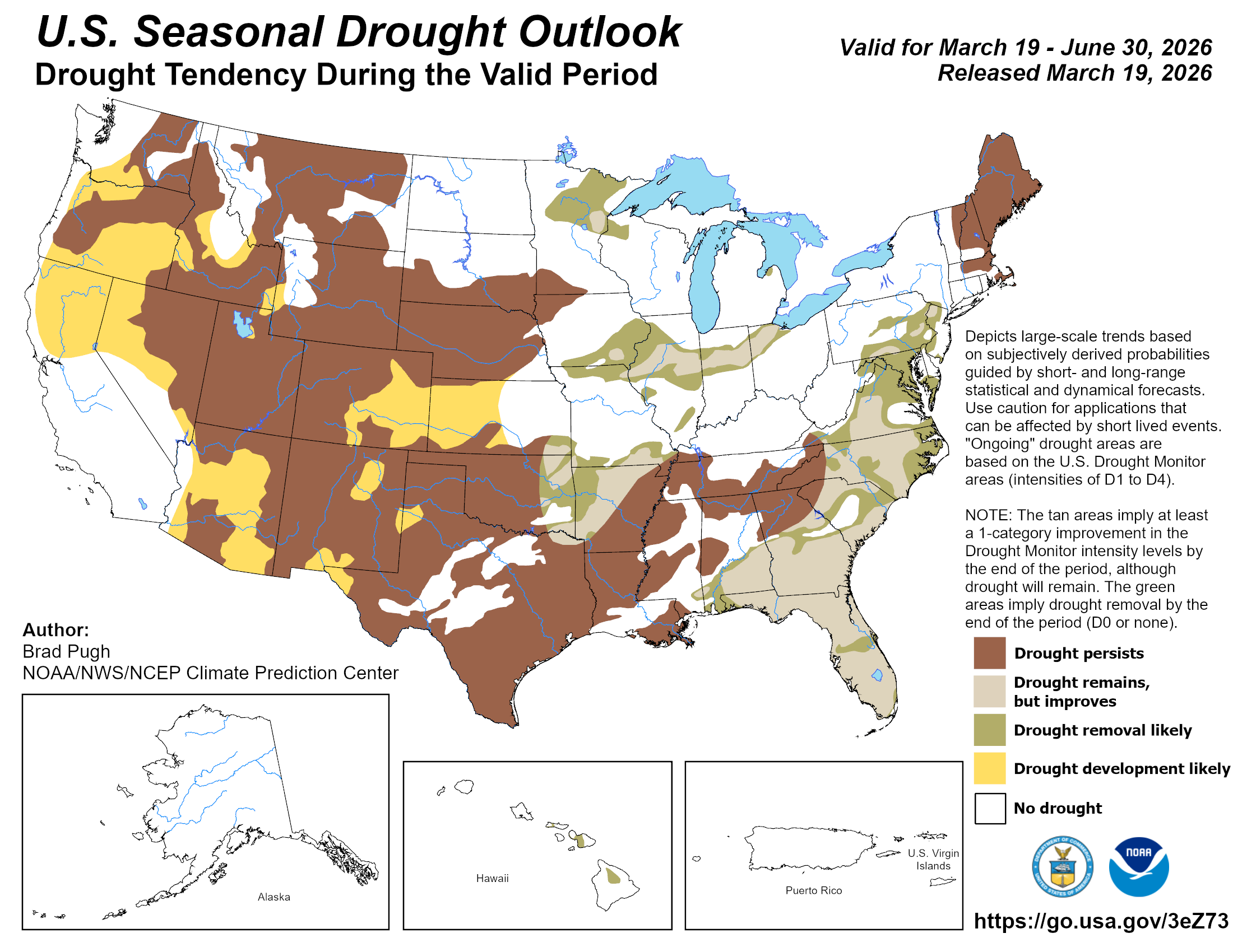
Be that as it may, a drought may also be persistent sometime during the summer, according to NOAA.
Find out what's happening in Tampafor free with the latest updates from Patch.
The outlook may be adjusted as summer nears and conditions change in Florida.
What's Behind Warmer Spring Temperatures
Despite the presence of La Niña in the tropical Pacific, NOAA predicts it will weaken and transition to ENSO-neutral conditions by April, likely lasting through May and June.
This transition, combined with long-term warming trends, contributes to the expectation of widespread warm conditions.
According to NOAA, El Niño conditions are likely to emerge and persist through at least the end of 2026. In the United States, El Niño is most associated with warmer, drier conditions in northern states as cool and wet patterns develop further south.
"El Niño can affect our weather significantly. The warmer waters cause the Pacific jet stream to move south of its neutral position," NOAA explains. "With this shift, areas in the northern U.S. and Canada are drier and warmer than usual. But in the U.S. Gulf Coast and Southeast, these periods are wetter than usual and have increased flooding."
El Niño can also impede Atlantic hurricane activity, especially during the second half of the season, AccuWeather forecasts said in their 2026 hurricane forecast.
AccuWeather is predicting “a near- to below-historical average” 2026 Atlantic hurricane season, which starts June 1 and runs through Nov. 30, of 11 to 16 named storms.
Of these storms, four to seven are expected to become hurricanes and two to four are predicted to strengthen into major hurricanes that are Category 3 or higher, AccuWeather said.
Get more local news delivered straight to your inbox. Sign up for free Patch newsletters and alerts.