Weather
See Town-By-Town Snowfall Totals From GA Winter Storm
A second state of emergency remains in effect after a snowstorm blew through Georgia and caused billion-dollar damage nationwide.

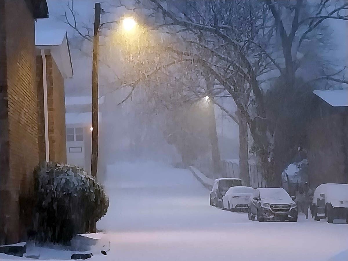
ATLANTA, GA — Nearly 8 inches of snow blanketed Georgia during Saturday's bomb cyclone, according to the National Weather Service on Monday.
AccuWeather on Monday reported the winter storm caused a range of $13 billion to $15 billion in damages and loss as it blasted across the U.S.
It was the second multibillion-dollar weather disaster to affect the U.S. in two weeks. The first storm came with an expense of $105 billion to $115 billion and impacted at least 200 million people, AccuWeather reported.
Find out what's happening in Atlantafor free with the latest updates from Patch.
In Georgia, Gov. Brian Kemp on Friday issued a second state of emergency in anticipation of the storm. It will expire Friday, and Georgia National Guard members remained activated for recovery.
Colbert experienced the most snow statewide at 7.5 inches, according to the NWS. Lexington, between Washington and Athens, followed suit with 7 inches.
Find out what's happening in Atlantafor free with the latest updates from Patch.
Part of metro Atlanta, including Smyrna, received snow flurries; but, the NWS reported 5.5 inches of snow fell near Lawrenceville and Buford in Gwinnett County.
Here are few snow totals from the NWS:
- Colbert 7.5 in
- Dunlap 7 in.
- Lexington 7 in.
- Blue Ridge 6.5 in.
- Buford 6 in.
- Commerce 6 in.
- Hiawassee 6.0 in
- Dacula 4.9 in.
- Dacula 4.8 in.
- Hull 4.5 in.
- Dawsonville 4.5 in.
- Lawrenceville 4.3 in.
- Dacula 4 in.
- Lula 4 in.
- Jefferson 4 in.
- Dahlonega 4 in.
- Lake Lanier Islands 3.5 in.
- Dacula 3.3 in.
- Athens 3 in.
- Dacula 3 in.
- Dacula 3 in.
- Loganville 3 in.
- Sugar Hill 2 in.
- Lawrenceville 2 in.
- Dunwoody 0.1 in.
The snowstorm's economic price tag includes economic effects from business closures, travel disruptions and snow, freeze and wind damage.
“This bomb cyclone is the latest costly setback amid a relentless stretch of cold, snowy, icy and dangerous winter weather,” AccuWeather Chief Meteorologist Jonathan Porter said in a news release. “Some communities have been struggling to clean up and fully rebound from the previous massive winter storm. Now they’re dealing with more costly disruptions and shutdowns. Dangerous cold that surged deeper into Florida is putting more crops and citrus groves at risk, driving losses even higher.”
While it appears Georgia will see a reprieve from wintry precipitation, the NWS predicted scattered showers for Wednesday in metro Atlanta. No drastic weather was forecast.
Temperatures, however, will steadily remain cool. Nightly lows should be 30 degrees on Monday and 29 degrees Wednesday and Thursday, according to the NWS. Tuesday night will feel a bit warmer at 45 degrees.
Here is the National Weather Service's early Monday afternoon forecast for metro Atlanta:
Today: Sunny, with a high near 47. West wind 5-10 mph, with gusts as high as 15 mph.
Tonight: Mostly clear, with a low around 30. West wind around 5 mph becoming calm.
Tuesday: Mostly cloudy, with a high near 57. Light southwest wind increasing to 5-10 mph in the morning. Winds could gust as high as 15 mph.
Tuesday Night: Showers. Low around 45. Southwest wind around 5 mph, with gusts as high as 15 mph. Chance of precipitation is 90 percent.
Wednesday: A 20 percent chance of showers before 1 p.m. Mostly cloudy, with a high near 52. Northwest wind 5-10 mph, with gusts as high as 20 mph.
Wednesday Night: Mostly cloudy, with a low around 29.
Thursday: Sunny, with a high near 46.
Thursday Night: Mostly clear, with a low around 29.
Friday: Sunny, with a high near 56.
Friday Night: Mostly clear, with a low around 34.
Saturday: Sunny, with a high near 52.
Saturday Night: Mostly clear, with a low around 30.
Sunday: Mostly sunny, with a high near 54.
Get more local news delivered straight to your inbox. Sign up for free Patch newsletters and alerts.