Weather
Winter Weather Advisory Issued As Snow Moves Into Atlanta Region
Rain in Atlanta and northern GA will be followed by cold and snow on Monday. A winter weather advisory and freeze warning are in effect.

Updated at 2:55 p.m.
ATLANTA, GA — Severe thunderstorms have largely moved through Georgia as of midafternoon Monday, but could be replaced by a cold rain that will change over to snow flurries.
Snow flurries with occasional snow showers are expected to move into portions of north and central Georgia, including the Atlanta metro region, which may accumulate on grassy areas and on elevated surfaces Monday afternoon and early evening, according to the National Weather Service.. Temperatures are expected to remain above freezing and roadways remain warm enough that impacts to travel are not expected at this time.
Find out what's happening in Atlantafor free with the latest updates from Patch.
A winter weather advisory is in effect for a portion of north and northwest Georgia, where snow accumulations of up to 1 inch in the higher elevations are possible. Freezing temperatures will occur areawide overnight, potentially harming crops and other sensitive vegetation, the agency said.
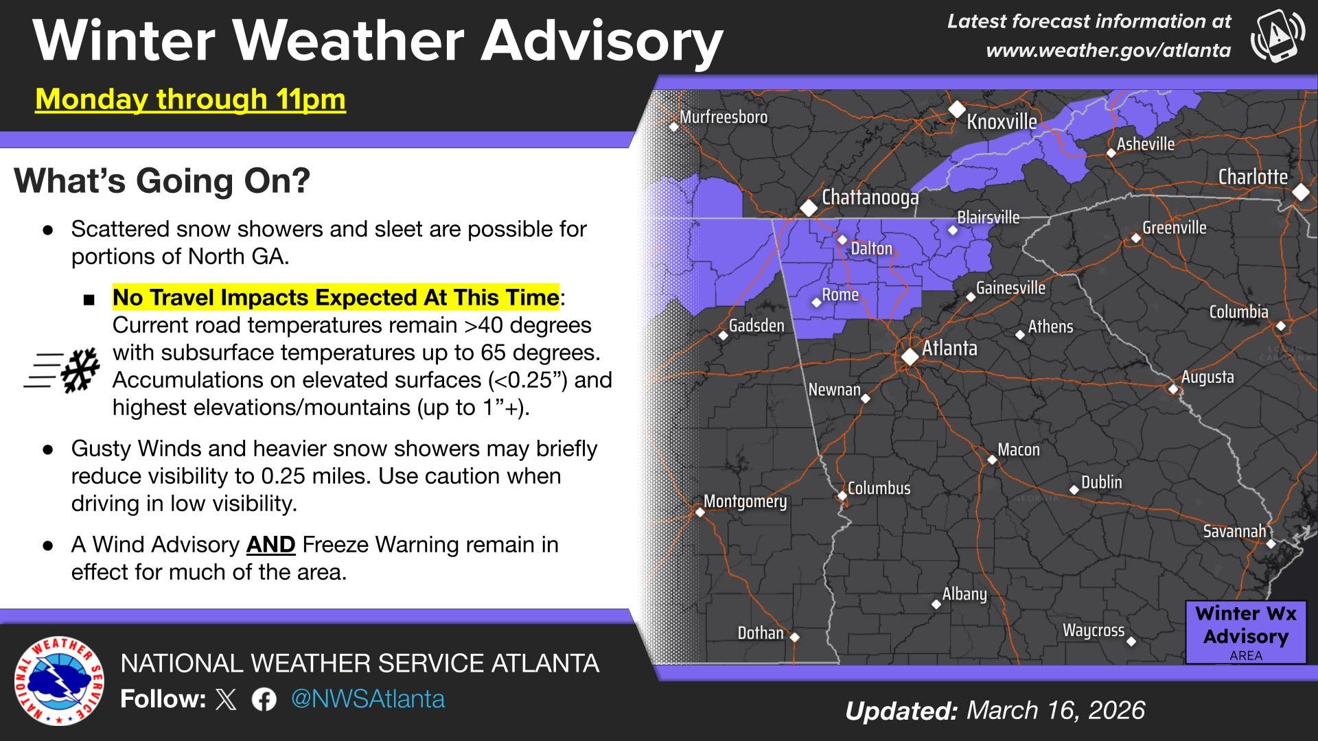
A tornado watch has expired for most of the state, while a high wind advisory and freeze warnings have been issued. Sub-freezing temperatures as low as 26 degrees are expected over parts of central, east central, north central, northeast, northwest, and west central Georgia.
Find out what's happening in Atlantafor free with the latest updates from Patch.
The wind advisory calls for northwest winds of 10 to 20 mph with gusts up to 35 mph until 2 a.m. Tuesday.
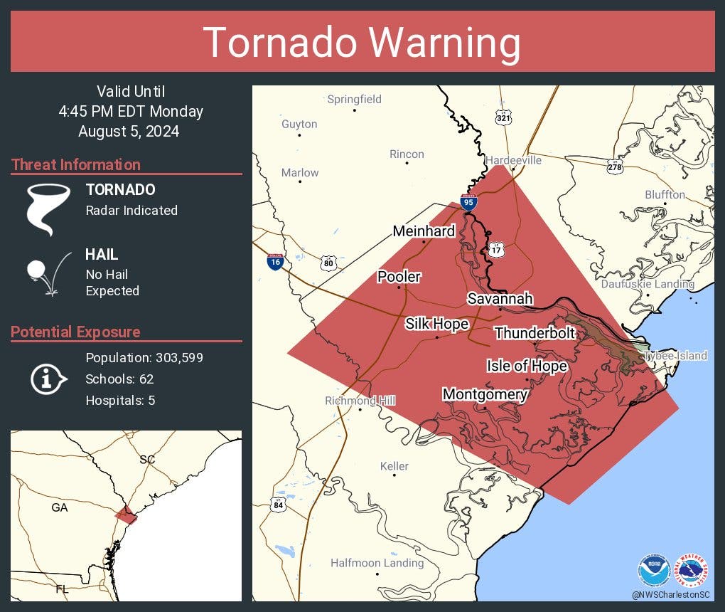
A tornado warning remains only for the Savannah area in far southeast Georgia near the Florida border.
FOX 5 Atlanta reported damage from strong winds early Monday, including trees down in Woodstock in Cherokee County near the Fulton County line, Sandy Springs in north Fulton County just south of the Chattahoochee River and Carroll County.
"Meteorologists are sounding the alarm for a widespread multiday severe risk stretching across the central and eastern United States from Sunday afternoon into Monday," Accuweather said. "Over a dozen states will be at risk for severe thunderstorms."
As thunderstorms move eastward toward the Eastern Seaboard, so will the risk of severe weather. At least some risk for severe thunderstorms is expected from Florida to New York, the private weather service said. AccuWeather meteorologists have upgraded the risk to high from just north of Baltimore to Columbia, South Carolina.
Once the system sweeps through the state, temperatures will plummet, possibly as low as 20 degrees.
A freeze warning is in place from 11 p.m. Monday to 10 a.m. Tuesday for numerous counties, including Bartow, Cherokee, Forsyth, Hall, Paulding, Cobb, Fulton, Gwinnet, Barrow, Douglas, and DeKalb.
"Frost and freeze conditions could kill crops, other sensitive vegetation and possibly damage unprotected outdoor plumbing," the National Weather Service said.
After a couple of days with high temperatures in the mid-40s and 50s, the region warms up and will hit a high of 80 by the weekend.
Here's the latest National Weather Service forecast for the Atlanta region this week:
Monday: Showers and thunderstorms likely before 11am, then a chance of showers. Mostly cloudy, with a temperature falling to around 40 by 2pm. West wind 15 to 20 mph, with gusts as high as 30 mph. Chance of precipitation is 70%.
Monday Night: Partly cloudy, with a low around 27. Northwest wind 10 to 15 mph, with gusts as high as 30 mph.
Tuesday: Sunny, with a high near 46. Northwest wind 10 to 15 mph, with gusts as high as 20 mph.
Tuesday Night: Mostly clear, with a low around 29. Northwest wind around 5 mph becoming calm in the evening.
Wednesday: Partly sunny, with a high near 55. Calm wind becoming south around 5 mph in the afternoon.
Wednesday Night: Mostly clear, with a low around 34.
Thursday: Sunny, with a high near 65.
Thursday Night: Mostly clear, with a low around 45.
Friday: Sunny, with a high near 74.
Friday Night: Mostly clear, with a low around 51.
Saturday: Mostly sunny, with a high near 79.
Saturday Night: Mostly clear, with a low around 55.
Sunday: Sunny, with a high near 80.
Get more local news delivered straight to your inbox. Sign up for free Patch newsletters and alerts.