Weather
Severe Storms, Flash Floods To Inundate GA: See Risks
Weather officials have issued a Level 2 slight risk of flash flooding and heavy rain in GA, where "cloud-to-ground" lightning is expected.

Flash flooding could be a concern during the tail end of the week as heavy rain is set to trample Georgia, according to the forecast.
Storms are expected to roll through the Peach State, starting Wednesday; but, the more problematic weather could come Thursday into Friday, according to the National Weather Service.
Areas from Dalton and Blairsville down to Eatonton and LaGrange were placed under a Level 2 slight risk for flash floods and heavy rain during the week's end. Further south, the NWS issued a Level 1 marginal risk.
Find out what's happening in Atlantafor free with the latest updates from Patch.
The NWS stated it is highly confident in this probability.
"Rain and thunderstorm chances are on the increase over the next few days ahead of an approaching front that will likely stall over north and central Georgia," the NWS stated.
Find out what's happening in Atlantafor free with the latest updates from Patch.
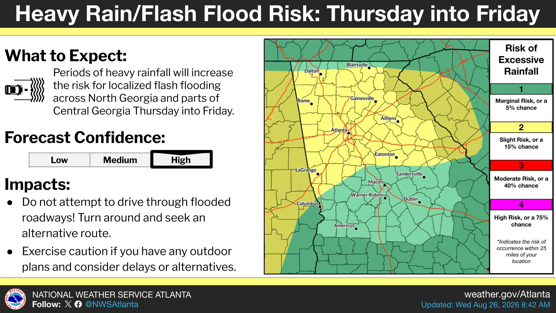
Starting Wednesday, residents could face gusty winds and frequent lightning in the afternoons, the NWS reported.
In metro Atlanta, the NWS predict "cloud-to-ground" lightning on Wednesday.
Forecasters are predicting rain chances through Monday in Georgia.
Seasonal temperatures may vary, ranging from the mid-80s to the mid-90s.
Here is the National Weather Service's Wednesday afternoon forecast for metro Atlanta:
This Afternoon: A 20 percent chance of showers and thunderstorms after 2 p.m. Mostly sunny, with a high near 92. Southeast wind around 5 mph becoming southwest.
Tonight: A 30 percent chance of showers and thunderstorms, mainly before 10 p.m. Partly cloudy, with a low around 72. Southeast wind around 5 mph becoming calm.
Thursday: A 30 percent chance of showers and thunderstorms, mainly after 3 p.m. Partly sunny, with a high near 90. Calm wind becoming southeast around 5 mph.
Thursday Night: A chance of showers and thunderstorms before 2 a.m., then a slight chance of showers after 3 a.m. Mostly cloudy, with a low around 71. Southwest wind around 5 mph becoming calm. Chance of precipitation is 40 percent.
Friday: A 50 percent chance of showers and thunderstorms after 2 p.m. Partly sunny, with a high near 88. Calm wind becoming west around 5 mph.
Friday Night: A 30 percent chance of showers and thunderstorms before 2 a.m. Mostly cloudy, with a low around 71.
Saturday: A 40 percent chance of showers and thunderstorms after 2 p.m. Mostly sunny, with a high near 88.
Saturday Night: A 30 percent chance of showers and thunderstorms before 8 p.m. Partly cloudy, with a low around 71.
Sunday: A 20 percent chance of showers and thunderstorms after 2 p.m. Mostly sunny, with a high near 88.
Sunday Night: A 10 percent chance of showers and thunderstorms before 8 p.m. Partly cloudy, with a low around 72.
Monday: A 20 percent chance of showers and thunderstorms. Mostly sunny, with a high near 90.
Monday Night: A 10 percent chance of showers and thunderstorms. Mostly clear, with a low around 73.
Tuesday: A 20 percent chance of showers and thunderstorms. Sunny, with a high near 93.
Get more local news delivered straight to your inbox. Sign up for free Patch newsletters and alerts.