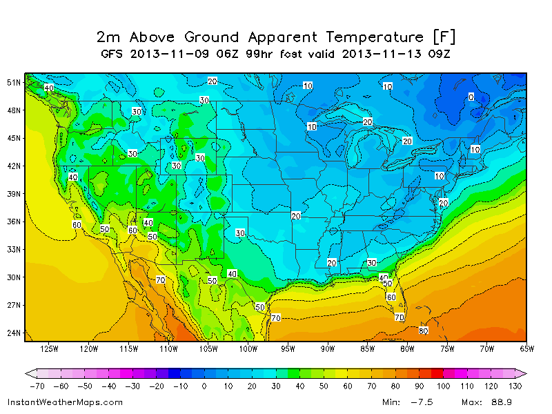

Get your winter clothes out, you're gonna need them next week, as an abnormally strong blast of arctic air descends on the southeast.
We've been watching the evolution of this system for the last week now, and the models are coming into better and better agreement regarding the details. There is no question about the cold air and both models have trended colder in their last few runs. I was looking at the latest Euro this morning and looking at the 2 meter air temps, and I didn't see us going very far above freezing from 7pm Tuesday through Friday. The GFS in't that cold so I'm not so sure about the Euro, but if it were to be true, we'd be looking at a record cold outbreak for so early in the year.
And while the cold air is one story, the even bigger story is our first chance for some winter precipitation in north Georgia. The latest AFD from the Atlanta NWS office talks about the setup:
WHILE THE UNSEASONABLY COLD AIR LOOKS TO BE A GIVEN AT THIS
POINT... THE TRICKY PART WILL BE HOW MUCH ATTENDANT MOISTURE EAST OF THE TROUGH AXIS WILL EXIST WHEN THE STRONG BACKDOOR COLD FRONT PUSHES ACROSS THE AREA... LIKELY TUESDAY EVENING INTO EARLY
WEDNESDAY. THE ECMWF IS A BIT SLOWER WITH MORE EXPANSIVE MOISTURE THAN THE GFS... WHILE THE GFS HAS BETTER MOISTURE IN FAR NORTHEAST GA WHERE TEMPS ARE LIKELY GOING TO BE MORE OF AN ISSUE WITH ANY WINTRY PRECIP POTENTIAL. STRONG CAA QUICKLY BRINGS -2 TO -4 850MB TEMPS TO NORTH GA BY 06Z WED WHILE LOW LEVEL MOISTURE IS STILL PRESENT BEHIND THE FRONT... AND BUFR SOUNDINGS INDICATE POTENTIAL FOR A QUICK RAIN SHOWER TO SNOW SHOWER TRANSITION AS THE PROGGED SATURATED COLUMNS BELOW 600-700MB SHIFT TO MAINLY ALL BELOW 0-C. THE GFS IS QUICKER TO DRY OUT THE COLUMN THAN THE ECMWF SO THERE IS UNCERTAINTY AS TO HOW MUCH MOISTURE WILL STILL BE AROUND TO PRECIPITATE AS THE DRY COLD AIR ADVECTION BATTLES AGAINST IT.
SURFACE TEMPS AT THE MOMENT LOOK TO BE A BIT TOO WARM FOR MOST
AREAS IN NORTH GA FOR ANY SNOW SHOWERS TO RESULT IN
ACCUMULATIONS... THOUGH THE HIGHER ELEVATIONS IN THE NORTHEAST HAVE THE BEST CHANCE AND LOW TO LIGHT ACCUMULATIONS CANNOT BE RULED OUT IN THE 06-12Z PERIOD WED MORNING.
ALL CONSIDERED...HAVE INTRODUCED RAIN OR SNOW SHOWER MIX TO MUCH OF THE NORTH NEAR A ROME... TO CANTON... TO WARRENTON LINE... STAYING MOSTLY NORTH AND EAST OF THE ATLANTA METRO AREA... THOUGH CANNOT RULE OUT POTENTIAL FURTHER SOUTH AT THIS MOMENT. KEEPING SLIGHT TO LOW END CHANCE POPS FOR NOW.
We're still far enough out to see more changes in the forecast, so more updates to come!
You can also see a loop of the snow cover in the continental US. This loop will continue to build as the winter progresses so you can track where the snow cover is.
---------------------------------------------------
Like what you read here and want to be notified of new posts and updates? You can subscribe to this weather blog by clicking here and then clicking on "Get email updates"
Please remember, whenever you need weather information, please visit us at DaculaWeather.com. You can also get the latest weather information by following us on Twitter, Facebook, and here on the Patch! DaculaWeather.com... Your Window to the Weather