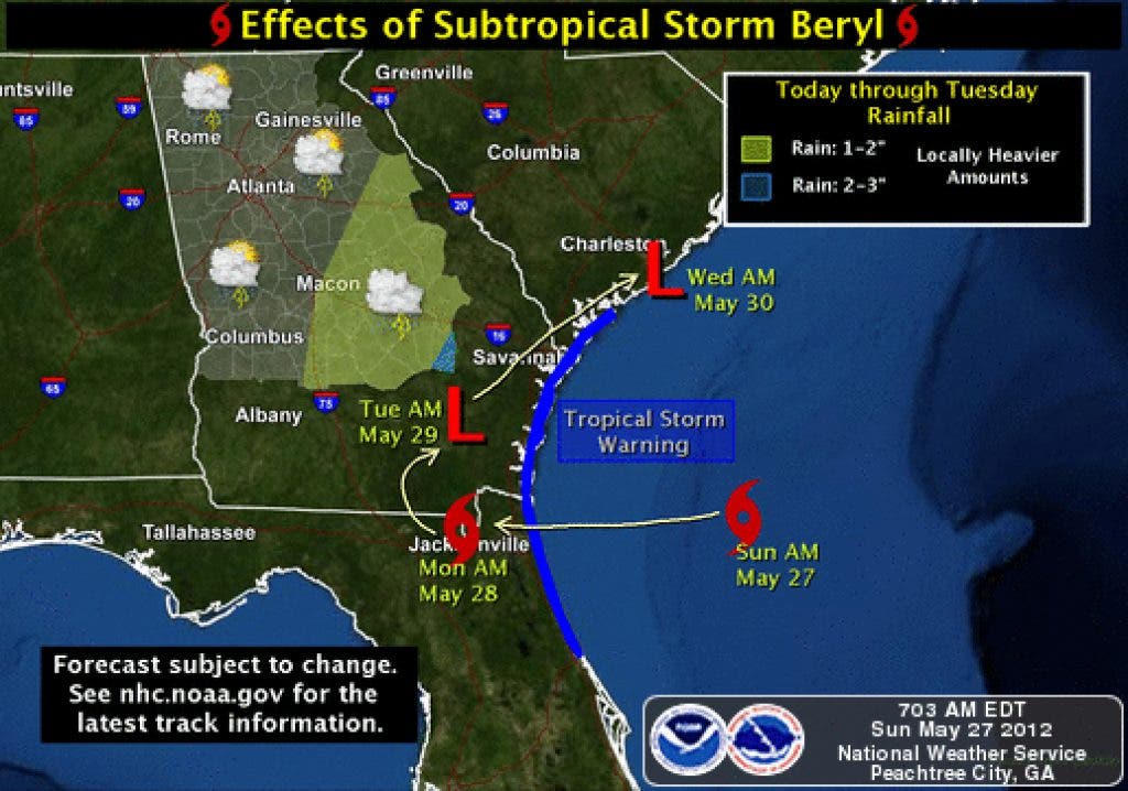


Beryl is now located about 120 miles from Brunswich GA and moving west at around 7 mph, and is expected to make landfall later this afternoon near the GA/FL border. You can see from this satellite view exactly where Beryl is located and can see that the outer fringes of the storm are just now arriving at the Georgia coastline. The bands of greatest rainfall currently are in the south and east quadrents of the storm. You can zoon in on this NEXRAD Level II radar image and see the circulation of Beryl as it moves west.
We are unfortunately going to be on the NW side of this system which means that the heaviest rains will be to our south and east. Most folks in central Georgia won't be complaining though as they are in desperate need for rainfall.
Winds will begin to pick up later this afternoon as Beryl comes ashore, though should remain below Wind Advisory criteria.
Find out what's happening in Daculafor free with the latest updates from Patch.
Beryl is forecast to make an abrupt turn to the NE sometime late Monday/Tuesday and slowly lift out of our area in advance of an approaching cold front.
So we will be in store for an off and on rainy period for the Monday through Friday timeframe. Cloud cover will help to moderate our temperatures somewhat and by the time a cold front passes on Friday, we will fall be to slightly below normal readings for this time of year.
Find out what's happening in Daculafor free with the latest updates from Patch.
Please remember, whenever you need weather information, please visit us at the new and improved DaculaWeather.com. You can also get the latest weather information by following us on Twitter and Facebook DaculaWeather.com... Your Window to the Weather