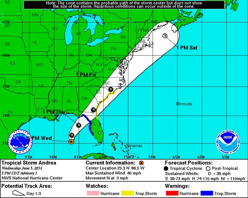
Around 6PM tonight, the National Hurricane Center announced that Tropical Storm Andrea formed in the Gulf of Mexico. Here is a portion of that discussion.
TROPICAL STORM ANDREA SPECIAL DISCUSSION NUMBER 1
NWS NATIONAL HURRICANE CENTER MIAMI FL AL012013
600 PM EDT WED JUN 05 2013
THE AIR FORCE RESERVE RECONNAISSANCE AIRCRAFT INVESTIGATING THELARGE AREA OF DISTURBED WEATHER OVER THE EASTERN GULF OF MEXICO HAS FOUND A CIRCULATION CENTER LOCATED NEAR THE WESTERN EDGE OF THELARGE MASS OF THUNDERSTORMS. THIS CENTER APPEARS TO HAVE FORMED VERY RECENTLY SO THE INITIAL MOTION ESTIMATE IS UNCERTAIN. THE AIRCRAFT MEASURED AN EXTRAPOLATED SURFACE PRESSURE OF 1002MB...PEAK 1000 FT FLIGHT-LEVEL WINDS OF 47 KT...AND BELIEVABLE BIAS-CORRECTED SFMR SURFACE WINDS OF AROUND 35 KT. THESE DATA SUPPORT AN INITIAL INTENSITY OF 35 KT. STRONG SOUTHWESTERLY SHEAR IS EXPECTED TO CONTINUE DURING THE NEXT COUPLE OF DAYS AND SIGNIFICANT STRENGTHENING APPEARS UNLIKELY. THE INTENSITY FORECAST SHOWS LITTLE OVERALL CHANGE IN STRENGTH... EVEN AFTER THE SYSTEM BECOMES EXTRATROPICAL IN 2 TO 3 DAYS.
Find out what's happening in Daculafor free with the latest updates from Patch.
Landfall is expected around the Big Bend area of the panhandle of Florida sometime on Thursday. More to come...
Please remember, whenever you need weather information, please visit us at the new and improved DaculaWeather.com. You can also get the latest weather information by following us on Twitter and Facebook DaculaWeather.com... Your Window to the Weather