Health & Fitness
Did You See the Big Yellow Light in the Sky today?
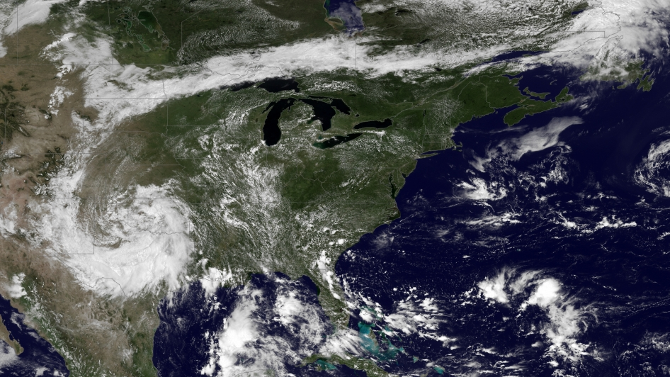
A little dryer... then a little wetter!
Haven't seen that big fireball in the sky very much in the last several weeks!
Today, the upper air is a little dryer than yesterday and because of that, our chance for rain is on the low side today. Still, we have ample low level moisture hanging around as evident by the low cumulus clouds. PW values have fallen to around 1.5" from the +2" values we had the other day, so we're not nearly as moist as we were. But lurking in wait off the GA/SC/FL coast is more moisture that's poised to return to our area by the weekend.
For today:
AREA FORECAST DISCUSSION...
UPDATED NATIONAL WEATHER SERVICE
PEACHTREE CITY GA
1137 AM EDT TUE JUL 16 2013
.UPDATE...
MAIN CHANGE FOR THE UPDATE WAS TO REDUCE POPS INITIALLY. HRRR IS SUGGESTING EXTENSIVE DEVELOPMENT ACROSS THE MOUNTAINS THIS AFTERNOON. NAM/SREF/GFS ARE PICKING UP ON SOME ACTIVITY UP THERE AFTER 18Z. WILL BE WATCHING THIS AREA FOR THE POTENTIAL NEED TO INCREASE POPS ACROSS THE MOUNTAINS INTO THE AFTERNOON. HAVE CHANCE POPS ACROSS THE SOUTHERN THIRD OF THE CWA... BUT SHOULD SEE BETTER COVERAGE REMAIN SOUTH AND EAST OF THE AREA.
As we move through the week, the strong area of high pressure that forced the upper low to retrograde west, will rotate a wave from NC/SC around the base of the high into Georgia on Wednesday, and will bring an increased chance of showers. But the ridge also begins to break down by Thursday and a more southwesterly flow should begin to bring the moisture back to our area for the extended period. Right now the NWS has us back in the 50% chance for showers and thunderstorms beginning on Friday and continuing through the weekend and into next week.
There are still discrepancies between the models past about 4-5 days out, so we'll have to wait a few days to get a better feel for next week. It appears that after this short lived warm-up, there may be a cooling trend as clouds and moisture help to keep our temperatures in a bearable range.
Enjoy the sunshine while you can, it may be sneaking back behind the clouds once again!
Please remember, whenever you need weather information, please visit us at the new and improved DaculaWeather.com. You can also get the latest weather information by following us on Twitter, Facebook, and here on the Patch! DaculaWeather.com... Your Window to the Weather