Community Corner
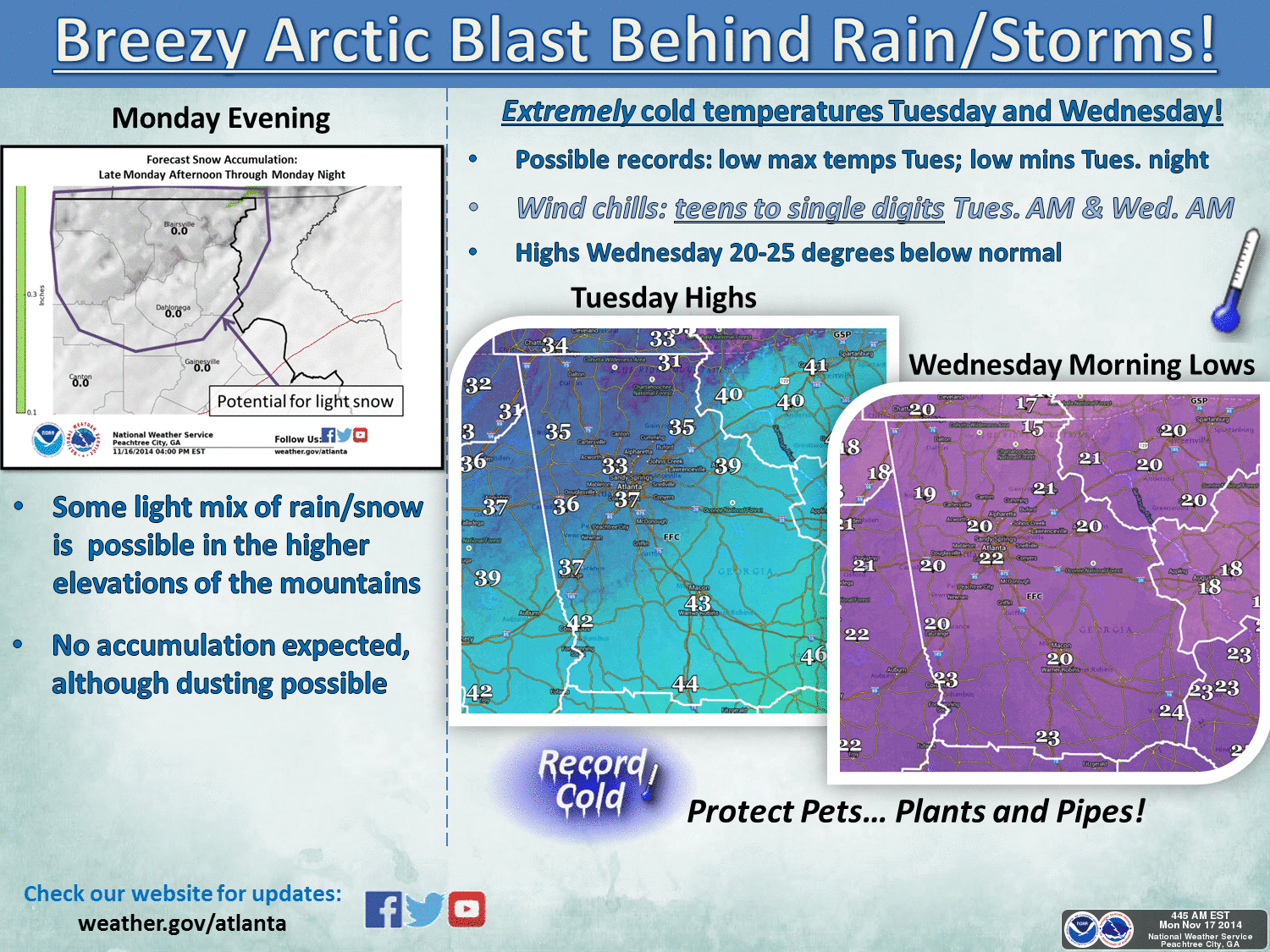
Brace Yourselves: Record Cold Temps Possible with Arctic Blast
Loganville-Grayson Weather: How low with the temps go? National Weather Service says in high teens to low 20s.

If you thought it was cold during the weekend, brace yourselves
The National Weather Service says another arctic blast will bring record cold to many places in north Georgia, including the Loganville and Grayson areas.
Overnight lows in the high teens to low 20s are possible the next two nights, with single-digit wind chills possible.
Find out what's happening in Loganville-Graysonfor free with the latest updates from Patch.
Temperatures could be 20 to 25 degrees below normal, the weather service said.
In Grayson and Loganville, the weather service forecast calls for lows of 24 tonight, 20 on Tuesday and 29 Wednesday. The high Tuesday is expected to be 36, then “warming” to 42 on Wednesday.
Find out what's happening in Loganville-Graysonfor free with the latest updates from Patch.
The weather service said light snow is expected in the northeast Georgia mountains, but no accumulation is expected.
While some light snow with little to no accummulation is possible this evening for the northeast, the big story is with the bitter cold arctic airmass will moving in for Tuesday and Wednesday... possibly breaking records for much of the area. Wednesday morning may see lows in the teens for some areas...but at least lower to mid 20s. Enhanced winds will result in wind chills of teens to single digits both Tuesday morning and Wednesday morning.
Get more local news delivered straight to your inbox. Sign up for free Patch newsletters and alerts.