Politics & Government
Vinings Vision could become reality soon
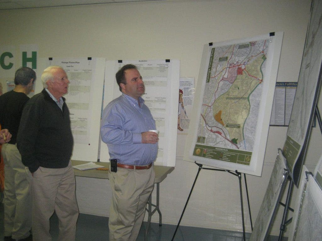
Cobb County's Community Development and Planning Division presented its master plan for the future of Vinings at a meeting Thursday.


Vinings residents were pleased with Vinings Vision Plan’s idea to create a plaza-type common area in their community, but suggestions to create one-way pairs on Paces Ferry and New Paces Ferry roads were not so well received at at .
The Thursday meeting was the to address land use, transportation and community character and improvement issues in Vinings. At the first two meetings the Community Development and Planning Division gathered information from citizens about what they liked and disliked about their community. Last night staff presented the master plan that it had formed based on citizen input and from meetings with the stakeholders committee.
“I think you can say without any doubt from anybody that this is a much more comprehensive plan and look for the Vinings area than you have seen in a long, long time,” said Bob Ott, District 2 commissioner. That’s really what the purpose was.”
Find out what's happening in Smyrna-Viningsfor free with the latest updates from Patch.
After the presentation, Planning Commission staff passed out green and red stickers so attendees could mark the projects that they liked and disliked on the master list. The most popular component of the master plan was the acquisition of the shopping center at the southwest corner of the intersection of Paces Mill and Paces Ferry to construct a plaza tentatively named Vinings Commons. This approval was evidenced by the large number of green stickers on the project chart and from comments from attendees.
On the contrary, many residents were opposed to making Paces Ferry and New Paces Ferry roads one-way pairs. Mandy Elliot, Planning Division staff, explained how the one-way pairs would work.
Find out what's happening in Smyrna-Viningsfor free with the latest updates from Patch.
“You’re coming westbound on Paces Ferry Road from the Chattahoochee River as you get to the intersection of New Paces Ferry Road,” she said “Paces Ferry Road becomes one-way as you’re going northbound. People going southbound would go down New Paces Ferry Road until they get to the intersection of New Paces Ferry where it becomes two-way traffic. Two-way traffic would remain on Paces Ferry and Paces Mill Road and this would also require creating a left turn lane from Paces Ferry onto New Paces Ferry that would run the length al the way to the Paces Mill intersection. And this would help queue the traffic for that left-turn on to New Paces Ferry Road. It would also probably require some signalization improvements. So if you have a train coming through and people are blocked on Paces Ferry, people would still get a priority for that left turn onto New Paces Ferry Road.”
This proposal was met with disapproval from Debby Bolt, Vinings resident and president of the Rotary Club of Vinings.
“I’m very opposed to that,” she said. “I don’t quite see how it’s going to work and a lot of Vinings comes up Randall Farm and I don’t know how that would work. I just think it would make it very awkward and I think it’s going to change too dramatically how we live in our own community.”
Bolt was not the only one with reservations as this proposal was marked with many red stickers on the project chart. Some were concerned about how this would impact firefighters at Fire Station Number Five when they respond to calls, though Elliott did note that a special signal would be installed that firefighters could operate to control traffic from the station.
Other elements of the plan included the construction of a roundabout at Woodland Brook Drive and Paces Ferry Road as a mean of increasing traffic flow. The master plan also included the development of two transition zones on Paces Ferry west of the railroad tracks and on Atlanta Road to provide a transition from the industrial development on the south side of Atlanta Road and the residential properties along Log Cabin Drive.
Another suggestion was for the creation of an interpretive trail that would extend throughout Vinings and indicate historic sites with signange that include maps, photos and text. The plan also proposed placing signs along four major roadways to mark entrance into the community.
The next step for the Vinings Vision Plan is for the Planning Division to take the suggestions from last night’s meeting and determine whether a fourth meeting is necessary. If so, that meeting would take place in Janaury.
“If we feel that there is good feedback and we think we’re in the right direction, then we may make the tweaks that need to be made and continue to get it out to the public through the Vinings Village homeowners associations in the area and then continue to look forward,” said Dana Johnson, planning division manager.
Once the plan has received the Vinings community’s stamp of approval, the planning division will present it to the Planning Commission of the Board of Commissioners for final approval.