Weather
7 Inches Of Snow Possible: Winter Weather Advisories Issued
Travel could become difficult, especially between 8 p.m. and 2 a.m., when the heaviest snow is expected.

ILLINOIS — Winter weather advisories have been issued for Thursday as a winter storm approaches the Chicago area.
The advisory has been issued for Lake, DuPage and northern and central Cook counties from 6 p.m. Thursday to 7 a.m. Friday, according to the National Weather Service.
A winter weather advisory is also in effect from 3 p.m. Thursday to 7 a.m. Friday for McHenry County.
Find out what's happening in Across Illinoisfor free with the latest updates from Patch.
The weather service said accumulating wet snow is expected with the storm, with total accumulations of 2 to 4 inches near the Interstate 290 corridor, and higher totals of 4 to 7 inches closer to the Illinois-Wisconsin border.
Find out what's happening in Across Illinoisfor free with the latest updates from Patch.
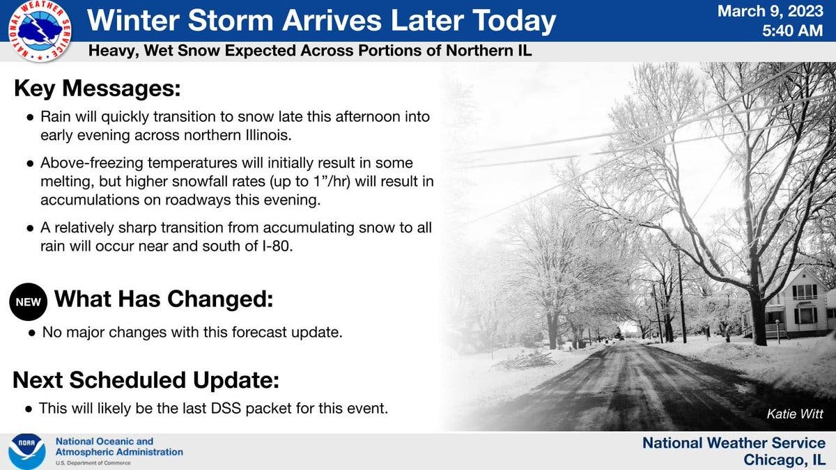
There will be a sharp cut-off from accumulating snow to all rain for areas near and south of Interstate 80, according to the weather service.
AccuWeather is predicting slightly higher totals for Joliet, with a probability of 72 percent for 3 to 6 inches of snow. The private forecaster said "deteriorating road conditions" will begin Thursday night and to "plan for a slow and slippery morning commute."
Snow showers will linger into Friday morning, and there are also more chances for snow expected Saturday night, Sunday and Monday, according to the weather service.
Get more local news delivered straight to your inbox. Sign up for free Patch newsletters and alerts.