Weather
More Tornadoes Possible, Severe Storms On Tuesday For Chicago Area
If severe storms do develop on Tuesday, all severe hazards, like destructive winds, tornadoes and hail, are possible.

ILLINOIS — There is potential for more severe weather for the Chicago area on Tuesday, according to the National Weather Service.
"There is a considerable amount of uncertainty," the weather service noted.
The week will start off quite warm, with a high of 67 expected on Monday and a high of 70 on Tuesday for areas north of Interstate 80, and 77 degrees south of I-80, according to the weather service.
Find out what's happening in Across Illinoisfor free with the latest updates from Patch.
4 Dead In Illinois, 16 Tornadoes Confirmed In Friday's Severe Weather
There is a chance of showers and thunder on Monday afternoon as well.
Find out what's happening in Across Illinoisfor free with the latest updates from Patch.
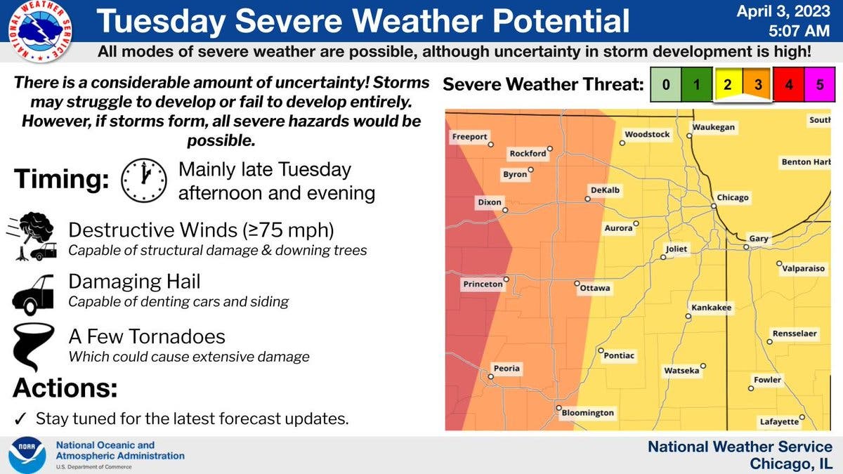
If severe storms do develop on Tuesday, all severe hazards would be possible, the weather service said. This would include destructive winds greater than 75 mph, damaging hail and a few tornadoes.
The timing of the severe weather on Tuesday would be late afternoon and evening.
"Potential outcomes at this time range from no storms in our area at all, to a few storms producing destructive hail and tornadoes capable of extensive damage," the weather service shared.
AccuWeather gave a 94 percent probability for thunderstorms for Joliet on Tuesday night. The private forecaster said "storms can bring flooding downpours, hail, damaging wind gusts and an isolated tornado."
After the storms, a cold front will move through the area on Wednesday morning, the weather service said. There will be non-thunderstorm winds on Wednesday, with gusts up to 50 mph.
Get more local news delivered straight to your inbox. Sign up for free Patch newsletters and alerts.