Weather
Extreme Cold Watch: Wind Chills 35 Below Zero Expected For Chicago Area
Another round of snow is also possible Wednesday evening before the dangerous cold on Thursday night.

An extreme cold watch has been issued for late Thursday through Friday morning, as wind chills as low as 35 below zero are expected for the Chicago area, according to the National Weather Service.
Wind chills that low can cause frostbite on exposed skin in as little as 10 minutes, the weather service said. You should dress in several layers, including a hat, face mask and gloves if you must go outside, NWS advised.
Before the cold begins on Thursday night, another round of snow is also possible Wednesday night, which may lead to hazardous travel. The weather service said a one- to two-hour burst of snow is possible, with a time range of 5 p.m. Wednesday to midnight.
Find out what's happening in Across Illinoisfor free with the latest updates from Patch.
Accumulations will be between 0.5 to 1 inch of snow.
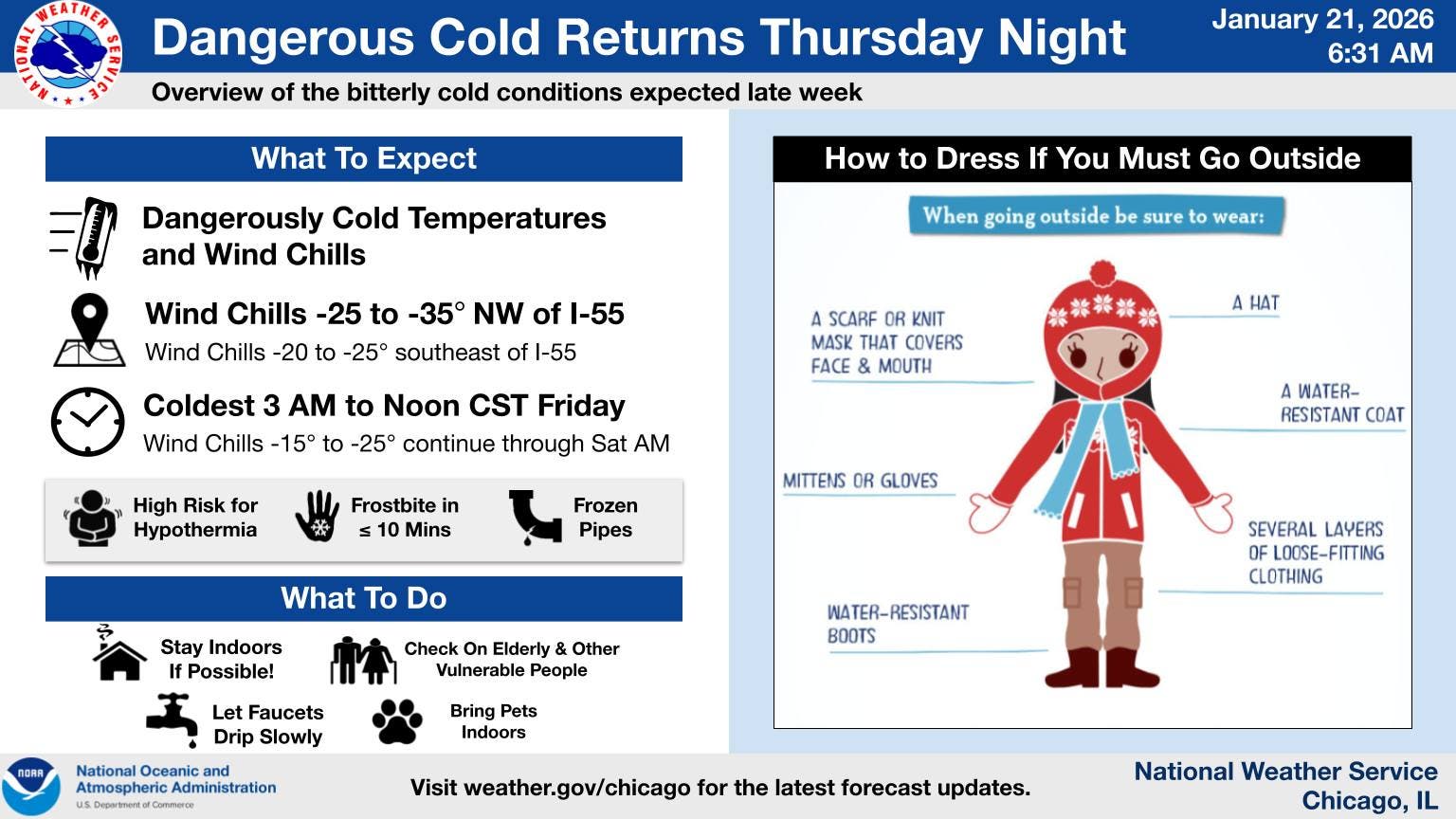
The dangerous cold begins Thursday night into Friday morning, and bitter cold will continue through the weekend, according to the weather service.
Find out what's happening in Across Illinoisfor free with the latest updates from Patch.
The weather service said there is high confidence in a period of bitter cold from Thursday night to Saturday morning, but there remains uncertainty on how extreme the cold and wind chills will be.
Currently, the weather service is forecasting a high of minus 2 on Thursday night, with wind chills as low as 35 below zero, and a high of minus 5 degrees on Friday with wind chills as low as 25 below zero.
Get more local news delivered straight to your inbox. Sign up for free Patch newsletters and alerts.