Weather
Illinois Snowstorm: Arctic Cold, 50 MPH Winds, 4-6 Inches Of Snow
Temperatures are expected to drop 20 to 30 degrees Thursday, with subzero temps and wind chills of -30 to -40 degrees by evening.


ILLINOIS — An arctic cold front, as well as possible blizzard conditions and high wind, is bearing down on the Chicago area, according to the National Weather Service. As of 8:30 a.m. Thursday, the weather service said the arctic front had crossed the Mississippi River and was approaching Interstate 39.
The weather service said temperatures will drop 20 to 30 degrees in 2 to 3 hours as the front moves through. By Thursday evening, the Chicago area could see subzero temperatures and wind chills of minus 25 to minus 35 degrees. There will also be quickly accumulating snow and reduced visibility.
The cold temperatures could cause a flash freeze on bridges and overpasses, according to the weather service. Roads will quickly become ice-covered as temperatures fall.
Find out what's happening in Across Illinoisfor free with the latest updates from Patch.
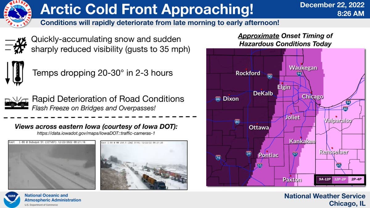
The entire Chicago area is under a winter storm warning, which ends at 6 a.m. Saturday. Snow and blowing snow could produce intermittent white-out conditions, according to the weather service.
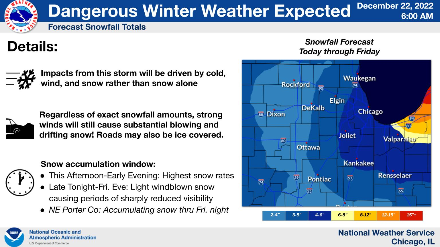
Through Friday, 4 to 6 inches of snow could hit most of the area, and there could be wind gusts as high as 50 mph. The weather service said a period of heavy snowfall with rates up to 1 inch per hour is likely on Thursday afternoon for some areas.
Find out what's happening in Across Illinoisfor free with the latest updates from Patch.
Most of the area will only see moderate snow, the weather service said, but the combination of snow, winds, and the cold will make travel "treacherous."
AccuWeather gave a forecast of 4 to 8 inches of snow, and a "poor" travel outlook for Thursday and Friday for the Chicago area. The private forecaster said the storm will undergo "bombogenesis," a rapid strengthening which will cause barometric pressure to fall and winds to "rush in and swirl at high speeds around the storm's center" — what's known among weather experts as a "bomb cyclone."
The weather service said dangerously cold wind chills as low as 30 to 40 below zero are expected Thursday night through Friday night. Those temperatures can cause frostbite on exposed skin in as little as 20 minutes.
Get more local news delivered straight to your inbox. Sign up for free Patch newsletters and alerts.