Weather
Record High Temps, Critical Fire Conditions Expected In Chicago Area
The area will experience record-like high temperatures to start the week before a drastic drop again midweek.

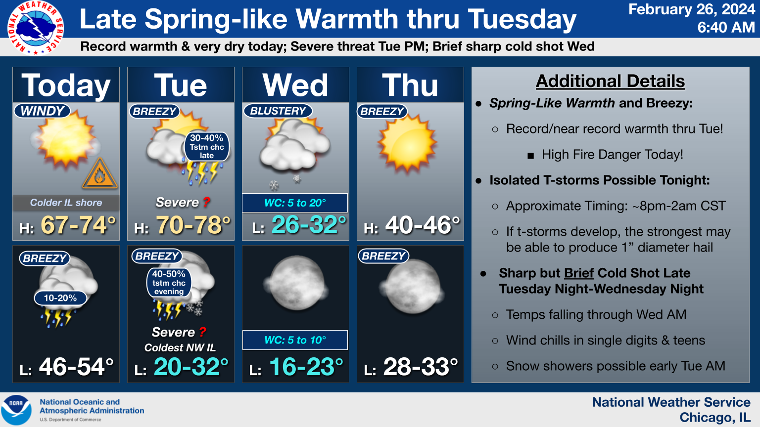
ILLINOIS — Record high temperatures are predicted for Chicagoland to start the week before cold weather returns Wednesday. According to the National Weather Service, record highs are "highly likely" for Chicago and Rockford, with temperatures in the 67 to 74 degree range for Monday, and 70 to 76 for Tuesday.
Due to the higher temperatures, NWS has issued a red flag high fire danger Monday. Strong southerly winds, which will gust over 30 mph at times, along with the record warm temperatures, and very dry conditions will cause any brush fires to spread rapidly and become difficult to control. Officials are asking residents to "exercise extreme caution" in disposing of smoking materials and consider postponing any outdoor burning.
In addition, isolated thunderstorms are possible between 8 p.m. to 2 a.m. Monday night. If the thunderstorms develop, NWS said the strongest will be able to produce 1-inch hail.
Find out what's happening in Across Illinoisfor free with the latest updates from Patch.
Temperatures are predicted to start falling heading into Wednesday morning, with wind chills in single digits and teens. Snow showers are possible Wednesday morning.
Find out what's happening in Across Illinoisfor free with the latest updates from Patch.
Get more local news delivered straight to your inbox. Sign up for free Patch newsletters and alerts.