Weather
Severe Thunderstorm, Snow Could Hit Chicago Area On Same Day
Accumulating snow is possible Sunday night into Monday as temperatures turn much colder for the start of the week.

After strong winds on Friday and a possibly rainy and snowy Saturday, Sunday will feature both a severe thunderstorm threat and the possibility of wintry weather into Monday.
"We're tracking yet another strong storm system due to arrive on Sunday," the weather service said.
Sunday will have a high of 66 degrees, and there will be waves of storms with an afternoon severe threat, according to the current forecast.
Find out what's happening in Across Illinoisfor free with the latest updates from Patch.
The weather service said the threat for severe weather is greatest near and east of Interstate 55.
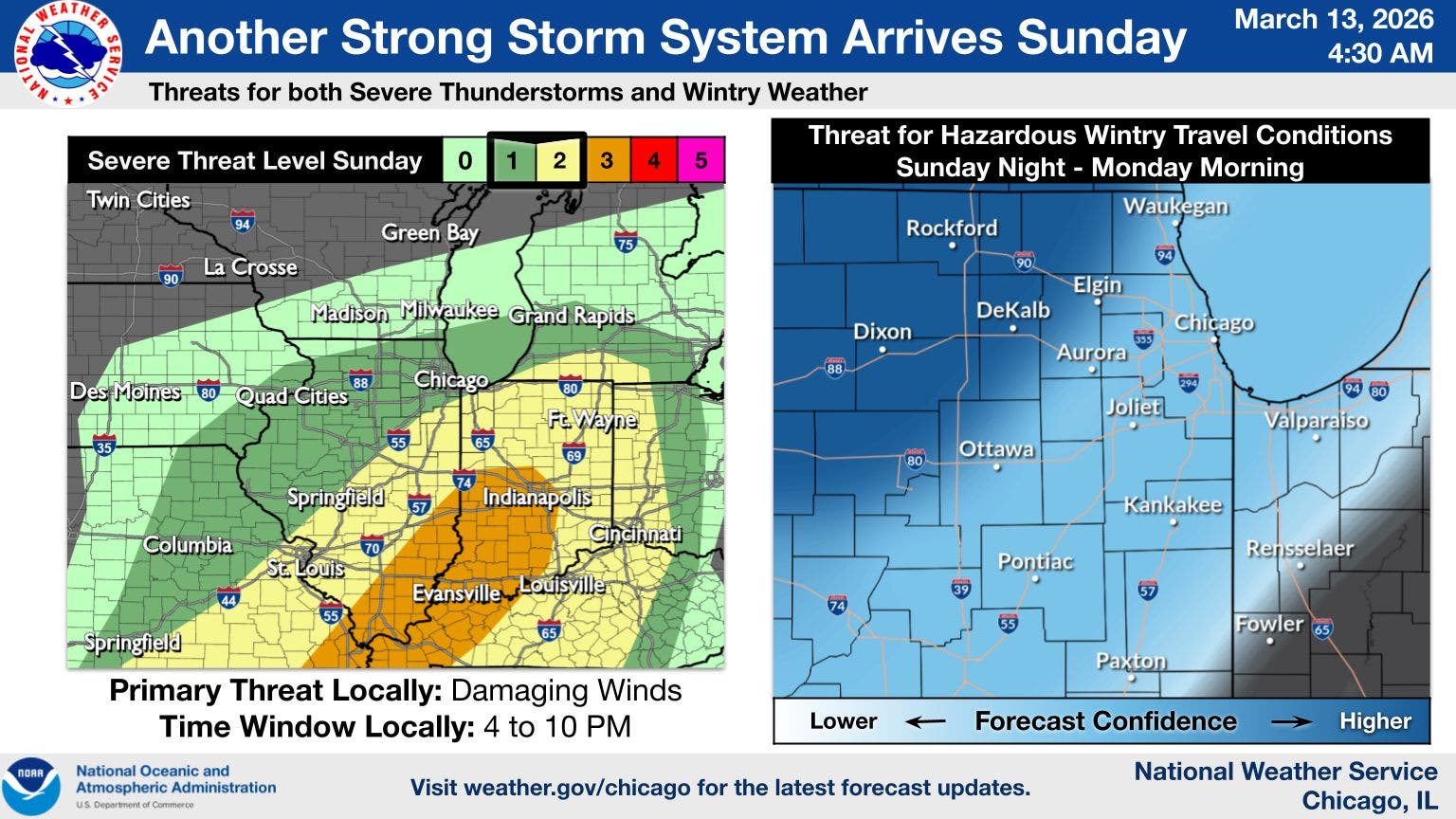
The primary threat will be damaging winds; more details on the severe weather will come as we get closer, the weather service said.
Find out what's happening in Across Illinoisfor free with the latest updates from Patch.
After storms, rain may change over to snow Sunday night, and continue into Monday.
"Accumulating snow and blowing snow are likely to occur in at
least part of the area Sunday night into Monday and will lead to travel impacts," the weather service said. "The greatest accumulations and travel impacts are currently most likely to occur west of Interstate 55."
Monday and Tuesday will also both be much colder, with a high of 32 on Monday and a high of 28 on Tuesday, according to the current forecast.
Get more local news delivered straight to your inbox. Sign up for free Patch newsletters and alerts.