Weather
Snow Accumulation Estimates, Timeline Released For Illinois
With bitterly cold temperatures continuing, the dry, fluffy snow could lead to slick road conditions and hazardous travel in many areas.

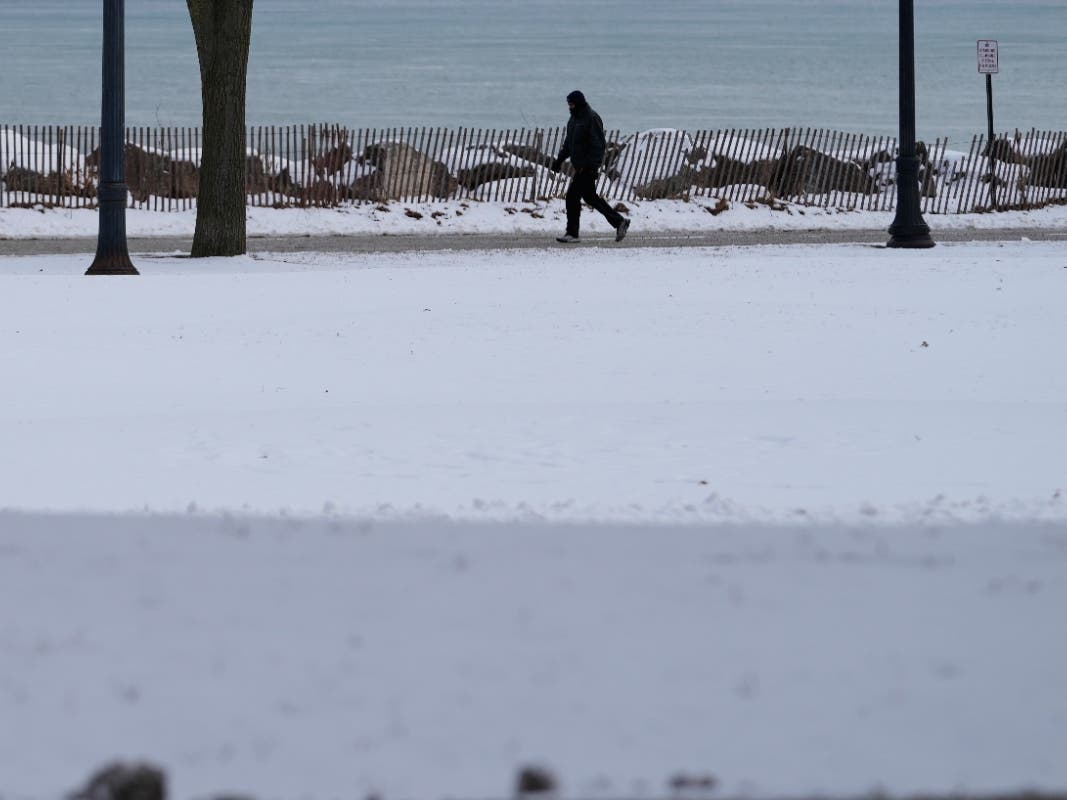
Bitterly cold temperatures continued into the weekend, as the National Weather Service released snowfall estimates and timing for a weekend snowstorm expected to hit late Saturday afternoon and last through Sunday.
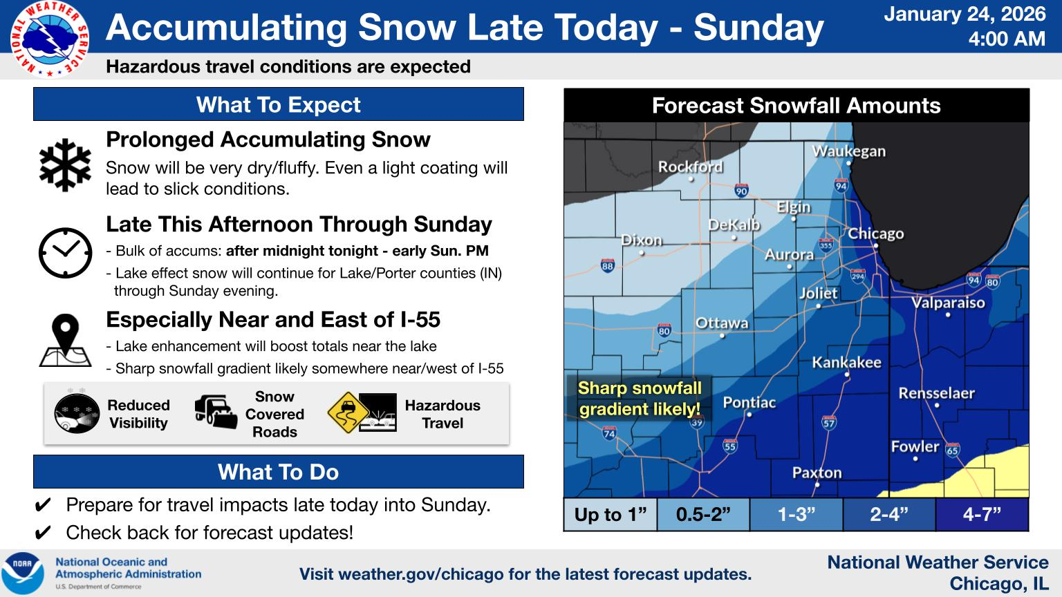
"A prolonged period of accumulating fluffy snow and associated hazardous travel is expected late today into Sunday," the weather service said.
Wind chills of -20 to -30 degrees were expected through the morning, with temperatures improving by Saturday afternoon.
Find out what's happening in Across Illinoisfor free with the latest updates from Patch.
NWS warned of increased risk for hypothermia, which can occur in under 30 minutes, as well as the risk of frozen pipes. Residents were urged to stay indoors if possible, let faucets drip slowly, check on the elderly and vulnerable people and bring pets indoors.
In Chicago, the Polar Bear Club canceled its annual polar plunge fundraiser due to expected dangerously cold temperatures.
Find out what's happening in Across Illinoisfor free with the latest updates from Patch.
Snow to hit Saturday afternoon
Very dry, fluffy snow accumulations are expected to begin Saturday afternoon and last through Sunday, with the bulk of accumulation happening after midnight and into early Sunday.
Lake effect snow was expected to continue for northwest Indiana, and the highest snowfall totals and most significant travel impacts were expected near Lake Michigan and especially near and east of I-55.
NWS warned that even a light coating of snow will lead to slick road conditions, and drivers were urged to account for snow-covered roads and reduced visibility.
Snowfall estimates
A sharp snowfall gradient is likely, with parts of the Chicago area getting anywhere from half an inch to three inches depending on location, with higher snow totals further east and into northwest Indiana of two to four inches for some areas and as much as 4 to 7 inches for others.
Cold temperatures continue into next week
After this weekend's snow, cold conditions will continue into next week, the NWS said. Sunday will bring wind chills of 0 to -10 degrees during the day and -10 to -20 degrees at night.
Morning wind chills of -15 to -25 and a high of 8 to 12 degrees are expected Monday.
Tuesday will be slightly warmer, with morning wind chills of -5 to -15 degrees and high temperatures of 16 to 21 degrees, with wind chills as low as -10 degrees and lows of 0 to 6 degrees overnight.
Get more local news delivered straight to your inbox. Sign up for free Patch newsletters and alerts.