Weather
Snow, Plummeting Temps To Hit Chicago Area Friday
Some roadways may become icy or snow covered this evening, with temperatures expected to drop drastically.

ILLINOIS — While recent weather might imply otherwise, there is still nearly a month left of winter. Expect an "abrupt end" to the mild weather at least for a day or two, starting Friday afternoon, according to the National Weather Service, as temperatures drop and snow is predicted for this evening.
A strong cold front will be hitting the area from the south, bringing rain with it, which will change to snow when the temperatures fall. With evening temperatures in the 20s, a steady snowfall, and blustery northerly winds, the National Weather Service said some roadways may become icy or snow covered, particularly bridges and overpasses.
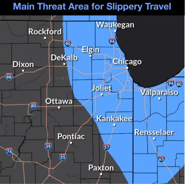
The main threat for potential slippery travel is shaded in light blue on the map below, which will cover far northeast/far northern Illinois and points south-southeastward.
Find out what's happening in Across Illinoisfor free with the latest updates from Patch.
For those dreaming of spring and warmer weather, another period of unseasonably warm weather is set to return Sunday into early next week. Daytime temperatures will go from 32 to 39 degrees Saturday, to 52 to 55 Sunday, and back up to 60 to 65 on Monday.
RELATED: Early Spring Possible In IL As El Niño Falls Apart — Forecast
Find out what's happening in Across Illinoisfor free with the latest updates from Patch.
Get more local news delivered straight to your inbox. Sign up for free Patch newsletters and alerts.