Weather
Snow Set To Return Following Wildfire Risk In IL: NWS
Dry and breezy conditions on Tuesday will result in an elevated risk for the spread of brush fires, according to National Weather Service.

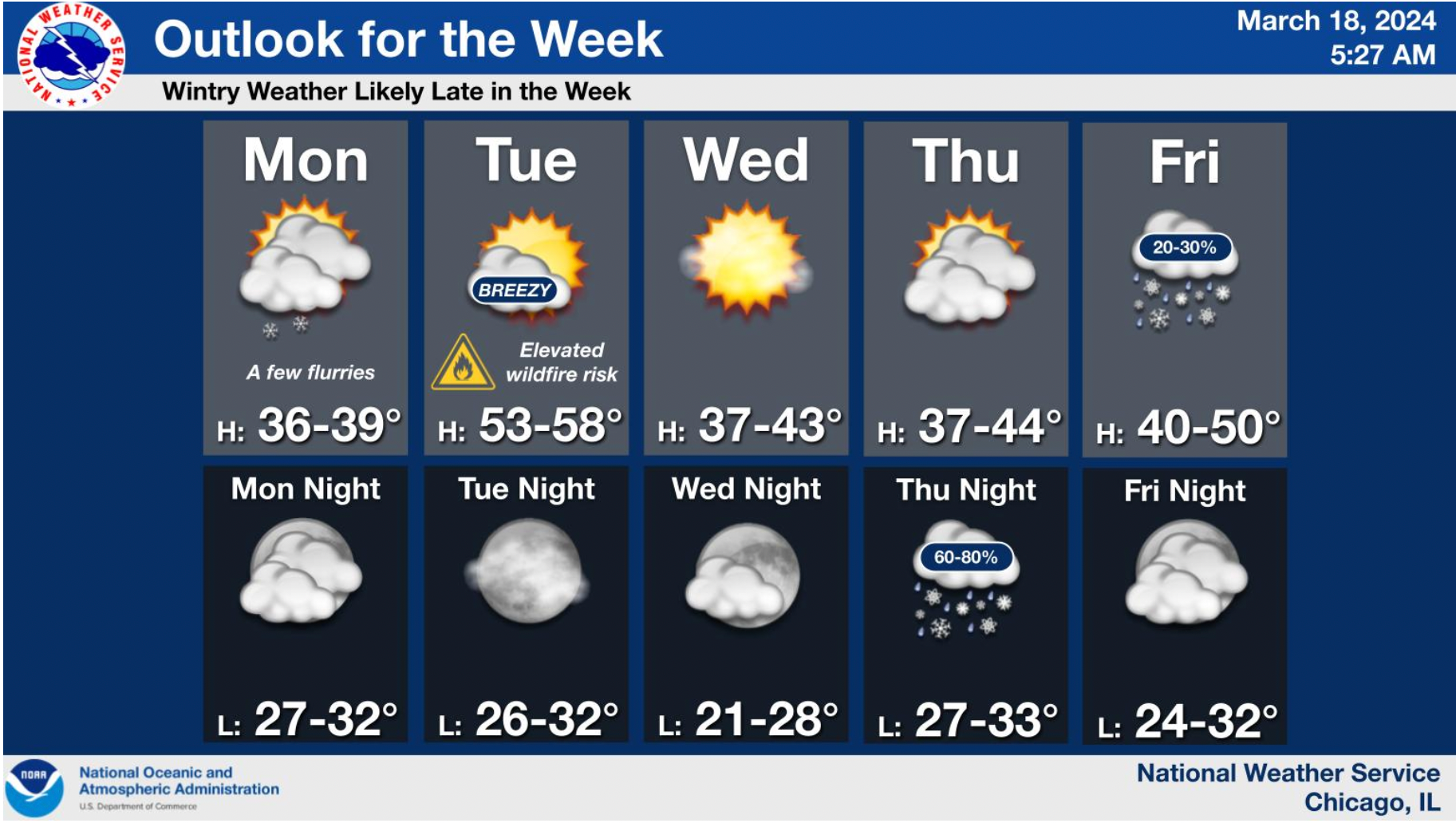
ILLINOIS — Yes, that was snow you saw Monday morning as lingering flurries made their way across the area. While highs are not expected to get out of the 30s for the rest of the day, warmer and breezier conditions Tuesday will elevate the risk for the spread of brush fires, according to the National Weather Service.
Wind gusts could reach as high as 35 mph during the day, 25 mph on Tuesday night.
Following Tuesday's highs between 53 and 58 degrees, a trend back to colder conditions is expected for the rest of the week. NWS said high will be between 37 and 43 on Wednesday, followed by between 37 and 44 on Thursday.
Find out what's happening in Across Illinoisfor free with the latest updates from Patch.
Wintry precipitation is "likely" after 8 p.m. Thursday night, with a low around 33 predicted.
On Friday, snow is also in the forecast as it possibly mixes with rain after 8 a.m., before gradually ending. It will be mostly cloudy with a high near 42, according to NWS.
Find out what's happening in Across Illinoisfor free with the latest updates from Patch.
Get more local news delivered straight to your inbox. Sign up for free Patch newsletters and alerts.