Weather
Stormy Weather On The Way To Chicago Area As Warmer Temps Return
Here's when severe weather could hit and how likely it is, according to the National Weather Service.

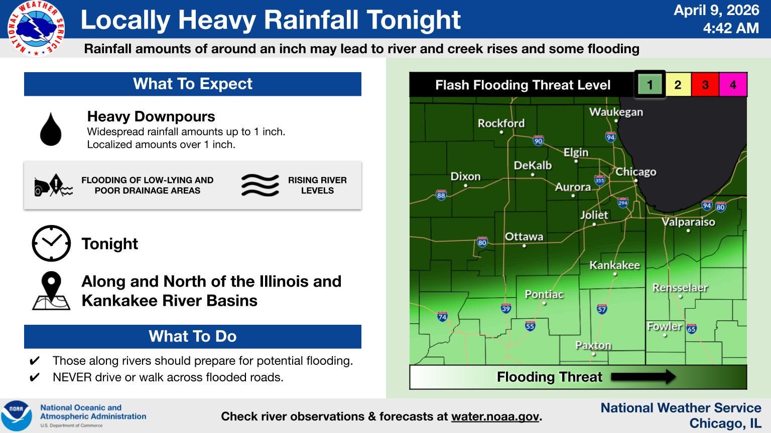
Heavy rain is possible Thursday evening into Friday morning, and there appears to be stormy weather on the way for early next week, according to the National Weather Service.
First, on Thursday, there is a high of 76 degrees, but rain will return late Thursday and into Friday morning. The weather service said heavy downpours are possible, and some areas could see over an inch of rain. Severe weather isn't expected.
"There could be another break in the rain Friday night into Saturday, but the early part of next week is looking stormy," the weather service said on its Facebook.
Find out what's happening in Across Illinoisfor free with the latest updates from Patch.
Friday will have a high of 62, and Saturday will have a high of 65 degrees. Sunday and Monday will be even warmer, with highs of 78 and 82, respectively.
The weather service said "a warmer and more active weather pattern" will develop during the weekend and into early next week. Several rounds of storms will be possible, "with the pattern favorable for some strong to severe storms at times."
Find out what's happening in Across Illinoisfor free with the latest updates from Patch.
The weather service currently has given Monday and Tuesday a level 2 of 5 severe storm risk.
Here's a more detailed look at the weather through the weekend, per the weather service:
THURSDAY: Scattered showers before 9 a.m., then a slight chance of showers and thunderstorms after 5 p.m. Partly sunny, with a high near 70. Southwest wind around 10 mph, with gusts as high as 20 mph. Chance of precipitation is 30%.
THURSDAY NIGHT: Showers and thunderstorms likely before 1 a.m., then showers and possibly a thunderstorm between 1 a.m. and 4 a.m., then showers after 4 a.m. Low around 46. North wind 5 to 10 mph becoming east northeast in the evening. Winds could gust as high as 15 mph. Chance of precipitation is 90 percent. New rainfall amounts between a half and three quarters of an inch possible.
FRIDAY: A 50 percent chance of showers before 1 p.m. Cloudy, then gradually becoming mostly sunny, with a high near 57. North northeast wind around 10 mph, with gusts as high as 15 mph.
FRIDAY NIGHT: Mostly clear, with a low around 36. East northeast wind 5 to 10 mph.
SATURDAY: Mostly sunny, with a high near 61. East southeast wind 5 to 10 mph, with gusts as high as 15 mph.
SATURDAY NIGHT: A 30 percent chance of showers. Mostly cloudy, with a low around 52.
SUNDAY: A 30 percent chance of showers after 1 p.m. Mostly cloudy, with a high near 75. Breezy.
SUNDAY NIGHT: Showers likely. Mostly cloudy, with a low around 62. Breezy.
Get more local news delivered straight to your inbox. Sign up for free Patch newsletters and alerts.