Weather
Severe Weather To Hit As 'Summer-Like Pattern' Comes To Chicago Area
Highs in the 80s are expected during the work week, as well as periods of possibly severe storms.

A "regional threat for severe weather" is possible on Tuesday and Wednesday as a "summer-like pattern" is expected in the Chicago area starting on Sunday, according to the National Weather Service.
While Friday and Saturday will have highs in the 60s; temperatures start to warm on Sunday, which has a high of 79 degrees. Monday has a forecasted high of 81, and Tuesday a high of 53, according to the current forecast.
"Not only will this pattern feature much warmer temperatures, but it will also bring additional periods of showers and thunderstorms, some of which could be severe," the weather service said. However, there will still be many dry hours.
Find out what's happening in Across Illinoisfor free with the latest updates from Patch.
The NOAA's Storm Prediction Center currently has all of northern Illinois in the 15-29 percent range for probability of severe weather on Tuesday.
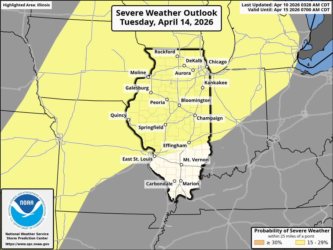
According to the Storm Prediction Center, there is "quite a bit of uncertainty" for severe potential from Monday to Wednesday in the central/southern Plains to the Midwest.
Find out what's happening in Across Illinoisfor free with the latest updates from Patch.
The weather service forecast said the warm and humid pattern will bring periodic showers and thunderstorms through the middle of the work week. Currently, the forecast shows a chance of storms on Saturday night, Sunday, Monday and Tuesday.
Get more local news delivered straight to your inbox. Sign up for free Patch newsletters and alerts.