Weather
Temps Could Reach Above Freezing By End Of Week In Chicago Area
The high for Friday is forecast to be 37 degrees.

"Seasonably cool" temperatures are likely for most of the week, marking a change from the frigid wind chills of the last few weeks, according to the National Weather Service.
The weather service said temperatures might even "reach the freezing mark late in the week."
Most of the week has highs in the upper 20s, although Thursday has a high of 34 and Friday has a high of 37, according to the current forecast.
Find out what's happening in Across Illinoisfor free with the latest updates from Patch.
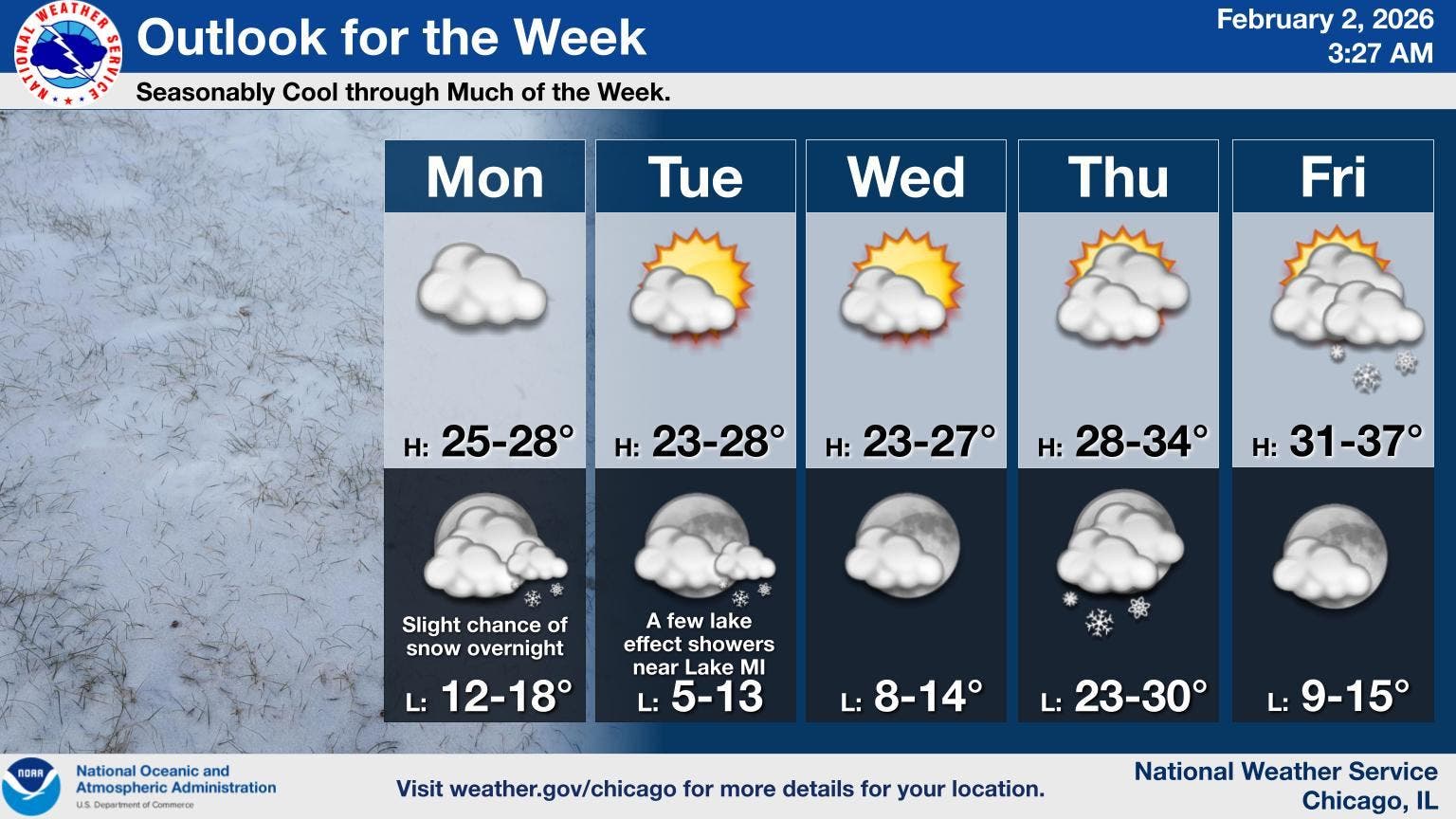
As for snow, there looks to be a slight chance of snow overnight on Monday, as well as a chance of lake effect showers near Lake Michigan on Tuesday night.
According to the current forecast, the next chance of snow will then come later in the week on Thursday night, and again on Friday.
Find out what's happening in Across Illinoisfor free with the latest updates from Patch.
Here's a look at what you can expect in the coming days:
MONDAY: Isolated flurries between 11 a.m. and 3 p.m. Mostly cloudy, with a high near 29. West northwest wind 5 to 10 mph.
MONDAY NIGHT: A 20 percent chance of snow after midnight. Mostly cloudy, with a low around 17. West northwest wind around 5 mph, with gusts as high as 10 mph.
TUESDAY: Mostly sunny, with a high near 26. North wind 5 to 10 mph.
TUESDAY NIGHT: Partly cloudy, with a low around 11. North northwest wind 5 to 10 mph.
WEDNESDAY: Mostly sunny, with a high near 26. West wind around 5 mph, with gusts as high as 10 mph.
WEDNESDAY NIGHT: Partly cloudy, with a low around 12.
THURSDAY: Partly sunny, with a high near 31.
THURSDAY NIGHT: A chance of snow before midnight. Mostly cloudy, with a low around 29.
FRIDAY: Mostly cloudy, with a high near 34.
FRIDAY NIGHT: Partly cloudy, with a low around 12.
Get more local news delivered straight to your inbox. Sign up for free Patch newsletters and alerts.