A tornado watch has been issued for most of far northern Illinois, including Boone, Jo Daviess, Lee, Rock Island, Winnebago, Carroll, Kane, McHenry, Stephenson, DeKalb, Lake, Ogle and Whiteside counties. The watch is in effect until 10 p.m. Tuesday.
Multiple waves of thunderstorms, with some severe, are possible on Tuesday, according to the National Weather Service. The weather service said that all hazards of severe weather are possible, particularly along and north of Interstate 88.
If storms develop in the afternoon, then they could have destructive hail, damaging winds and tornadoes. Storms that develop in mid-evening or overnight hours could have damaging winds, hail and embedded brief tornadoes, according to the weather service.
Find out what's happening in Across Illinoisfor free with the latest updates from Patch.
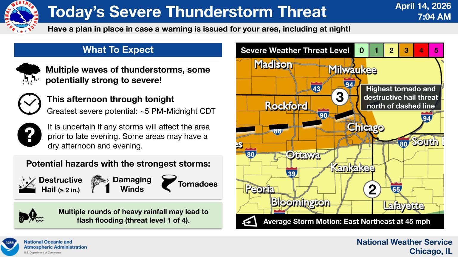
The weather service said confidence that storms develop or move into the area before late evening on Tuesday remains low.
"However, if they do, conditions are favorable for them to quickly become severe with all hazards possible," the weather service said on its Facebook.
Find out what's happening in Across Illinoisfor free with the latest updates from Patch.
Waves of storms are also expected through the end of the week, as well as warm and humid conditions. The high for Tuesday is 83 degrees, 78 on Wednesday, 75 on Thursday and 80 on Friday.
Get more local news delivered straight to your inbox. Sign up for free Patch newsletters and alerts.