Weather
Slushy Snow Will Impact Commute As Front Moves Through Illinois: NWS
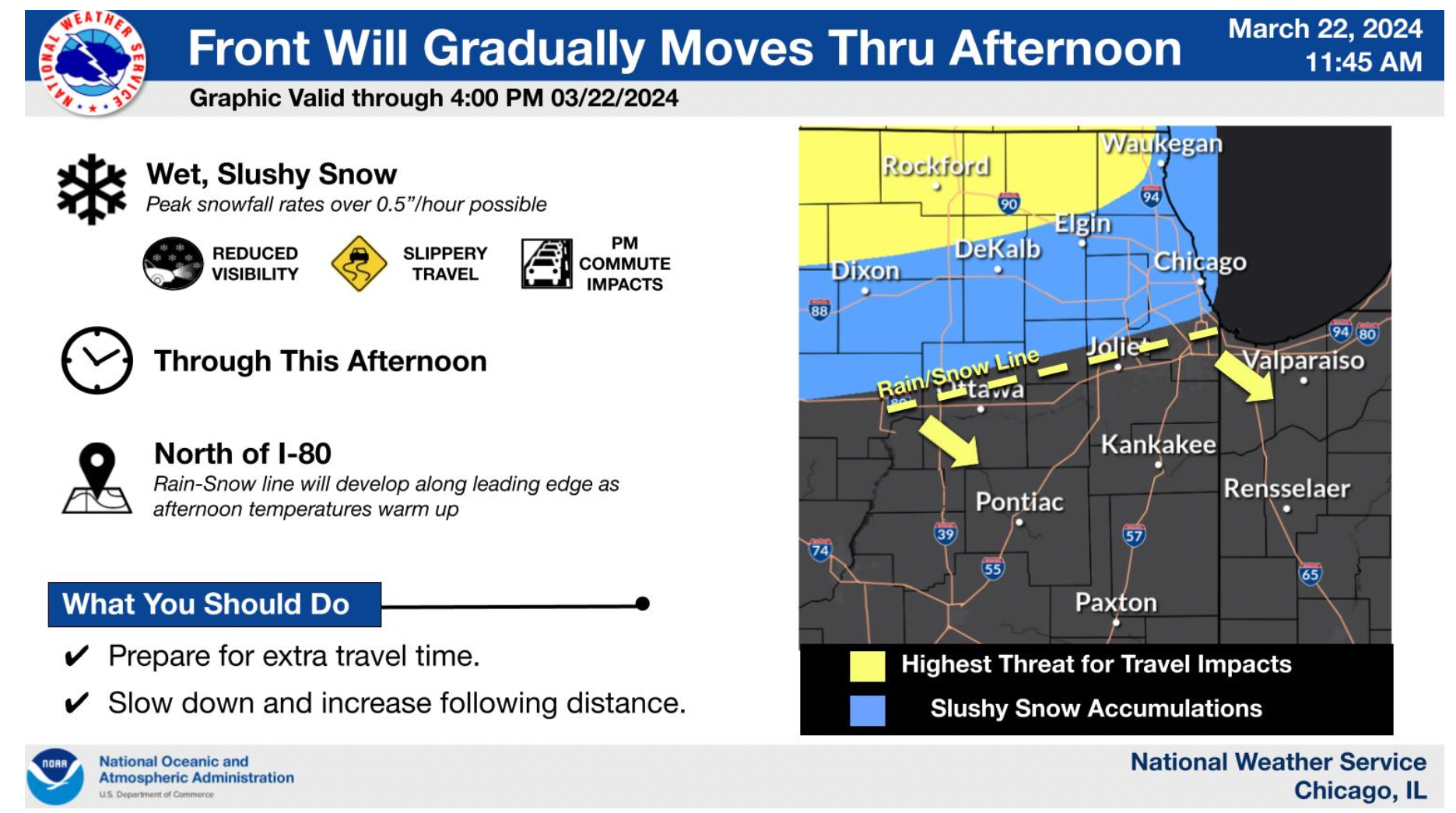
Reduced visibility and slippery travel is expected Friday afternoon as a front moves east to the southeast.

ILLINOIS — As a weather front moves through the area, expect a challenging drive home from work Friday, especially in the northern suburbs. The National Weather Service is predicting reduced visibility and slippery travel with the front traveling east to the southeast.
A band of higher snow rates will move with the front across northeast Illinois toward Indiana. As the front passes, expect higher snow rates, according to NWS.
Motorists are advised to prepare for extra travel time and should slow down, while also increasing following distance.
Find out what's happening in Across Illinoisfor free with the latest updates from Patch.
RELATED: Wet Snow Could Impact Friday Commute For Northern Suburbs — NWS
The front is expected to exit between 6 p.m. and 9 p.m. with lingering flurries predicted near Lake Michigan.
Find out what's happening in Across Illinoisfor free with the latest updates from Patch.
Temperatures will drop to between 20 and 30 degrees on Friday evening.
Saturday will be partly sunny, with a high near 37, as wind gusts possibly getting as high as 20 mph. Sunday will be mostly cloudy, with a high near 45, as things warm up a bit to start next week.
Get more local news delivered straight to your inbox. Sign up for free Patch newsletters and alerts.