Weather
Hour-by-Hour Heat Index for Today; Plus, Afternoon and Evening Storms
When will the heat peak? How hot will we feel? When will the storm clouds roll in? A detailed look at today's extreme weather.

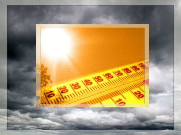
Another hot and muggy day is expected for the Chicago area with thunderstorms, heavy rain and flooding possible throughout the day and more likely tonight.
Temperatures will be at or slightly above 90 degrees for much of the Chicago area on Wednesday. High moisture in the air will result in uncomfortably hot and humid conditions with peak afternoon heat index values expected to top out between 100 and 105 degrees, according to a special weather statement issued by the National Weather Service.
Here is an hour-by-hour look at today’s heat:
Find out what's happening in Chicagofor free with the latest updates from Patch.
- 10 a.m.: Temperature, 83 degrees - Heat Index, 90 degrees
- 12 p.m.: Temp, 86 - Heat Index, 93
- 2 p.m.: Temp, 90 - Heat Index, 98
- 4 p.m.: Temp, 92 - Heat Index, 101
- 6 p.m.: Temp, 88 - Heat Index, 96
- 8 p.m.: Temp, 85 - Heat Index, 93
- 10 p.m.: Temp, 82 - Heat Index, 87
Those out and about in the heat are reminded to avoid prolonged outdoor activity during the afternoon. For those who must spend time outside, remember to wear lightweight and loose-fitting clothing and to drink plenty of water. Prolonged exposure to today’s heat could lead to heat-related illnesses, especially for small children, pets and the elderly.
Find out what's happening in Chicagofor free with the latest updates from Patch.
More via the National Weather Service’s special weather statement
Thunderstorms, Flooding in Forecast Tonight
There is a significant risk for thunderstorms and flooding throughout the Chicago area today. Scattered thunderstorms are possible mainly north of Interstate 80 with a chance that some afternoon storms, if they develop, would bring gusty winds. Later this afternoon and into the evening, widespread thunderstorms are expected across north central Illinois and will expand into northeast Illinois and northwest Indiana. Heavy rain is expected with theses storms and could result in flooding, especially over north central Illinois where a flood watch has been issued, according to the National Weather Service.
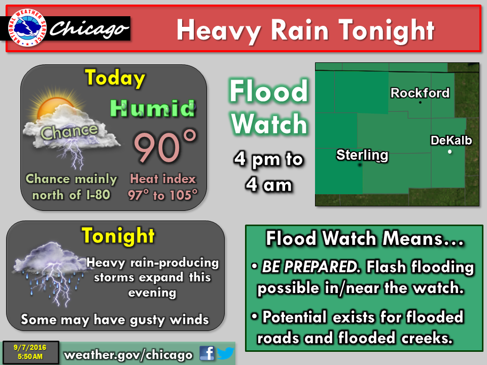
The storms are expected to become more widespread between 6 and 9 p.m. across north central Illinois and then will slowly expand east. Rainfall amounts of 2 to 3 inches or more are possible in areas under the flood watch.
Due to the still wet conditions from August, elevated streamflow on some area creeks and streams could lead to flash flooding this evening.
Here is a look at the forecasted time frame when the rain and storms are expected to hit:
- From 11 a.m. to 7 p.m., there is 30 to 50 percent chance for rain and thunderstorms for the Chicago area
- The likelihood for rain and thunderstorms will be between 60 to 70 percent at 8 p.m.
- That likelihood will increase to 80 to 100 percent from 9 p.m. until 2 a.m. Thursday
- From 3 a.m. to 4 a.m. on Thursday, the chance for rain and thunderstorms will be between 60 to 70 percent
- Between 5 a.m. and 9 a.m., the chance for rain will be between 30 to 50 percent
When Will This Heat Break?
Thursday should be a bit cooler, with temperatures in the mid-80s and a chance for thunderstorms in the morning. From Friday through the weekend, temperatures are expected to reach a high in the mid-70s. Showers and thunderstorms are possible again during the day Friday and more likely overnight.
Here is a detailed look at the forecast for the coming days:
- Thursday: Cloudy with a 30 percent chance of showers and thunderstorms in the morning...then partly cloudy in the afternoon. Highs in the mid 80s. West winds 10 to 15 mph.
- Thursday Night: Mostly clear. Lows in the mid 60s in the suburbs...but in the upper 60s downtown. Northwest winds 5 to 10 mph in the evening shifting to the northeast after midnight.
- Friday: Mostly cloudy with a 50 percent chance of showers and thunderstorms. Highs in the upper 70s. Southeast winds 10 to 15 mph.
- Friday Night: Showers and thunderstorms likely. Lows in the mid 60s in the suburbs...but in the upper 60s downtown. Chance of precipitation 70 percent.
- Saturday: Partly sunny. Slight chance of showers and thunderstorms in the morning. Highs in the mid 70s. Chance of precipitation 20 percent.
- Saturday Night: Mostly clear. Lows in the mid 50s in the suburbs...but in the upper 50s downtown.
- Sunday Through Monday: Clear. Highs in the mid 70s. Lows in the mid 50s in the suburbs...but around 60 downtown.
- Monday Night: Partly cloudy with a 30 percent chance of showers. Lows in the lower 60s.
- Tuesday: Mostly cloudy with a 40 percent chance of showers and thunderstorms. Highs in the mid 70s.
More via the National Weather Service
Photo via Shutterstock
Get more local news delivered straight to your inbox. Sign up for free Patch newsletters and alerts.