Weather
Thunderstorms, Much-Needed Rain In Forecast For Chicago Area
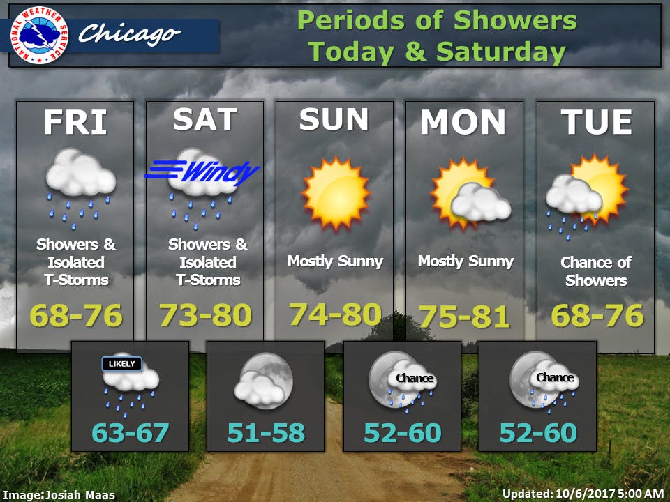
A look at the weather forecast for the Chicago area for this weekend.


Thunderstorms and some much-needed rainfall is in the forecast for the Chicago area for Friday and Saturday, according to the National Weather Service. A warm front will move north across the area Friday with periods of showers and an isolated thunderstorm possible throughout the day. There will also be a chance of rain Friday night as lows overnight remain mild for early October – only dropping into the mid-60s.
Strong southerly wind gusts will develop Saturday morning and shift westerly Saturday afternoon as a cold front moves across the area, according to the National Weather Service. Wind gusts could reach as high as 40 mph through early Saturday evening.
Another period of showers and possibly a few thunderstorms are expected ahead of the cold front Saturday. Generally dry weather is expected Sunday and Monday as high temperatures remain in the mid-70s and nearing 80 degrees, according to the National Weather Service.
Find out what's happening in Chicagofor free with the latest updates from Patch.
(For more information on this and other neighborhood stories, subscribe to Patch to receive daily newsletters and breaking news alerts.)
Here is a more detailed look at the weather forecast for the coming days:
Find out what's happening in Chicagofor free with the latest updates from Patch.
FRIDAY: Showers likely, then showers and possibly a thunderstorm after 1pm. High near 71. South southeast wind 5 to 10 mph. Chance of precipitation is 80%. New rainfall amounts between a quarter and half of an inch possible.
- FRIDAY NIGHT:Showers likely and possibly a thunderstorm before 1am, then a chance of showers and thunderstorms after 1am. Cloudy, with a low around 66. South wind 10 to 15 mph, with gusts as high as 20 mph. Chance of precipitation is 70%. New rainfall amounts between a tenth and quarter of an inch, except higher amounts possible in thunderstorms.
- SATURDAY: A chance of showers and thunderstorms, then showers and possibly a thunderstorm after 1pm. High near 78. Breezy, with a south wind 15 to 20 mph, with gusts as high as 35 mph. Chance of precipitation is 80%. New rainfall amounts between a tenth and quarter of an inch, except higher amounts possible in thunderstorms.
- SATURDAY NIGHT: A 20 percent chance of showers before 1am. Mostly cloudy during the early evening, then gradual clearing, with a low around 54. Breezy, with a west southwest wind 15 to 20 mph decreasing to 5 to 10 mph after midnight. Winds could gust as high as 30 mph.
- SUNDAY: Sunny, with a high near 77. Southwest wind 5 to 10 mph.
- SUNDAY NIGHT: Mostly clear, with a low around 57.
- COLUMBUS DAY:Sunny, with a high near 78.
- MONDAY NIGHT: A slight chance of showers after 1am. Partly cloudy, with a low around 58.
- TUESDAY: A chance of showers. Partly sunny, with a high near 71.
- TUESDAY NIGHT:
- A chance of showers, mainly before 1am. Mostly cloudy, with a low around 54.
- WEDNESDAY: Partly sunny, with a high near 66.
Also See: Here's Why Autumn Full Moons Are So Special
Get more local news delivered straight to your inbox. Sign up for free Patch newsletters and alerts.

