Weather
Flash Flooding, Thunderstorms in Forecast Friday, This Weekend
A flash flood warning has been issued for a portion of the Chicago suburbs. S

Heavy rains are expected to drop up to two inches per hour across portions of the Chicago suburbs Friday afternoon, according to the National Weather Service.
A flash flood warning has been issued for DuPage County, northeastern DeKalb County, northwestern Will County, southern Kane County and south Central Cook County, according to the National Weather Service. The flash flood warning will remain in effect until 8:15 p.m.
At 2:19 p.m., doppler radar indicated a thunderstorm producing heavy rain was expected to move across the warned area and flash flooding could follow, according to the National Weather Service. Some of the locations that could experience the flash flooding include: Aurora, Naperville, Bolingbrook, Orland Park, Wheaton, Downers Grove, Elmhurst, Lombard, Romeoville, Plainfield, St. Charles, Glen Ellyn, West Chicago, Batavia, Lockport, Westmont, Homer Glen, Lisle and Villa Park. The flash flooding could also affect I-55 between mile markers 263 and 278, I-80 near mile marker 142, I-88 between mile markers 94 and 139 and I-355 between mile markers 4 and 26.
Find out what's happening in Crystal Lake-Caryfor free with the latest updates from Patch.
Local Doppler Radar

Weather officials are reminding residents not to drive across a flooded road and to report flooding to local law enforcement agencies.
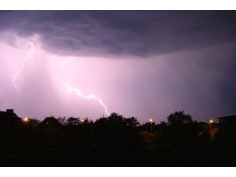
Scattered thunderstorms are expected to continue through tonight for the Chicago area. The strongest storms will produce heavy downpours and gusty winds. There is also a chance of thunderstorms for Saturday.
Find out what's happening in Crystal Lake-Caryfor free with the latest updates from Patch.
Meanwhile, a beach hazard statement has been issued for beaches along Lake Michigan in northeastern Illinois and northwestern Indiana through late Friday night. Life-threatening waves and currents are expected at the beaches and people visiting should stay out of the water, according to the National Weather Service. Waves could reach heights of three to five feet and strong rip currents are expected.
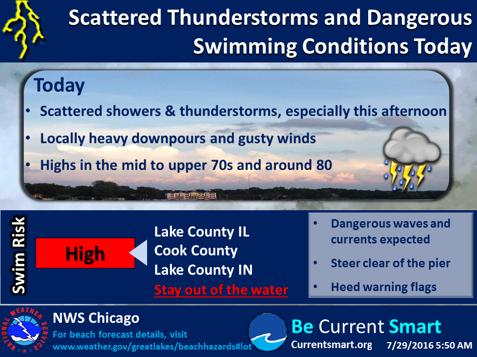
Temperatures in the lower 80s are expected for much of the Chicago area on Friday while highs are only expected to reach into the upper 70s on Saturday. There is a 30 percent chance of thunderstorms on Saturday. For Sunday, expect partly cloudy skies and highs in the 80s.
Here is a more detailed look at the forecast for the weekend.
- Rest of Friday: Mostly cloudy with a 40 percent chance of showers and thunderstorms. Highs in the lower 80s...except upper 70s along the lakefront. Northeast winds 10 to 15 mph.
- Tonight: Mostly cloudy with a 40 percent chance of showers and thunderstorms. Lows in the mid 60s. Northeast winds 10 to 15 mph.
- Saturday: Mostly cloudy with a 30 percent chance of showers and thunderstorms. Highs in the upper 70s. Northeast winds 10 to 15 mph.
- Saturday Night: Partly cloudy. Lows in the mid 60s in the suburbs...but in the upper 60s downtown. Northeast winds 10 to 15 mph.
- Sunday: Partly cloudy. Highs in the lower 80s. Northeast winds 5 to 10 mph.
- Sunday Night: Mostly clear. Lows in the upper 60s.
- Monday: Mostly sunny. Highs in the mid 80s inland...but only around 80 near the lake.
Would you like to see your outdoors or weather photo featured in our weekend or week-ahead weather report? E-mail a photo with a brief description to dennis@patch.com. Please include your hometown.
Get more local news delivered straight to your inbox. Sign up for free Patch newsletters and alerts.