Weather
Heavy Rain, Severe Thunderstorms, Flash Flooding Possible for Chicago Area
Storms are in the forecast Friday but the rest of the weekend is expected to be clear with highs in the 80s.

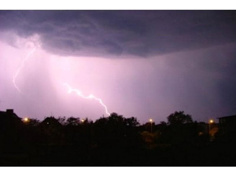
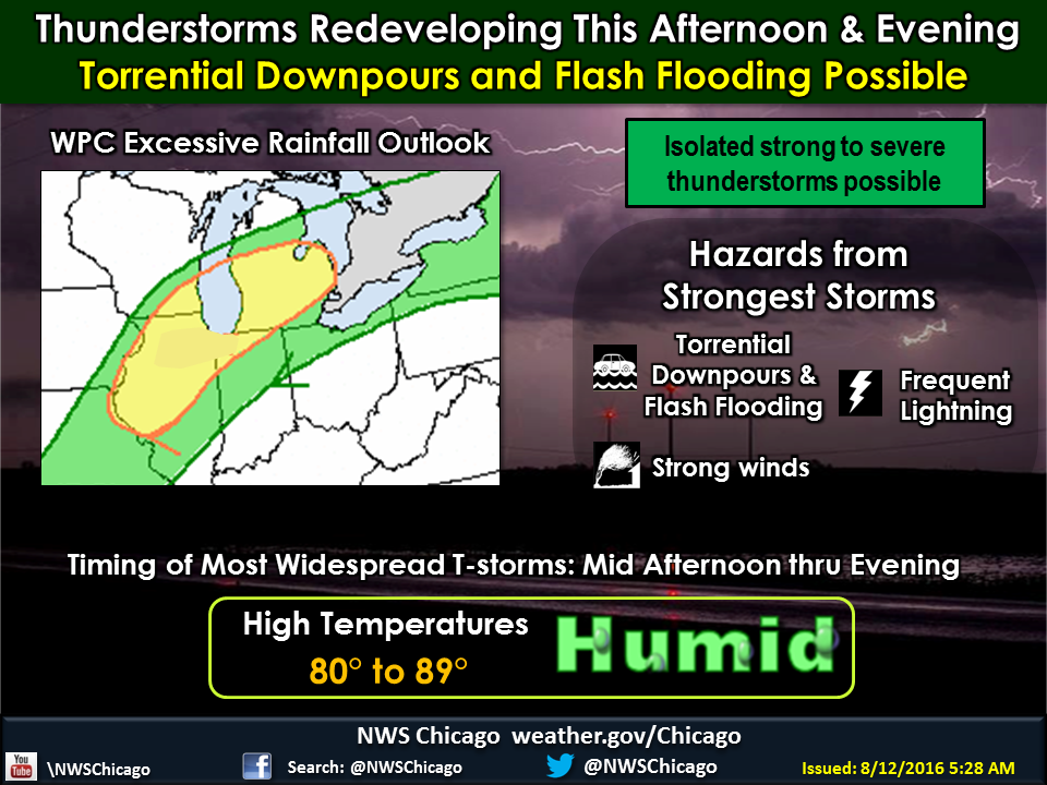
Torrential downpours that could lead to localized flash flooding and thunderstorms, some severe, are in the forecast for today but the rest of the weekend should be clear of storms and rain with highs in the mid-80s.
Thunderstorms are expected to redevelop across northwest Illinois late Friday morning into early this afternoon and then spread across the rest of northeast Illinois by late afternoon and into northwest Indiana this evening, according to the National Weather Service.
These storms will have the potential to produce torrential rainfall rates of two inches per hour or more, which may lead to localized flash flooding. A flash flood watch has been issued for counties throughout the Chicago area, and the most likely areas to see the heaviest rainfall will be along and north of the Interstate 80 corridor.
Find out what's happening in Crystal Lake-Caryfor free with the latest updates from Patch.
Some of the storms may also produce strong gusty winds. This precipitation will end from northwest to southeast Friday night.
Here is a look at what to expect for weather for the rest of the weekend:
Find out what's happening in Crystal Lake-Caryfor free with the latest updates from Patch.
- Today: Showers likely and possibly a thunderstorm before 11 a.m., then showers and thunderstorms likely after 11 a.m. Some of the storms could produce heavy rain. Cloudy, with a high near 82. South wind 5 to 10 mph becoming east in the afternoon. Chance of precipitation is 70 percent. New rainfall amounts between a half and three quarters of an inch possible.
- Tonight: Showers and thunderstorms, mainly before 1 a.m. Some of the storms could produce heavy rain. Low around 68. East wind around 5 mph becoming west after midnight. Chance of precipitation is 80 percent. New rainfall amounts between a half and three quarters of an inch possible.
- Saturday: A 10 percent chance of showers and thunderstorms before 7 a.m. Partly sunny, with a high near 83. Northwest wind 5 to 10 mph.
- Saturday Night: Partly cloudy, with a low around 64. North northwest wind around 5 mph becoming calm in the evening.
- Sunday: Mostly sunny, with a high near 84. North wind 5 to 10 mph.
- Sunday Night: Partly cloudy, with a low around 64.
- Monday: Mostly sunny, with a high near 81.
Would you like to see your outdoors or weather photo featured in our weekend or week-ahead weather report? E-mail a photo with a brief description to amie.schaenzer@patch.com. Please include your hometown.
Get more local news delivered straight to your inbox. Sign up for free Patch newsletters and alerts.