Crime & Safety
'Quite A Sharp Turn' Where Darien Crash Happened
Fence is often down along stretch of state road. The city has contacted the state.

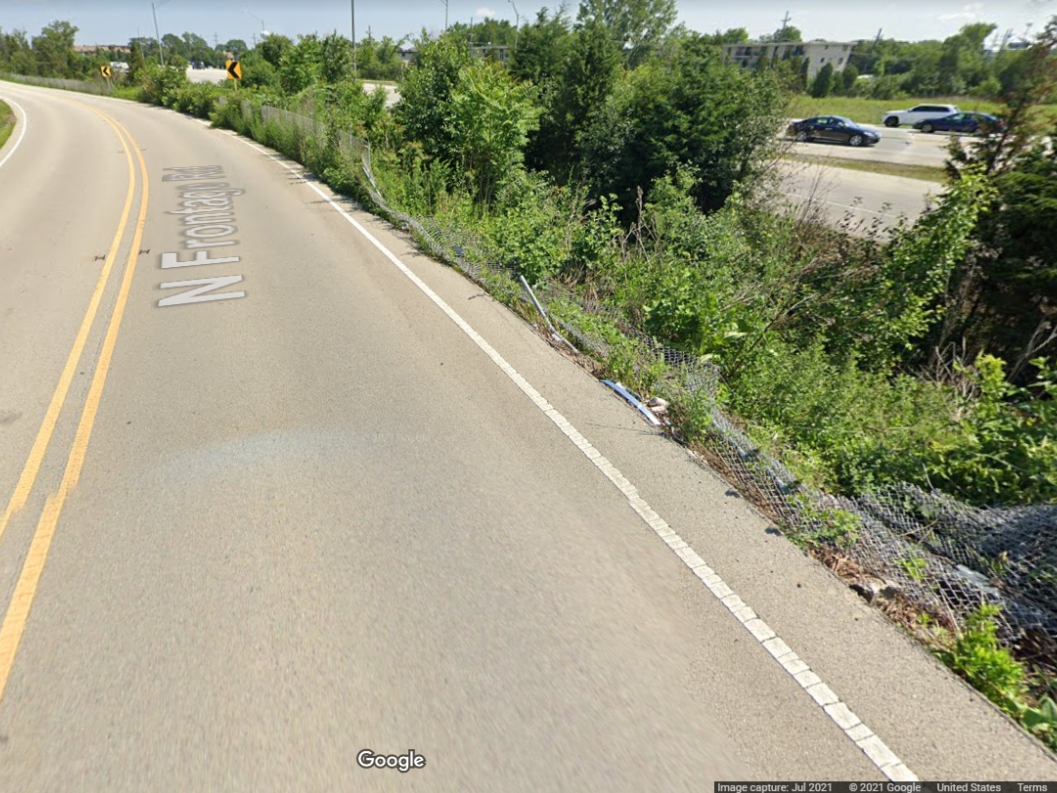
DARIEN, IL — The fence is down a lot where the fatal motorcycle accident happened on North Frontage Road in Darien late last month. One official called the curve in the road "quite a sharp turn."
At Monday's City Council meeting, Alderwoman Mary Sullivan said she had received several communications about the crash and the stretch of road in question.
"The fence has been down for quite some time," she said. "They were inquiring about a guardrail."
Find out what's happening in Darienfor free with the latest updates from Patch.
About 7 a.m. Sept. 27, a passerby saw a motorcycle in a ditch between North Frontage Road and the Cass Avenue ramp to southbound Interstate 55. A man and a woman died in the crash.
The rider was believed to have been heading east on North Frontage hours earlier.
Find out what's happening in Darienfor free with the latest updates from Patch.
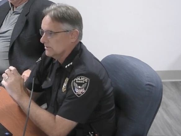
At the meeting, Dan Gombac, the city's municipal services director, said guardrails are not used as a defense for cars veering off the roadway.
"There are other alternatives, whether it's a roadway reconfiguration or additional safety markers, for example," he said.
In an email to Patch on Wednesday, Gombac explained further: "Guardrails serve as a traffic safety barriers or vehicle restraint systems. Vehicle restraint systems are systems intended that could redirect a vehicle such as a barrier curb. Typically, the area is studied to determine the type/s of safety barriers should be utilized to prevent accidents."
During the meeting, Gombac said the city would be in contact again with the state Department of Transportation, which owns the road in question.
"The fence, as we all know, appears to be coming down four to five times a year. It's fixed. The next thing you know, it's wiped out for about 300 to 500 feet every time," Gombac said.
Sullivan said that in the latest instance, the fence has been down for a long time. That was the case when a Google Maps photo was taken in July.
"That is quite a sharp turn," Sullivan said. "We're not even talking weather issues right now. It was a dry night. There was no ice."
Get more local news delivered straight to your inbox. Sign up for free Patch newsletters and alerts.