Community Corner
Wolf Road, 1920s: Dirty, Dusty and Dangerous
Local residents take Wolf Road across Ogden Avenue every day. But, this road once looked, and could have looked, much different.

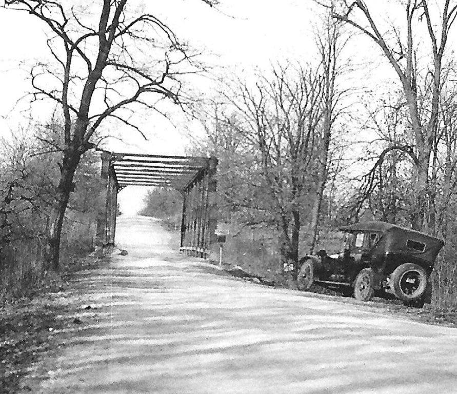


Despite the dreaded red light cameras at Ogden Avenue, motorists who use Wolf Road are accustomed to a well-paved, all-weather roadway with good directional signs and shoulders. But, in the 1920’s, motorists driving north to Westchester encountered a much different situation: dirt, dust, and no guard rails. See first photo.
In fact, look at this photo of the original Wolf Road Bridge over Salt Creek. Second photo. Can you imagine what it was like to pass a large truck (or horse-and-wagon) going the opposite direction?
Then, there’s the matter of what could have been. In the 1920’s, the 60 acres on the northeast corner of Wolf and Ogden were not yet owned by the Forest Preserve District. As a result, in 1928 there was a plan to develop an “apartment city” at that location. Newspaper accounts from that era described the project as “… a series of apartment buildings, to contain 500 apartments, and with them the necessary grounds and amusement facilities, such as tennis courts, etc. The buildings are to contain four, five, and six-room apartments to be owned cooperatively.” Fortunately, this idea never materialized, keeping Wolf a much less congested and scenic roadway.
Find out what's happening in Western Springsfor free with the latest updates from Patch.
But, the 1930’s did bring other changes to Wolf Road. For example, the next time you drive north on Wolf, notice how the road takes a gentle turn to the west after you cross Ogden Avenue. See third photo.
But, it wasn’t always so. When Wolf Road was originally laid out in the early part of the last century, the portion of the road north of Ogden Avenue didn’t connect to the village’s “East Avenue” (later, Wolf Road). In fact, the north section of the road intersected Ogden Avenue nearly as far west as Grand Avenue. That meant that “East Avenue” motorists who wanted to go north to Westchester had to first turn left onto Ogden and then, a half block or so later, turn right to get onto northbound Wolf Road.
Find out what's happening in Western Springsfor free with the latest updates from Patch.
Fortunately, Cook County eventually decided to curve the north section of Wolf Road a little east so that it would align with the village’s portion of Wolf Road. In fact, look at this 1938 aerial view (fourth photo) and you can still see the old north-south right-of-way just west (left) of the “new” roadway.
This wasn’t the first attempt to alter the way that Western Springs motorists traveled north and south. In 1930, a long-range planning study was undertaken by La Grange, La Grange Park, and Western Springs. Among the many recommendations was a proposal to completely re-engineer the Wolf Road and Ogden intersection. As shown in the fifth photo, this would have involved splitting the north-south traffic between Grand Avenue and Wolf Road, as well as creating an underpass for Ogden Avenue “through traffic” moving east and west. Note that the plan would have also created two “future business” zones at the intersection, presumably for gasoline stations or similar businesses. Fortunately, this plan also never materialized.
This same study also envisioned a huge “municipal golf course and playground” being located in the Forest Preserves directly north of Western Springs … from Ogden all the way to 31st Street. See sixth photo. In fact, Wolf Road would have gone directly through the golf course, which might have made for some interesting approach shots. Eventually, the Forest Preserve District did build the Meadowlark 9-hole golf course just west of Wolf Road and south of 31nd Street. As a result, one might say that at least part of the plan was implemented.