Weather
MD Winter Weather Advisory In Effect; More Snow, Sleet Coming
A winter weather advisory is in effect overnight, then snow, rain and sleet hit Maryland over the MLK Day weekend.

BALTIMORE, MD — The second straight week with snowfall expected across Maryland began with a winter weather advisory Thursday into Friday before more snow, sleet and freezing rain strike this weekend, the National Weather Service says. While the accumulation will be an inch or so by Friday morning, the timing prompted authorities to urge commuters to get home early.
The greatest threat for impact from this light snowfall during evening rush hour was north and west of Interstate 95 from Baltimore to Fredericksburg, Virginia, and also near Interstate 66 in
northern Virginia, forecasters say. A winter weather advisory for snow means periods of snow will cause primarily travel difficulties. Expect snow covered roads and limited visibilities, and use caution while driving. The latest road conditions can be obtained by calling 5 1 1.
“We are asking the public to leave work early enough to get home before the storm hits or shelter in place so that our crews can clear the roads,” said MDOT SHA Administrator Greg Slater in a news release. “If the snow plows and salt trucks are stuck in normal rush hour congestion, our crews can’t treat the roads and motorists may be stuck in snow gridlock for hours.”
Find out what's happening in Annapolisfor free with the latest updates from Patch.
According to the latest forecast models, 1 to 3 inches of snow was possible Thursday evening. The Baltimore-Washington region could start seeing precipitation as early as 4 p.m., although the latest weather predictions call for snowfall starting closer to 7 p.m.
The weekend will bring more rounds of snow that could mix with sleet Saturday into Sunday. Bitterly cold wind chills are likely Sunday night into Monday morning that will make it feel like the temperature is below zero at times.
Find out what's happening in Annapolisfor free with the latest updates from Patch.
Cities likely to see snow overnight include: Washington, Baltimore, Eldersburg, Westminster, Reisterstown, Cockeysville, Bowie, Suitland-Silver Hill, Clinton, College Park, Greenbelt, Laurel, Camp Springs, Glen Burnie, Annapolis, Severn, South Gate, Severna Park, Arnold, Odenton, Germantown, Damascus, Bethesda, Rockville, Gaithersburg, Silver Spring, Lisbon, Columbia, Ellicott City, Jarrettsville, and Aberdeen.
The weather service has issued several alerts for the coming storm. A winter weather advisory is in effect from 4 p.m. Thursday to 4 a.m. Friday for parts of central and north-central Maryland and northern Virginia, including the far northern and western suburbs of Washington and Baltimore. The advisory calls for up to 2 inches of snowfall this evening in Montgomery County and Frederick.
A separate winter weather advisory is in effect from 6 p.m. Thursday to 4 a.m. Friday for Carroll, northern Baltimore, northwest Howard and northwest Harford counties.
In a hazardous weather outlook, the weather service said: "There is the slight threat for a winter storm Saturday and Saturday night. A brief period of wintry precipitation is possible Sunday. If this threat materializes, it may cause travel disruptions."
(For more news like this, find your local Patch here. If you have an iPhone, click here to get the free Patch iPhone app; download the free Patch Android app here. And like Patch on Facebook!)
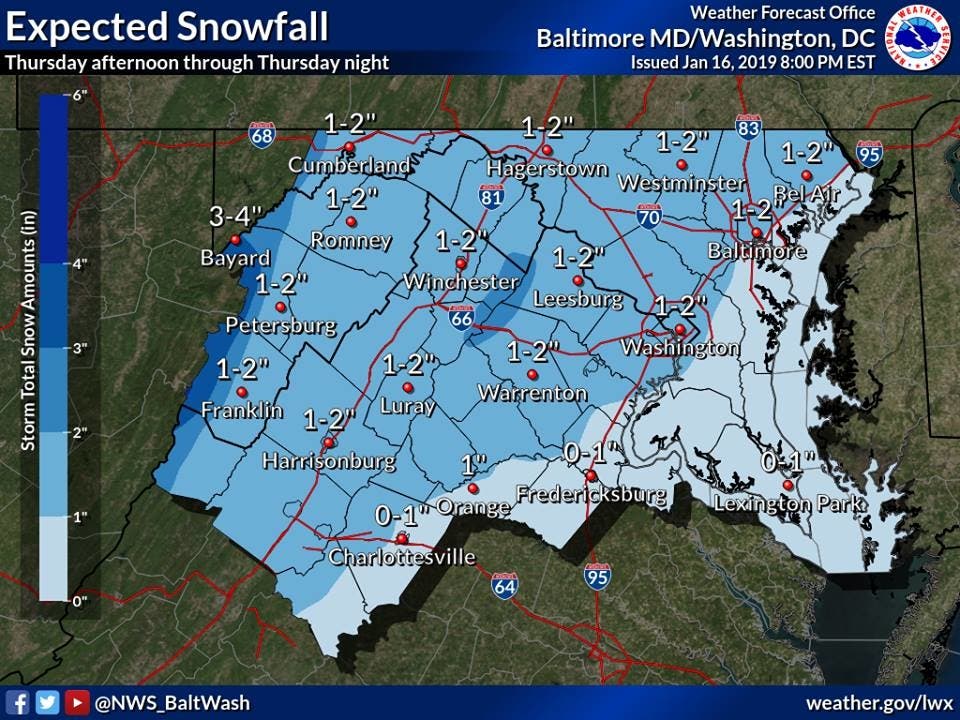
Here's a closer look at the forecast, courtesy of the National Weather Service.
Thursday: A chance of snow, mainly after 5pm. Mostly cloudy, with a high near 35. Northeast wind around 6 mph becoming southeast in the afternoon. Chance of precipitation is 30%.
Thursday Night: Periods of snow before 4am, then a chance of snow and sleet. Patchy fog after 4am. Low around 32. Southeast wind around 6 mph. Chance of precipitation is 90%. New snow and sleet accumulation of 1 to 2 inches possible.
Friday: A chance of snow and sleet before 7am. Patchy fog before 10am. Otherwise, cloudy, then gradually becoming mostly sunny, with a high near 44. Calm wind becoming west 5 to 7 mph in the morning. Chance of precipitation is 30%.
Friday Night: Partly cloudy, with a low around 30. Northwest wind around 6 mph becoming calm.
Saturday: Rain and snow between 10am and 4pm, then rain, snow, and sleet after 4pm. High near 40. Calm wind becoming east 5 to 8 mph in the morning. Chance of precipitation is 80%.
Saturday Night: Rain and sleet, becoming all rain after 7pm. Low around 36. Chance of precipitation is 100%.
Sunday: Rain, snow, and sleet likely before 1pm, then a chance of snow between 1pm and 4pm. Cloudy, with a high near 43. Chance of precipitation is 70%.
Sunday Night: Partly cloudy, with a low around 10.
M.L.King Day: Sunny, with a high near 20.
Monday Night: Mostly clear, with a low around 13.
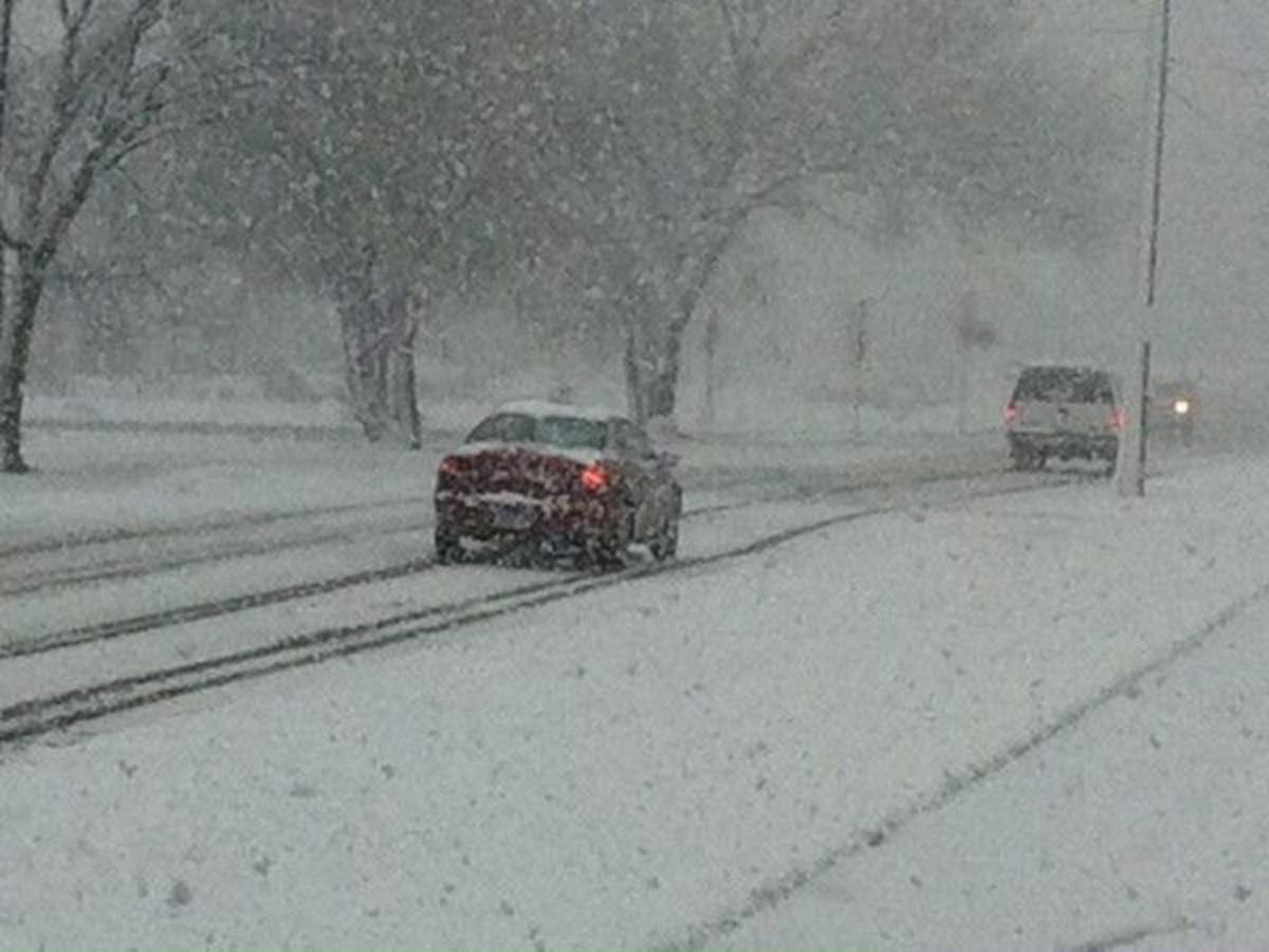
Patch photo; graphic by National Weather Service
Get more local news delivered straight to your inbox. Sign up for free Patch newsletters and alerts.