Weather
Peak Atlantic Hurricane Season 2016 Is Here Maryland
Breaking: Forecasters at NOAA say we could be in for a bumpy ride over the next eight weeks, with peak storm time near Labor Day.

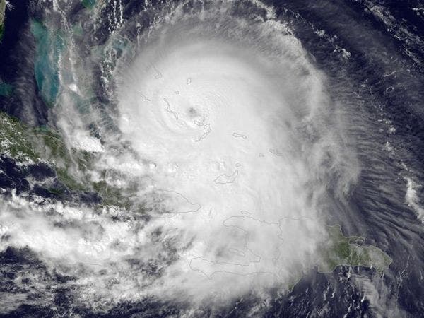
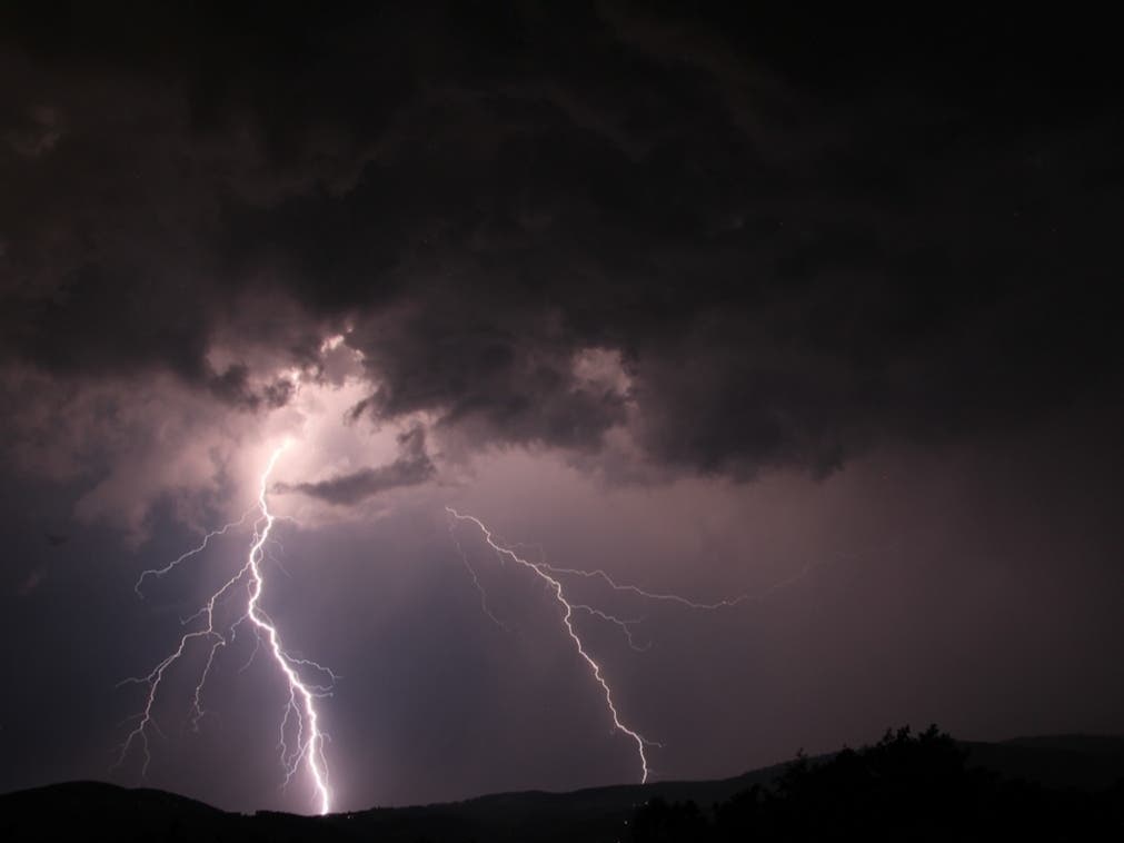
After a sleepy start for Maryland, the peak of the 2016 Atlantic hurricane season has arrived and Tropical Storm Gaston, Tropical Depression Fiona and an unnamed disturbance are swirling in the Atlantic Ocean. None are anywhere close to the Mid-Atlantic region so far, but we need to keep a weather eye out, say scientists at the National Oceanic and Atmospheric Administration.
Gaston should be a hurricane by Tuesday night, says the Weather Channel, although it's not a threat to land any time soon. It may reach Bermuda by Sunday, says one predicted path.
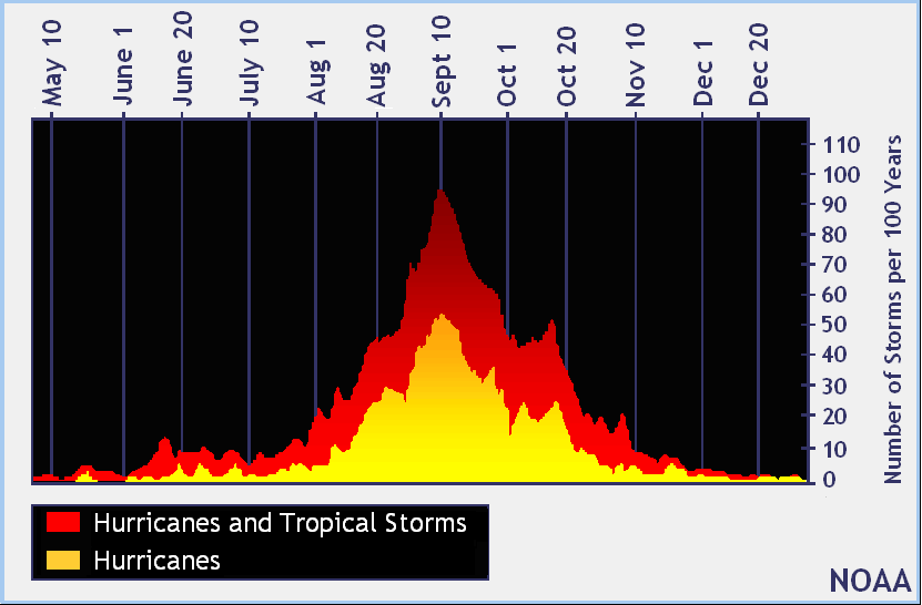
While hurricane season technically lasts from June 1 to Nov. 30, forecasters call the period between mid-August and mid-October the “season within the season.” This eight-week period “is often the most active and dangerous time for tropical cyclone activity,” NOAA explained on its website.
Find out what's happening in Annapolisfor free with the latest updates from Patch.
The eight-week period that starts now is historically responsible for major spikes in tropical weather activity, NOAA said. In fact, it accounts for about 78 percent of all tropical storm days on record. It is also the period when 87 percent of the category 1 and 2 hurricane days on record occurred. In addition, this period is responsible for “a whopping 96 percent of the major (category 3, 4 and 5) hurricane days.”
Right around Labor Day weekend historically seems to be the "peak within the peak." So stay tuned to see how our weather shapes up for the weekend of Sept. 3-5.
Find out what's happening in Annapolisfor free with the latest updates from Patch.
Just last week, NOAA forecasters revised their predictions for the season, saying there’s a 70 percent chance of 12 to 17 named storms forming. The forecast for the season now includes the potential for two to four major hurricanes.
“We’ve raised the numbers because some conditions now in place are indicative of a more active hurricane season, such as El Niño ending, weaker vertical wind shear and weaker trade winds over the central tropical Atlantic, and a stronger west African monsoon,” said Gerry Bell, lead seasonal hurricane forecaster at NOAA’s Climate Prediction Center.
So, what makes this eight-week stretch of peak activity we've entered so special?
“Tropical waves are coming off of the coast of Africa roughly every three days, and the very early and late parts of the year provide additional types of potential seedlings,” NOAA’s website explains.
Other environmental conditions this time of year tend to be more conducive for storm development, as well. The factors that align during this period include wind, temperature and moisture. Wind shear that might rip a disturbance apart in May, for example, tends to weaken by late August, NOAA said.
»See also: Atlantic Hurricane Predictions Turn Nasty, 12-17 Named Storms Expected
“This minimum in the shear combines with favorable thermodynamics – ocean temperatures in the deep tropics that increase with each day of summer sun, warmer air temperatures, and increasing atmospheric moisture,” NOAA explained. “When the dynamics and thermodynamics are in sync, as they often are from mid-August through early October, disturbances like African tropical waves can easily strengthen.”
The conditions gradually become less ripe for development in mid-October when increased wind shear tends to reappear and water and air temperatures cool. While the season continues through Nov. 30, the areas where storms can develop becomes limited, NOAA explained.
Although the peak of the season is now, with Sept. 10 being the statistical peak day, forecasters warn that preparation and vigilance are critical for residents in coastal areas from June through November.
“It doesn’t matter whether activity levels are high or low – it only takes one storm to make it a bad year for you,” forecasters warn.
As the 2016 season runs through its peak, forecasters at NOAA urge residents in coastal areas to be prepared. It’s not a question of if, but when, forecasters say.
To find out more about hurricane season and storm preparation, read these related Patch stories:
- Time to Prepare for 2016 Atlantic Hurricane Season
- Remember Agnes? 14 Maryland Hurricane Names You May Want To Forget
- Hurricane Tips If Storm Hits Maryland
Maryland has been spared "the big one" on most occasions, but for roughly 60 years, named hurricanes have battered our water-oriented state, altering our lifestyles and our history.
Hurricanes Connie and Diane pounded Maryland in October 1955. Just days apart in their torture on the East Coast, the storms caused widespread flooding. Connie essentially came right up the Bay.
Meanwhile, Diane came on land near the Carolina border and turned east to pass over northern Maryland before going back out to sea.
Most recently, Hurricane Sandy in October of 2012 made landfall just north of the upper Chesapeake Bay region, and destroyed the Ocean City fishing pier. From there it went on to devastate oceanfront areas of New Jersey and New York.
To keep up with storm activity as the season develops, bookmark the National Hurricane Center’s website and keep an eye on your hometown Patch site for local information.
Patch editor Sherri Lonon contributed to this story
Graphics courtesy of NOAA
Get more local news delivered straight to your inbox. Sign up for free Patch newsletters and alerts.