Weather
Maryland Weekend Weather: Nasty Summer Storm Brings Flash Flood Warnings
An intense summer storm will deliver drenching rain, gusty thunderstorms and miserable conditions in Maryland this weekend.

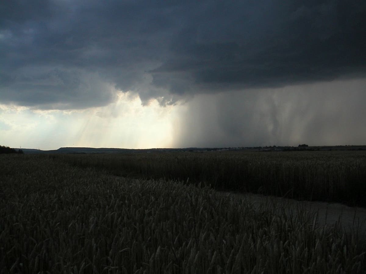
MARYLAND — Maryland could get walloped with the worst storm of the summer this weekend, and it's supposed to be one you normally see in October. A rare summer storm is poised to strike the region, bringing thunderstorms, gusty winds and drenching downpours.
The National Weather Service told Patch that at some point in the storm, it will follow the protocol of a nor'easter: Move up from the South, stop in its tracks and churn, producing a flooding risk.
Flash flooding warnings have already been issued in parts of Maryland, including Prince George's and Montgomery County, and more are possible throughout the day. The National Weather Service predicts rainfall totals will range from 2-4 inches, though it's possible that some areas could see about 6 inches.
Find out what's happening in Baltimorefor free with the latest updates from Patch.
As of 11:40 a.m. Friday, the National Weather Service reports 3.19 inches of rain in 45 minutes six miles northwest of Silver Spring, in Montgomery County.
The threat of several more inches of rain has Maryland State Police warning drivers to be cautious while on the road, and to avoid driving into water over roads. According to the National Oceanic and Atmospheric Administration, it takes just 12 inches of rushing water to strand a small vehicle, while 24 inches of fast flowing water can carry away most vehicles.
Find out what's happening in Baltimorefor free with the latest updates from Patch.
1140am: CoCoRAHS spotter reports 3.19 inches of #rain IN 45 MINUTES 6 miles northwest of Silver Spring MD! #flood
— NWS DC/Baltimore (@NWS_BaltWash) July 28, 2017
1115am: Already getting reports of water rescues. This is ahead of/in addition to main heavy rain threat late this afternoon/evening! (1/2)
— NWS DC/Baltimore (@NWS_BaltWash) July 28, 2017
Flash Flood Warning including Germantown MD, Silver Spring MD, Rockville MD until 2:45 PM EDT pic.twitter.com/AR3VJCkCoD
— NWS DC/Baltimore (@NWS_BaltWash) July 28, 2017
The Centers for Disease Control and Prevention says more than half of flood-related deaths occur when a vehicle is driven into hazardous flood water.
Here are some simple tips to avoid flood-related injuries:
- “Turn Around, Don’t Drown.” A driver, especially at night, has no idea how deep the water is or whether the road underneath is still intact. Pay attention to road signs that close roads.
- Delay commuting until precipitation moves away and stream and river flooding has a chance to recede and safe travel is possible.
- Pay close attention to local weather forecasts and plan accordingly.
- If a traffic signal is flashing completely out due to a power interruption, motorists on all legs of an intersection must stop and treat the intersection as a four-way stop according Maryland
- Never maneuver around low hanging trees or wires or try to move branches or downed wires out of the travel lanes.
- Be aware of the potential for hydroplaning. Often during heavy rainfall, water pools quickly on a roadway surface. At high speeds, even a small amount of water can cause you to lose traction and ultimately control of your vehicle.
- Increase following distances between vehicles. Remember to use low-beam headlights when windshield wipers are in operation.
- Be familiar with areas that have a history of flooding and plan an alternate route.
- Log onto md511.org or call 511 from a hands-free device to obtain the latest, real-time travel conditions.
- Live traffic cameras can be accessed by logging onto roads.maryland.gov and clicking on the CHART icon.
Here's the latest from the National Weather Service:
Friday Afternoon: Showers likely, mainly after 3pm. Cloudy, with a high near 82. Southeast wind around 6 mph. Chance of precipitation is 70%. New precipitation amounts between a quarter and half of an inch possible.
Friday Night: Showers and possibly a thunderstorm. Some of the storms could produce heavy rain. Low around 68. Northeast wind 7 to 9 mph. Chance of precipitation is 100%. New rainfall amounts between 1 and 2 inches possible.
Saturday: Showers and possibly a thunderstorm before 9am, then showers likely between 9am and 3pm, then showers and possibly a thunderstorm after 3pm. High near 76. North wind 13 to 16 mph, with gusts as high as 23 mph. Chance of precipitation is 80%. New rainfall amounts between a half and three quarters of an inch possible.
Saturday Night: Showers and possibly a thunderstorm before 9pm, then a chance of showers. Low around 62. North wind 9 to 14 mph. Chance of precipitation is 80%. New precipitation amounts between a tenth and quarter of an inch, except higher amounts possible in thunderstorms.
Sunday: A slight chance of showers before 9am. Mostly sunny, with a high near 79. North wind around 10 mph. Chance of precipitation is 20%.
Sunday Night: Partly cloudy, with a low around 63.
Monday: Mostly sunny, with a high near 83.
Pixabay Photo
Get more local news delivered straight to your inbox. Sign up for free Patch newsletters and alerts.