Weather
Snowfall Totals Increase For Parts Of MD, Winter Storm Watch Issued
Predicted snowfall totals have nearly doubled for a coastal storm approaching Maryland this weekend. A winter storm watch has been issued.

Updated at 4:45 p.m.
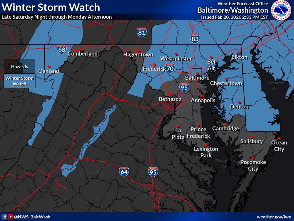
The National Weather Service on Friday issued a winter storm watch for parts of Maryland ahead of a coastal system that could now drop up to 5 inches of snow on some parts of the state.
The watch is in effect from Sunday afternoon to Monday morning for Baltimore, Montgomery, Howard, Harford, Frederick and Carroll counties.
Find out what's happening in Baltimorefor free with the latest updates from Patch.
"Snow may begin Sunday morning, but the heaviest snow and coldest temperatures are most likely late Sunday afternoon through early Monday morning," the National Weather Service said in the alert.
The storm is expected to track from the Gulf Coast on Saturday to the Atlantic coast on Sunday, according to the latest AccuWeather forecast, and will likely spread snow from West Virginia, Virginia and Pennsylvania to the mid-Atlantic and New England coasts.
Find out what's happening in Baltimorefor free with the latest updates from Patch.
While the storm’s exact track and rate of intensification remain to be seen, a majority of the Baltimore region will likely see a mix of light rain and snow starting during the overnight hours on Saturday and continuing into Monday.
"The critical question for heavy versus light snow along I-95 is the track of the coastal storm," said Dan DePodwin, AccuWeather vice president of forecasting operations. "That track will depend on how quickly the storm intensifies."
.jpg)
According to The Washington Post's Capital Weather Gang, Baltimore area residents can likely expect some light rain and mixed precipitation during the predawn hours on Sunday, followed by light rain, snow or a mix during the day.
"We lean toward any snow being fairly light with temperatures in the mid-30s or higher, which would limit accumulation potential during the daylight hours," the Capital Weather Gang wrote. "But we can’t rule out snow becoming heavy enough to drop temperatures closer to freezing and start accumulating, especially on grassy areas, by late afternoon."
Snow is likely on Sunday night, which offers the best chance for accumulation. A lingering chance of snow remains through Monday morning, according to forecasters.
Looking ahead, Marylanders should expect a chilly start to the workweek with temperatures slightly above freezing, though conditions should be milder by midweek.
Here's a look at the detailed National Weather Service forecast for the Baltimore region:
Friday Night: Partly cloudy, with a low around 37. West wind 6 to 10 mph, with gusts as high as 18 mph.
Saturday: Mostly cloudy, then gradually becoming sunny, with a high near 51. Northwest wind 3 to 6 mph.
Saturday Night: A chance of rain after 1am, mixing with snow after 4am. Increasing clouds, with a low around 33. Calm wind. Chance of precipitation is 50%.
Sunday: Rain and snow. High near 39. Calm wind becoming northeast 5 to 7 mph in the afternoon. Chance of precipitation is 90%. Little or no snow accumulation expected.
Sunday Night: Snow, possibly mixed with rain, becoming all snow after 10pm. Low around 30. North wind 6 to 8 mph. Chance of precipitation is 90%. New snow accumulation of 2 to 4 inches possible.
Monday: A chance of snow before 1pm, then a chance of rain and snow. Mostly cloudy, with a high near 38. Chance of precipitation is 50%.
Monday Night: Mostly cloudy, with a low around 25.
Tuesday: Mostly sunny, with a high near 35.
Get more local news delivered straight to your inbox. Sign up for free Patch newsletters and alerts.