Community Corner
UPDATED: Bel Air Weather Closings, Road Conditions, Power Outages, Snow Totals
Snow settles after arctic blast whips through Harford County.


WEATHER ALERTS: A wind chill warning is in effect until 6 p.m. Sunday, with the National Weather Service calling for temperatures from zero to the single digits with wind chills that feel like 20 and 30 degrees below.
The National Weather Service has placed Bel Air under a wind advisory until 4 p.m. Sunday, with the potential for wind gusts from 20 to 30 mph and up to 45 mph. Wind may cause downed power lines and trees, according to the National Weather Service. Officials advised that snow may blow across the area, limiting visibility.
CLOSINGS: Harford Community College and Towson University’s northeast campus in Bel Air will both be closed on Sunday, Feb. 15, the college announced Saturday night. All activities, classes and events are canceled Sunday. Visit www.harford.edu or call 443-412-2322 for updates.
Find out what's happening in Bel Airfor free with the latest updates from Patch.
ROAD CONDITIONS: Due to pavement temperatures below freezing, salt may not be effective on roads, according to the State Highway Administration, which cautioned drivers Sunday morning to look out for ice.
On Saturday night, roads throughout the county were “slippery and hazardous,” Harford County Emergency Management said. State highway and county public works crews were treating and plowing the roads as needed, the report stated. Officials advised drivers to slow down and allow extra time.
Find out what's happening in Bel Airfor free with the latest updates from Patch.
What does it look like near you? Tell us in the comments! You can also post pics in the comments and on the Bel Air Patch Facebook page.
The State Highway Administration warns that frigid temperatures and wind may complicate road conditions:
“Expect below freezing temperatures overnight; drivers should reduce speeds, especially along ramps, bridges and overpasses. The National Weather Service issued a travel advisory for the area. Air and pavement temperatures are expected to drop, and crews will continue to address areas where drifting snow is likely to occur. Forecasters predict high winds reaching nearly 50 mph overnight, bringing the possibility of downed power lines and fallen trees. When approaching signals without power, drivers should treat the intersection as a four-way stop. The National Weather Service reports that roads which are slushy will turn icy due to below-freezing temps.”
POWER OUTAGES: By noon on Sunday, five BGE customers were without power in Harford County, according to BGE, which reported it had restored power to 2,366 customers who had lost power during the storm.
At approximately 12:15 a.m., there were 478 customers without power, according to BGE. Most were concentrated in the Joppatowne area, off Clayton Road. There were 2,038 customers without power in Harford County at 11:42 p.m., according to BGE.
Call in fallen or sparking wires at 877-778-2222 and report power outages online.
SNOW ACCUMULATION: Northeastern Bel Air had 2 inches of snow on the ground at approximately 8:30 p.m., according to unofficial reports from the National Weather Service. At 6:52 p.m., Bel Air was reporting 1 inch.
Whiteford had 1.3 inches at 8:30 p.m., according to the unofficial totals. The most snow reported so far in the state was in Frostburg in Allegany County, which had 5 inches, followed by Simpsonville in Howard County with 4.1 inches.
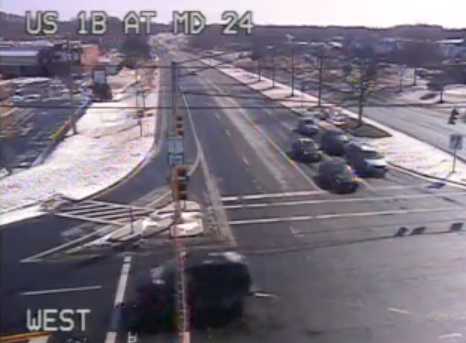
Photos of MD 24 at US 1 at approximately 12:10 p.m. Sunday and 11:25 p.m. Saturday, courtesy of CHART.
Get more local news delivered straight to your inbox. Sign up for free Patch newsletters and alerts.