Weather
MD Weather: Snow In Forecast 2 Times For Central MD This Week
Snow is possible Monday and Tuesday, followed by another chance shortly afterward.

MARYLAND — There are multiple chances for winter weather this week in central Maryland. The first is Monday afternoon to Tuesday morning.
Another round of winter weather is in the forecast Wednesday night into Thursday, according to the National Weather Service.
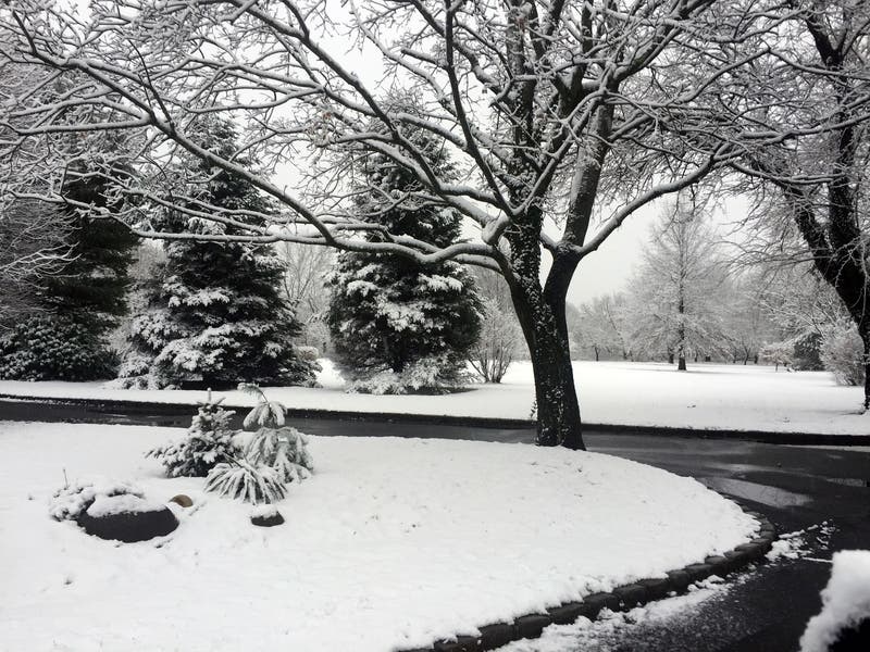
Snow began Sunday afternoon in western Maryland, where up to 1 inch of snow accumulated in Garrett County and parts of West Virginia before 5 p.m., the National Weather Service reported.
Find out what's happening in Bel Airfor free with the latest updates from Patch.
Find out what's happening in Bel Airfor free with the latest updates from Patch.
Here's a look at some roads in Garrett County Sunday evening:


"There is a winter weather alert in effect for Monday into the evening hours," the Baltimore City Department of Transportation said in a statement Sunday. "Our Baltimore City Snow Team will be ready to treat all city roads as the storm begins. If you must travel tomorrow, please drive below the speed limit as this storm could bring snow, ice, and rain."
In the Baltimore metro area, the wintry mix is expected to begin after 2 p.m. Monday with rain, then snow after 5 p.m., according to the forecast. A combination of rain, snow, freezing rain and sleet could occur after 3 a.m., with about an inch of accumulation possible by Tuesday morning.
Western Maryland is under a winter storm watch from 10 a.m. Monday to 1 p.m. Tuesday. Snow, sleet and more than 0.25 inch ice are possible. Power outages and tree damage could occur, and travel may be nearly impossible Monday night to Tuesday morning, according to the watch, which calls for a wintry mix of snow, sleet and freezing rain for parts of Garrett and Allegany counties.
From Monday to Tuesday, about 1 to 4 inches of snow could occur in far northern Maryland, according to a spokesman for the governor, who said 0.1 to 0.3 inch ice could occur in central Maryland and along the Pennsylvania line while 0.5 inch ice is possible in western Maryland.
The Baltimore City Snow Team is ready for the predicted snow storm Monday! We want to ensure that staff, equipment, and plans are prepared and ready to respond to tomorrow's winter storm. To learn more, check out this great video: https://t.co/RKZN7dtIRH
— Baltimore City DOT (@BmoreCityDOT) January 24, 2021
Here is the forecast for the Baltimore-Washington metro area, according to the National Weather Service:
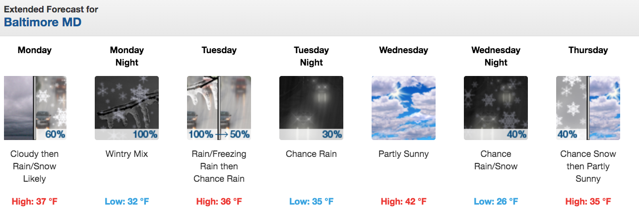
Monday: Cloudy, with a high near 37 and low around 32 degrees. Slight chance of rain from 1 to 4 p.m., then rain and snow likely. Chance of precipitation is 70 percent. New snow accumulation of less than a half inch possible.
Monday night: Rain and snow with possibly freezing rain before 3 a.m., then freezing rain may be mixed with sleet from 3 to 4 a.m., then freezing rain after 4 a.m. Chance of precipitation is 100 percent. Less than 0.1 inch ice and less than 1 inch of snow and sleet are possible.
Tuesday: High near 37 and low of 35 degrees. Rain, mainly before 7 a.m. Chance of precipitation is 80 percent. New precipitation amounts of less than 0.1 inch possible.
Wednesday: High near 44 and low around 26 degrees. Slight chance of rain before 1 a.m., then partly sunny. Chance of precipitation is 30 percent.
Wednesday night: Chance of rain and snow before 1 a.m., then a chance of snow. Mostly cloudy, with a low around 26. Chance of precipitation is 40 percent.
Thursday: High near 36 and low around 20.
Get more local news delivered straight to your inbox. Sign up for free Patch newsletters and alerts.