Weather
Winter Storm Warning Extended In Harford County
Power outages could occur, and ice is likely to make travel difficult if not impossible, the National Weather Service warns.


HARFORD COUNTY, MD — The National Weather Service has extended the winter storm warning it issued for Harford County. The warning was set to expire by midday but is now in effect until 7 p.m. on Tuesday, Feb. 12.
A winter storm warning means significant amounts of snow, sleet and ice could make travel impossible or extremely dangerous.
In this case, the warning states that because of freezing rain, about 0.1 to 0.25 inch ice accumulated through Tuesday morning, which will make later travels challenging.
Find out what's happening in Bel Airfor free with the latest updates from Patch.
Carroll, Baltimore, Frederick, Harford and Washington counties are under the winter storm warning until 7 p.m. on Tuesday, Feb. 12.
"Travel may become extremely difficult, especially north of Interstate 70 to near the Pennsylvania border," according to the warning. "The freezing rain will likely result in scattered power outages."
Find out what's happening in Bel Airfor free with the latest updates from Patch.
Based on preliminary reports to the National Weather Service, 0.1 inch ice had accumulated in Bel Air by 8:50 a.m.
Here are some tips for driving in wintry conditions.
- Clean off your car thoroughly; remove all snow and ice before leaving.
- Slow down and increase following distances.
- Accelerate and brake slowly because it takes longer to reduce speed.
- Be extra alert on ramps, bridges and overpasses, which freeze first.
- Allow for extra travel time.
- Treat traffic lights that are out as four-way stops.
- Buckle up.
- Try to move onto the shoulder if your vehicle becomes disabled.
If the front wheels skid, look where you want to go and steer in that direction. Do not hit the brakes.
The front wheels will grasp the road and when traction returns, the vehicle will begin to be steerable again.
PREVIOUS WARNING — Some parts of Harford County may see up to 9 inches of snow by Tuesday morning. That is what a winter storm warning from the National Weather Service says.
Snow totals of up to 9 inches may occur in northwestern Harford County and northern Baltimore County, near the Pennsylvania border, by 10 a.m. on Tuesday, Feb. 12. That includes snow that has already fallen from Sunday through Monday, according to the winter storm warning.
A measurement of 6.7 inches of snow in Bel Air was reported to the National Weather Service before 12:15 a.m. Tuesday.
The National Weather Service issues a winter storm warning when significant amounts of snow, sleet and ice could make travel impossible or extremely dangerous.
Carroll, Baltimore, Frederick, Harford and Washington counties are under the winter storm warning until 10 a.m. on Tuesday, Feb. 12.
RELATED: HCPS Makes Weather Decision For Tuesday, Feb. 12
In most areas, the warning calls for 3 to 7 inches of accumulation of snow and sleet. Freezing rain accumulations of 0.1 to 0.25 inch are expected through Tuesday morning as well.
Because of the weight of snow, sleet and freezing rain, weather officials anticipate power outages.
Travel may be the most challenging north of I-70 near the Pennsylvania border, according to the winter storm warning.
These are the latest preliminary snowfall totals submitted to the National Weather Service as of 2:35 a.m. on Tuesday, Feb. 12:
- 6.7 inches in Bel Air at 12:13 a.m. Tuesday, measured by a local official
- 6.6 inches in Fallston at 9 p.m. Monday, measured by a trained spotter
- 4.8 inches in Bel Air at 8 p.m. Monday, measured by a trained spotter
- 5.3 inches in Bel Air at 4:36 p.m. Monday, measured by a local official
- 3.5 inches in Bel Air at 12:25 p.m. Monday, measured by a trained spotter
- 3.3 inches in Abingdon at 11:30 a.m. Monday, measured by a trained spotter
- 3 inches in Scarboro at 11:54 a.m. Monday, measured by a trained spotter
- 3 inches in Abingdon at 2 p.m. Monday, measured by a trained spotter
- 2.5 inches in Bel Air at 8:55 a.m. Monday, measured by a trained spotter
PREVIOUSLY ISSUED WINTER WEATHER ADVISORY (EXPIRED): A few more inches of snow may be on the way. The National Weather Service issued a winter weather advisory that states snow, sleet and freezing rain are expected in parts of Maryland, including Harford County.
Effective until 10 a.m. on Tuesday, Feb. 12, the winter weather advisory applies to Baltimore, Carroll, Frederick, Harford and Washington counties.
The advisory calls for 5 to 8 inches of snow and sleet near the Pennsylvania border, with 1 to 3 inches of snow near Interstate 70.
Between 0.1 and 0.2 inch of freezing rain may also accumulate overnight into Tuesday morning, the winter weather advisory states.
Drivers should anticipate slippery conditions, particularly around and north of I-70, weather officials advised.
Already, more than 4 inches of snow had fallen in Harford County by 6 p.m. on Monday, Feb. 11.
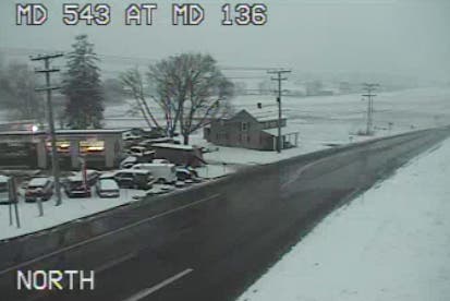
Image via CHART.
Here are the preliminary snow totals submitted to the National Weather Service from the area:
- 4.3 inches in Fallston; measured at noon by a trained spotter
- 4.2 inches in Bel Air; measured at 12:56 p.m. by a county official
- 3.3 inches in Abingdon; measured at 11:30 a.m. by trained spotter
- 3 inches in Scarboro; measured at 11:54 a.m. by trained spotter
- 3 inches in Abingdon; measured at 2 p.m. by trained spotter
- 2.5 inches in Pleasant Hills; measured at 9:20 a.m. by CoCoRaHS
Traffic camera image via CHART. Ice accumulation pic from Feb. 12 by Elizabeth Janney. Snowman photo by Shutterstock.
Get more local news delivered straight to your inbox. Sign up for free Patch newsletters and alerts.