Weather
Severe Storm Threat For MA To Bring Heavy Rain, Damaging Winds: See Latest Forecast
The storm threat is part of a warm front that will move through the region on Thursday.

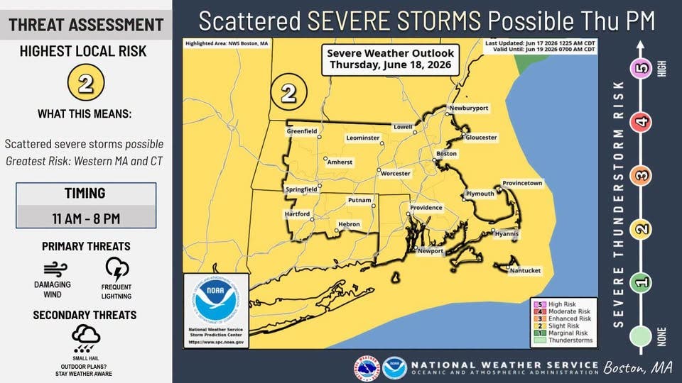
The National Weather Service has issued a severe storm threat alert for Thursday with the highest chance of storms bringing downpours and damaging winds between 11 a.m. and 8 p.m.
The NWS said a warm front lifting through the region will bring a wave of humid and unsettled weather in what has otherwise been a refreshing week.
"Expecting two rounds of rainfall," the NWS said, "the first, a round of showers in the morning followed by a chance of strong to severe thunderstorms later in the afternoon.
Find out what's happening in Across Massachusettsfor free with the latest updates from Patch.
"The strength and coverage of severe weather depends on the amount of instability and clearing during the afternoon."
The NWS said the greatest risk for strong storms is in western Massachusetts and Connecticut. But an elevated risk was set for across the state.
Find out what's happening in Across Massachusettsfor free with the latest updates from Patch.
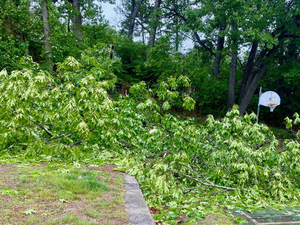
Winds could top 35 mph with downpours causing flooding in poor drainage areas.
The forecast is looking good beyond Thursday, however, after a sunny Wednesday with low humidity and highs near 80 degrees.
The storms should move out later on Thursday, paving the way for a very warm and sunny Friday with a high of 86 degrees.
The Juneteenth holiday weekend is looking mostly nice overall with sunny skies and highs in the 80s for the second straight weekend.
Rain will not return until at least Monday with cooler temperatures in the 70s.
From the National Weather Service:
Today
Mostly sunny, with a high near 81. Light south wind becoming southeast 5 to 10 mph in the afternoon.
Tonight
Partly cloudy, with a low around 61. South wind 3 to 8 mph.
Thursday
Showers and possibly a thunderstorm, mainly before 5pm, then a chance of showers and thunderstorms after 5pm. High near 80. Southeast wind 7 to 17 mph, with gusts as high as 31 mph. Chance of precipitation is 80%.
New rainfall amounts between a tenth and quarter of an inch, except higher amounts possible in thunderstorms.
Thursday Night
A chance of showers and thunderstorms before 8pm, then a slight chance of showers between 8pm and 10pm. Mostly cloudy, then gradually becoming mostly clear, with a low around 66. West wind 8 to 11 mph, with gusts as high as 22 mph. Chance of precipitation is 30%.
New precipitation amounts of less than a tenth of an inch, except higher amounts possible in thunderstorms.
Juneteenth
Sunny, with a high near 86. West wind 10 to 15 mph, with gusts as high as 25 mph.
Friday Night
Clear, with a low around 64. West wind around 11 mph.
Saturday
Sunny, with a high near 83. West wind 13 to 15 mph, with gusts as high as 26 mph.
Saturday Night
Mostly clear, with a low around 63. West wind 9 to 13 mph.
Sunday
Sunny, with a high near 83. Northwest wind around 10 mph.
Sunday Night
Partly cloudy, with a low around 63. West wind 3 to 6 mph.
Monday
A chance of showers. Partly sunny, with a high near 76. Calm wind becoming east 5 to 9 mph in the afternoon. Chance of precipitation is 50%.
Monday Night
Showers likely. Mostly cloudy, with a low around 62. Northeast wind around 8 mph becoming north after midnight. Chance of precipitation is 60%.
Tuesday
Mostly sunny, with a high near 80. North wind 6 to 8 mph.
Get more local news delivered straight to your inbox. Sign up for free Patch newsletters and alerts.