Weather
MA Prepares For Major Winter Storm: Latest Forecast, Accumulation Estimates, How To Prepare
Snowfall total forecasts are rising rapidly for the storm that will move in amid bitterly cold arctic air this weekend.

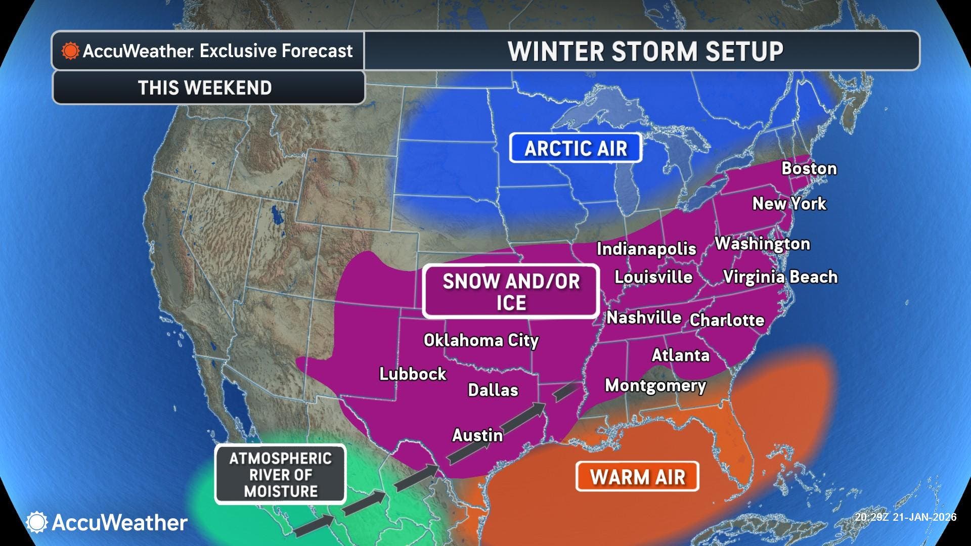
MASSACHUSETTS — Most of the state will get walloped with up to 18 inches of snow from a powerful winter storm that is expected to hammer much of the East Coast with debilitating snow and ice this weekend.
The storm, combined with extreme cold temperatures that will include wind chills 10 to 20 degrees below zero on Saturday morning, is making for a painful one-two punch throughout New England.
The National Weather Service on Friday released its snow predictions for the storm that is expected to begin late Sunday morning and ramp up during the afternoon into the early morning hours of Monday. Snow could linger throughout Monday, with the NWS now calling for a widespread 12 to 18 inches across the state.
Find out what's happening in Across Massachusettsfor free with the latest updates from Patch.
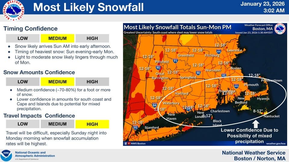
The exception could be the South Coast, Cape Cod and the Islands, where enough sleet and rain may mix in to hold totals closer to 8 to 12 inches.
If it snows more than 6 inches at Boston's Logan Airport — as expected — it will be the first time in four years (more than 1,400 days) that has happened.
Find out what's happening in Across Massachusettsfor free with the latest updates from Patch.
Travel is expected to be very difficult — especially from Sunday night into Monday morning. Snow emergency parking bans and school cancellations should be commonplace throughout the state to start the week.
"People in the path of this storm should prepare to hunker down for the weekend," AccuWeather Chief Meteorologist Jonathan Porter said. "Emergency supplies should include food that does not require cooking, bottled water, extra blankets, medicine and battery packs to keep cell phones charged."
Massachusetts will likely escape most of the dangerous icing and blizzard conditions in the mid-Atlantic and metro New York City and Philadelphia areas, with snow totals enhanced because of the brutally cold temperatures, adding to the "fluff factor" in accumulations.
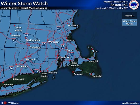
The NWS issued a Winter Storm Watch for all of Massachusetts, Connecticut and Rhode Island on Thursday that will almost certainly be upgraded to a warning this weekend.
There is also a Cold Weather Advisory in place beginning Friday night at 10 as temperatures plummet after a sunny day with highs near 30 degrees.
Overnight lows near 4 degrees, combined with winds gusting to 30 mph, will make it feel up to 20 degrees below zero in the morning.
Saturday will be a very cold and windy day with highs in the teens and the wind chill at minus-11, according to the NWS.
Winds will calm Saturday night amid another frigid one with lows near 7 and wind chills below zero.
Once the snow starts on Sunday morning, it will likely continue to fall for much of the next two days before clearing and cold weather returns on Tuesday.
The Massachusetts Emergency Management Agency is encouraging residents to start preparing now for the storm.
With a significant snowstorm forecast to affect much of Massachusetts on Sunday and Monday, now is the time to start taking steps to prepare. For more information visit https://t.co/ncHqGL4wWU pic.twitter.com/4oYUfWx5cE
— MEMA (@MassEMA) January 22, 2026
With extremely cold temperatures forecast for this weekend, it's important to take steps to prevent the pipes in your home from freezing. Learn more: https://t.co/Z60ssqeVFh pic.twitter.com/hHyLJbz06g
— MEMA (@MassEMA) January 21, 2026
With a significant winter storm forecast to bring 12+ inches of snow to much of Massachusetts on Sunday and Monday, it's time to make preparations. • Prepare for possible power outages. Fully charge your cellphone, laptop and any essential electronic devices before the storm.… pic.twitter.com/QKVRh4CqNw
— MEMA (@MassEMA) January 23, 2026
More on Patch:
Get more local news delivered straight to your inbox. Sign up for free Patch newsletters and alerts.