Politics & Government
New Map Center Unveiled at Boston Public Library
The Boston Public Library opened the Norman B. Leventhal Map Center during a ribbon cutting ceremony Saturday.


Imagine a corridor full of maps from the 15th century up to the present day; the maps are in an endless supply, and a person could spend the whole day analyzing them.
Such a place now exists at the Boston Public Library. On Saturday, the library unveiled a new renovated space for the Norman B. Leventhal Map Center with an opening ceremony and ribbon cutting.
Located on the first floor of the library’s McKim Building, the renovated space features a new exhibitions gallery, a public learning center, and a reading room for map research. Other elements include a world globe three feet in diameter, a custom stained glass reproduction of a 1775 map of Boston, and children exploration areas with puzzles, books, memory games, and map-related activities.
Find out what's happening in Back Bayfor free with the latest updates from Patch.
Under construction since April of this year, the renovation of 5,760 square feet is a city of Boston capital project. Mayor Thomas M. Menino spoke at the opening ceremony, saying that this map center is yet another great addition to the Boston Public Library.
“You are going to be amazed when you see this map center,” Menino said prior to cutting the ribbon. “This is another example of what Norman [Leventhal] has done for this city. This was possible thanks to his vision and tenacity.”
Find out what's happening in Back Bayfor free with the latest updates from Patch.
Leventhal is a philanthropist and founder of the map center, created in 2004 as a partnership between the Boston Public Library and Leventhal.
Its mission is to use the library’s permanent collection of 200,000 maps and 5,000 atlases, in addition to a select group of rare maps collected by Leventhal, for the enjoyment and education of all.
“I’m so proud to see the map center today and to help improve the education for the children of Boston,” Leventhal said. “Amy Ryan [President of the Boston Public Library] has shown great vision and commitment to making this happen.”
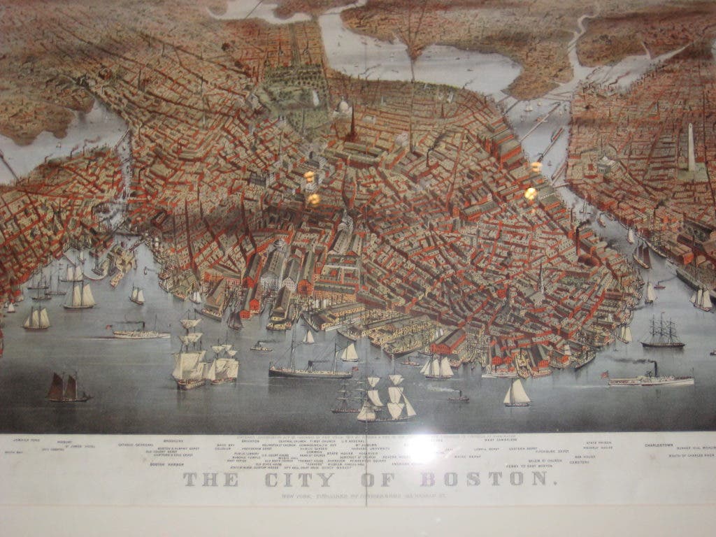
The map collection ranges from the 15th century to the present day. The maps are from all over the world, but there is a particular strength in maps and atlases of Boston, Massachusetts, and New England.
Vernon Domingo, a geography professor at Bridgewater State University, and he was very excited to see the renovated map center for the first time.
“This is so great because things that were previously kept in storage are now available to the public, so people can learn about physical and cultural changes of the city over the last 300 years,” Domingo said. “Also, people can learn about the world, and these maps help us understand the world and all of the changes.”
After the opening ceremony and ribbon cutting, there were exhibition tours and a geography-centered puppet show for children held in the nearby courtyard.
The map center’s initial exhibitions will be open to the public during regular library hours. The exhibitions feature Leventhal Map Center Treasures, as well as Unconventional Maps: Exploring the Stories of Cartographic Curiosities.