
Heavy rain will soak the the Commonwealth Monday evening, but no snow is expected. Forecasters said the storm will stay primarily rain - bringing with it the threat of floods - making for a tough evening commute.
The National Weather Service said Sunday night all of Massachusetts can expect between an inch and an inch and a half of rain by Tuesday morning. The Cape could see slightly less, and there may be wet snow out west.
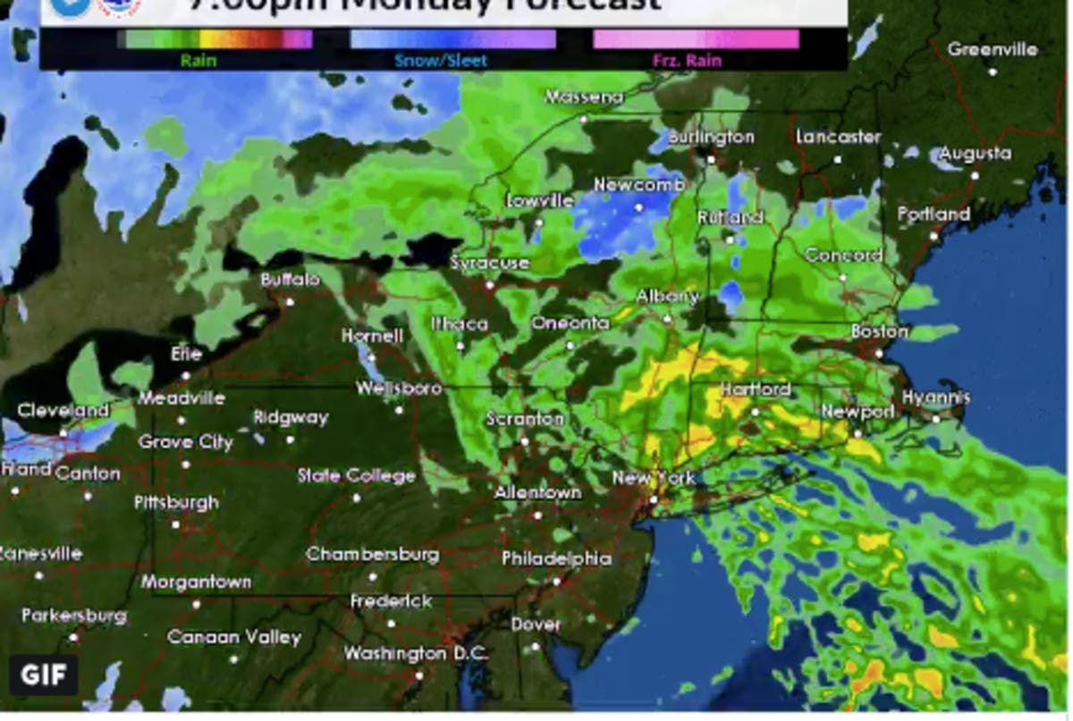
"Height of impacts around late afternoon Monday into early evening Monday with concern towards the Monday PM commute," the NWS wrote. The simulated radar below gives a sense of when to expect the worst of it.
Find out what's happening in Bostonfor free with the latest updates from Patch.
[Monday → Tuesday] Rough timeline of precip outcomes, however not to be taken verbatim; soaking rain @ Monday evening, the threat of isolated urban, low-lying flooding; perhaps some wet snow for the Berkshires ... overall, impacts for the Monday PM commute pic.twitter.com/W0XSHRCBab
— NWS Boston (@NWSBoston) November 25, 2018
There are also going to be some more serious wind gusts Monday night - up to 55 miles per hours on the water. You can see the maximum wind gust map below.

If it feels like we've gotten a ton of rain this month, we have. The NWS said much of Southern New England is already at 150 to 300 percent of its normal monthly precipitation in November.
Find out what's happening in Bostonfor free with the latest updates from Patch.
NWS radar screenshot
Get more local news delivered straight to your inbox. Sign up for free Patch newsletters and alerts.


